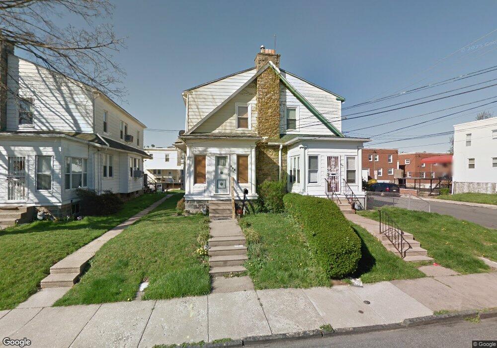
900 Bullock Ave Lansdowne, PA 19050
Estimated Value: $207,000 - $250,000
3
Beds
1
Bath
1,258
Sq Ft
$174/Sq Ft
Est. Value
About This Home
This home is located at 900 Bullock Ave, Lansdowne, PA 19050 and is currently estimated at $218,470, approximately $173 per square foot. 900 Bullock Ave is a home located in Delaware County with nearby schools including Evans Elementary School, Penn Wood Middle School, and Penn Wood High School - Cypress Street Campus.
Ownership History
Date
Name
Owned For
Owner Type
Purchase Details
Closed on
Jan 5, 1998
Sold by
Brock Crystal and Oneal Harvey
Bought by
Brock Michael and Brock Crystal
Current Estimated Value
Home Financials for this Owner
Home Financials are based on the most recent Mortgage that was taken out on this home.
Original Mortgage
$71,300
Interest Rate
7.09%
Mortgage Type
FHA
Create a Home Valuation Report for This Property
The Home Valuation Report is an in-depth analysis detailing your home's value as well as a comparison with similar homes in the area
Home Values in the Area
Average Home Value in this Area
Purchase History
| Date | Buyer | Sale Price | Title Company |
|---|---|---|---|
| Brock Michael | -- | -- |
Source: Public Records
Mortgage History
| Date | Status | Borrower | Loan Amount |
|---|---|---|---|
| Closed | Brock Michael | $71,300 |
Source: Public Records
Tax History
| Year | Tax Paid | Tax Assessment Tax Assessment Total Assessment is a certain percentage of the fair market value that is determined by local assessors to be the total taxable value of land and additions on the property. | Land | Improvement |
|---|---|---|---|---|
| 2025 | $4,442 | $104,030 | $32,380 | $71,650 |
| 2024 | $4,442 | $104,030 | $32,380 | $71,650 |
| 2023 | $4,034 | $104,030 | $32,380 | $71,650 |
| 2022 | $3,847 | $104,030 | $32,380 | $71,650 |
| 2021 | $5,817 | $104,030 | $32,380 | $71,650 |
| 2020 | $3,785 | $60,600 | $18,680 | $41,920 |
| 2019 | $3,718 | $60,600 | $18,680 | $41,920 |
| 2018 | $3,666 | $60,600 | $0 | $0 |
| 2017 | $3,589 | $60,600 | $0 | $0 |
| 2016 | $333 | $60,600 | $0 | $0 |
| 2015 | $339 | $60,600 | $0 | $0 |
| 2014 | $333 | $60,600 | $0 | $0 |
Source: Public Records
Map
Nearby Homes
- 851 Bullock Ave
- 808 Serrill Ave
- 825 Laurel Rd
- 813 Arbor Rd
- 911 W Cobbs Creek Pkwy
- 734 Bullock Ave
- 820 Fern St
- 6535 Windsor St
- 702 Cedar Ave
- 6528 Windsor St
- 727 Fern St
- 912 Whitby Ave
- 1781 S 65th St
- 6951 Chester Ave
- 1016 Whitby Ave
- 1757 S Avondale St
- 1758 S Avondale St
- 622 Yeadon Ave
- 6520 Allman St
- 1903 S 65th St
- 902 Bullock Ave
- 904 Bullock Ave
- 846 Bullock Ave
- 906 Bullock Ave
- 844 Bullock Ave
- 901 Yeadon Ave
- 908 Bullock Ave
- 903 Yeadon Ave
- 905 Yeadon Ave
- 847 Yeadon Ave
- 842 Bullock Ave
- 907 Yeadon Ave
- 845 Yeadon Ave
- 909 Yeadon Ave
- 840 Bullock Ave
- 912 Bullock Ave
- 901 Bullock Ave
- 903 Bullock Ave
- 843 Yeadon Ave
- 905 Bullock Ave
Your Personal Tour Guide
Ask me questions while you tour the home.