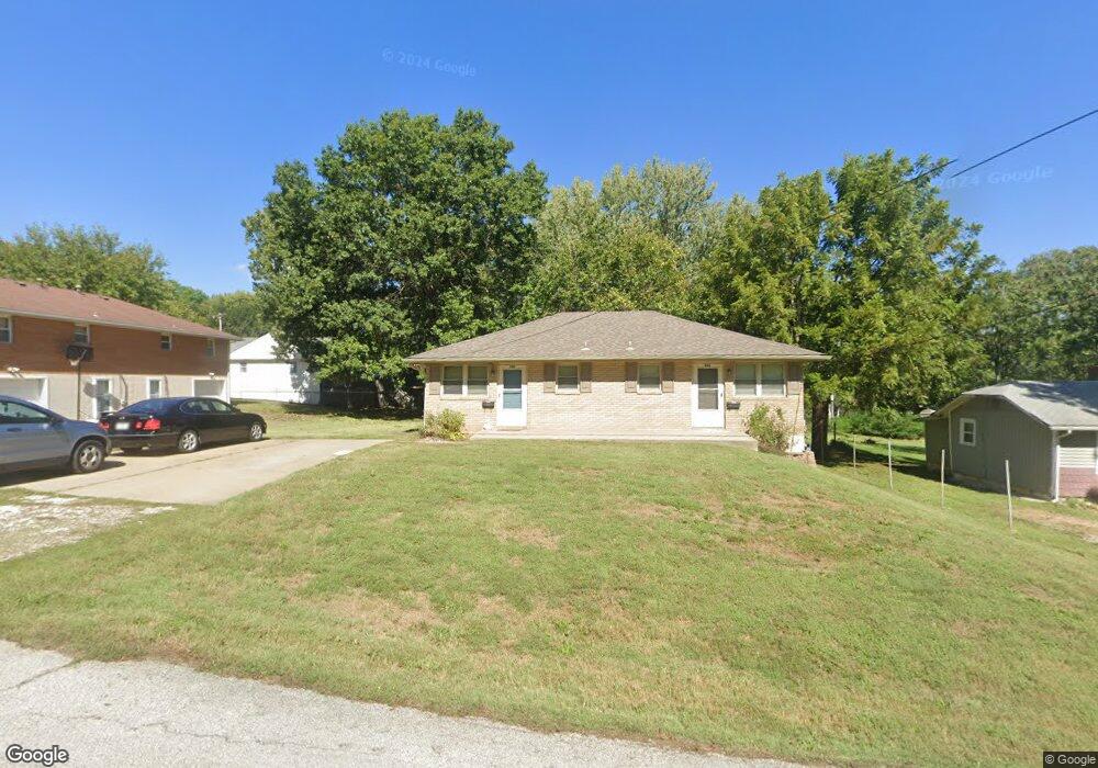
900 E Stone St Independence, MO 64050
Benton NeighborhoodEstimated Value: $144,000 - $208,000
2
Beds
2
Baths
1,120
Sq Ft
$158/Sq Ft
Est. Value
About This Home
This home is located at 900 E Stone St, Independence, MO 64050 and is currently estimated at $177,092, approximately $158 per square foot. 900 E Stone St is a home located in Jackson County with nearby schools including Thomas Hart Benton Elementary School, Bridger Middle School, and Bingham Middle School.
Ownership History
Date
Name
Owned For
Owner Type
Purchase Details
Closed on
Oct 15, 2019
Sold by
Homeland Properties Llc
Bought by
Powell Property Holdings Llc
Current Estimated Value
Purchase Details
Closed on
Feb 5, 2003
Sold by
Pettit Cynthia Ann
Bought by
Homeland Properties Llc
Purchase Details
Closed on
Feb 3, 2003
Sold by
Landmark Enterprise Llc
Bought by
Pettit Cynthia Ann
Purchase Details
Closed on
Nov 17, 2000
Sold by
Kluska William T and Pettit Cynthia A
Bought by
Landmark Enterprise Llc
Create a Home Valuation Report for This Property
The Home Valuation Report is an in-depth analysis detailing your home's value as well as a comparison with similar homes in the area
Home Values in the Area
Average Home Value in this Area
Purchase History
| Date | Buyer | Sale Price | Title Company |
|---|---|---|---|
| Powell Property Holdings Llc | -- | Kansas City Title Inc | |
| Homeland Properties Llc | -- | -- | |
| Pettit Cynthia Ann | -- | -- | |
| Landmark Enterprise Llc | -- | -- |
Source: Public Records
Tax History
| Year | Tax Paid | Tax Assessment Tax Assessment Total Assessment is a certain percentage of the fair market value that is determined by local assessors to be the total taxable value of land and additions on the property. | Land | Improvement |
|---|---|---|---|---|
| 2025 | $1,321 | $21,932 | $3,570 | $18,362 |
| 2024 | $1,291 | $19,072 | $3,165 | $15,907 |
| 2023 | $1,291 | $19,072 | $1,486 | $17,586 |
| 2022 | $1,432 | $19,380 | $1,656 | $17,724 |
| 2021 | $1,431 | $19,380 | $1,656 | $17,724 |
| 2020 | $1,291 | $16,987 | $1,656 | $15,331 |
| 2019 | $1,270 | $16,987 | $1,656 | $15,331 |
| 2018 | $1,158 | $14,784 | $1,441 | $13,343 |
| 2017 | $1,158 | $14,784 | $1,441 | $13,343 |
| 2016 | $1,140 | $14,414 | $1,710 | $12,704 |
Source: Public Records
Map
Nearby Homes
- 912 E Stone St
- 914 E South Ave
- 903 S Pope Ave
- 1040 E Stone St
- 1120 S Leslie St
- 930 S Leslie St
- 925 S Emery St
- 808 S Savage St
- 913 S Hocker Ave
- 1124 S Haden St
- 603 E Myrtle St
- 801 S Crane St
- 715 S Savage St
- 1340 S Emery Ave
- 904 S Pearl St
- 1339 S Hocker Ave
- 1312 S Pearl St
- 504 S Hunter St
- 421 E Angus St
- 921 S Noland Rd
- 1017 S Logan Ave
- 1015 S Logan Ave
- 1101 S Logan Ave
- 919 E Stone St
- 916 E Stone St
- 1013 S Logan Ave
- 1109 S Logan Ave
- 907 E Stone St
- 921 E Stone St
- 930 E Stone St
- 911 E South Ave
- 913 E South Ave
- 1000 S Logan Ave
- 1004 S Logan Ave
- 1129 S Logan Ave
- 1007 S Logan Ave
- 915 E South Ave
- 1120 S Logan Ave
- 1122 S Logan Ave
Your Personal Tour Guide
Ask me questions while you tour the home.