900 Fm487 Jarrell, TX 76537
Estimated payment $66,498/month
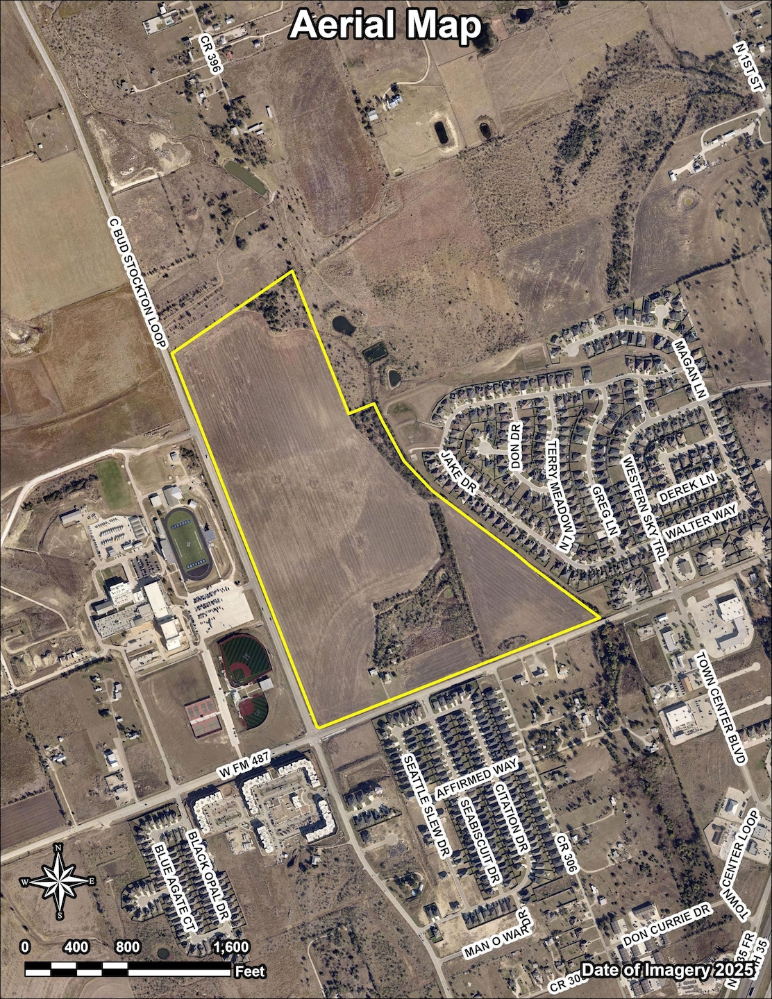
About This Lot
LOCATION/FRONTAGE:
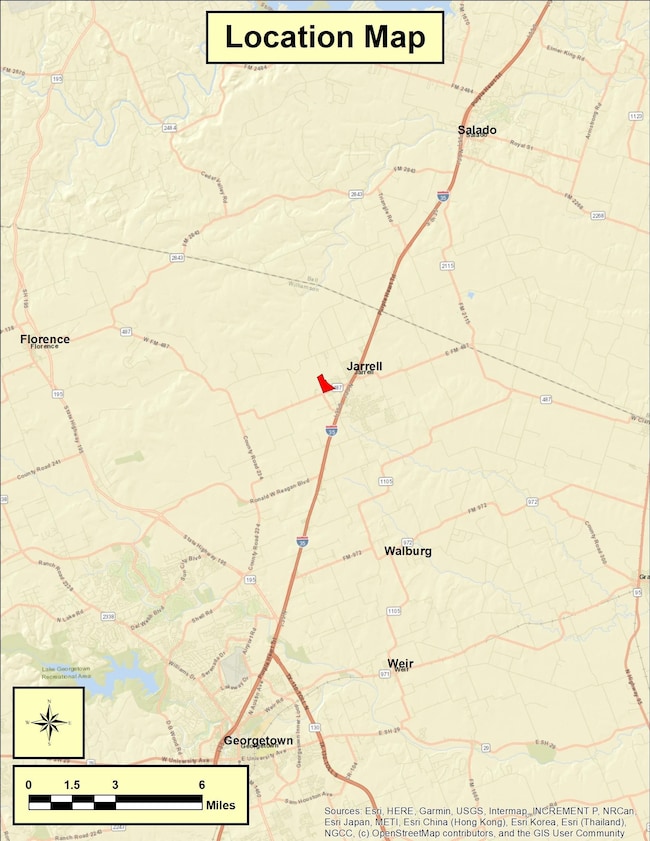
The property is located at the northeast corner of FM 487 and C Bud Stockton Loop about 0.6 mile west of IH-35 on the west side of Jarrell, Williamson County, Texas. The property has 2,343.47 feet of frontage along the north side of the FM 487 and 3,115.91 feet of frontage along the east side of C Bud Stockton Loop.
LEGAL:
114.07 acres out of the J. Roebuck Survey, Abstract No. 527 in Williamson County, Texas. (See attached survey dated 9/18/2024)
UTILITIES:
City of Jarrell has a 12 water line located along the south side of FM 487. City of Jarrell has an 8-inch wastewater line along the propertys FM 487 frontage. There is also a 12-inch wastewater line along a portion of the propertys eastern boundary.
ZONING:
Jarrell ETJ
SCHOOL DISTRICT:
Jarrell ISD
TAXES:
Currently under Agriculture Use Valuation Buyer responsible for any roll-back taxes upon change of use.
2025 Tax Accounts R011224 (1.56 acres) and R011223 (125.82 acres)
MINERALS (OIL & GAS):
Sellers thought to own all. Minerals shall convey with acceptable contract.
FLOOD PLAIN:
Based on data obtained from the FEMA National Flood Insurance Digital Flood Insurance Rate maps for Williamson County, Texas, the property is not located within the 100 year floodplain. See Atlas 14 map.
EASEMENTS:
An easement to Jarrell-Schwertner Water Supply Corporation, a utility easement to City of Jarrell, and a wastewater utility easement to Jarrell I.S.D. Visible electric and easements of record.
IMPROVEMENTS:
The property contains a 1,713 SF house with a 540 SF attached garage. House constructed around 1979. Several corrugated sheet metal livestock/hay barns are located north of the house. Improvements sold As-Is and represented to have minimal overall value.
COMMENTS:
Land is within rapidly expanding urban growth trends adjacent to the City of Jarrell within Williamson County. Temple/Belton urban area north of subject. The property consists primarily of cropland with areas of moderate tree cover. There is one stock pond on the property which provides water for livestock. Topography and elevation are very conducive to many uses.

Property Details
Property Type
- Land
Map
Home Values in the Area
Average Home Value in this Area
Property History
| Date | Event | Price | List to Sale | Price per Sq Ft |
|---|---|---|---|---|
| 11/14/2025 11/14/25 | For Sale | $10,500,000 | -- | -- |
- 900 W Fm 487
- 125 Citation Dr
- 150 Seattle Slew Dr
- 153 Citation Dr
- 515 War Admiral Dr Unit A & B
- 550 C Bud Stockton Loop
- 221 Seattle Slew Dr
- 329 Jake Dr
- 225 Seattle Slew Dr
- 229 Seattle Slew Dr
- 228 Citation Dr
- 232 Seattle Slew Dr
- 233 Seattle Slew Dr
- 238 Seattle Slew Dr
- 257 Seattle Slew Dr
- 133 Greg Ln
- 308 Black Opal Dr
- 153 Blue Agate Ct
- 340 Black Opal Dr
- 161 Greg Ln
- 643 County Rd 306
- 510 Whirlaway Dr Unit A
- 515 War Admiral Dr Unit B
- 515 War Admiral Dr Unit A
- 883 C Bud Stockton Loop
- 511 County Rd 306 Unit 511 CR 306 Unit A
- 473 Cr 306 #B
- 455 County Rd 306
- 101 Stockton Family Ct
- 365 County Road 306 Unit A
- 100 Stockton Family Ct
- 301 Citation Dr
- 408 Black Opal Dr
- 105 Everett Ct Unit B
- 100 Zayd Ct Unit A
- 105 Zayd Ct Unit A
- 100 Everett Ct Unit B
- 108 Zayd Ct Unit B
- 100 Bailey Kay Ct Unit B
- 92 Sandstone Dr Unit B
Ask me questions while you tour the home.