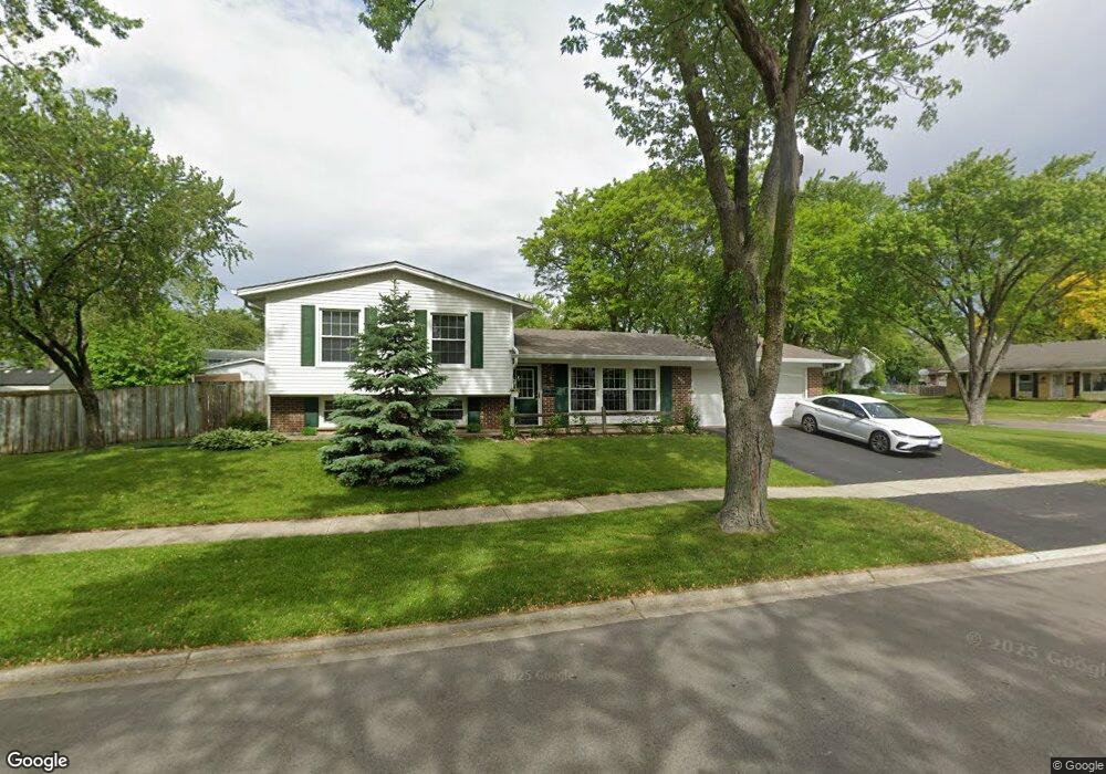
900 Glenside Ct Hanover Park, IL 60133
Estimated Value: $277,000 - $367,000
2
Beds
2
Baths
1,084
Sq Ft
$308/Sq Ft
Est. Value
About This Home
This home is located at 900 Glenside Ct, Hanover Park, IL 60133 and is currently estimated at $333,414, approximately $307 per square foot. 900 Glenside Ct is a home located in Cook County with nearby schools including Anne Fox Elementary School, Jane Addams Junior High School, and Hoffman Estates High School.
Ownership History
Date
Name
Owned For
Owner Type
Purchase Details
Closed on
Aug 13, 2001
Sold by
Seidel Philip T and Fortney Thomas K
Bought by
Fortney Tom and Fortney Lisa E
Current Estimated Value
Home Financials for this Owner
Home Financials are based on the most recent Mortgage that was taken out on this home.
Original Mortgage
$42,000
Interest Rate
7.28%
Create a Home Valuation Report for This Property
The Home Valuation Report is an in-depth analysis detailing your home's value as well as a comparison with similar homes in the area
Home Values in the Area
Average Home Value in this Area
Purchase History
| Date | Buyer | Sale Price | Title Company |
|---|---|---|---|
| Fortney Tom | $80,000 | -- |
Source: Public Records
Mortgage History
| Date | Status | Borrower | Loan Amount |
|---|---|---|---|
| Closed | Fortney Tom | $42,000 |
Source: Public Records
Tax History Compared to Growth
Tax History
| Year | Tax Paid | Tax Assessment Tax Assessment Total Assessment is a certain percentage of the fair market value that is determined by local assessors to be the total taxable value of land and additions on the property. | Land | Improvement |
|---|---|---|---|---|
| 2024 | $7,213 | $25,940 | $7,029 | $18,911 |
| 2023 | $6,963 | $25,940 | $7,029 | $18,911 |
| 2022 | $6,963 | $25,940 | $7,029 | $18,911 |
| 2021 | $6,150 | $20,624 | $4,595 | $16,029 |
| 2020 | $6,145 | $20,624 | $4,595 | $16,029 |
| 2019 | $6,232 | $23,174 | $4,595 | $18,579 |
| 2018 | $6,106 | $20,583 | $4,055 | $16,528 |
| 2017 | $6,029 | $20,583 | $4,055 | $16,528 |
| 2016 | $5,954 | $20,583 | $4,055 | $16,528 |
| 2015 | $5,635 | $18,425 | $3,514 | $14,911 |
| 2014 | $5,554 | $18,425 | $3,514 | $14,911 |
| 2013 | $5,366 | $18,425 | $3,514 | $14,911 |
Source: Public Records
Map
Nearby Homes
- 630 S Walnut Ln
- 7843 Kensington Ln
- 7873 Asbury Cir S
- 802 Lexington Cir
- 8181 Northway Dr
- 7418 Nantucket Cove
- 8138 N Carrolton Ct
- 7837 Huntington Cir S
- 630 Clover Ln
- 1307 Kingsbury Dr Unit A
- 763 Verandah Dr
- 1283 Bristol Ln
- 1316 Kingsbury Dr Unit 1
- 1323 Kingsbury Dr Unit 2
- 7468 Filmore Ave
- 1933 Whittier Ln
- 1011 Mercury Dr Unit 7
- 1105 Stratford Ln
- 224 Glenridge Ln
- 136 Caryville Ln
- 910 Glenside Ct
- 7820 Northway Dr
- 922 Glenside Ct
- 999 Glenside Ct
- 7833 Northway Dr
- 7847 Northway Dr
- 7800 Northway Dr
- 7827 Northway Dr
- 981 Glenside Ct
- 7879 Northway Dr Unit 8
- 7803 Carlisle Dr
- 934 Glenside Ct
- 977 Glenside Ct
- 7902 Northway Dr
- 7819 Northway Dr
- 7895 Northway Dr
- 975 Glenside Ct
- 7825 Carlisle Dr Unit 8
- 7802 Berkshire Dr
- 7903 Northway Dr