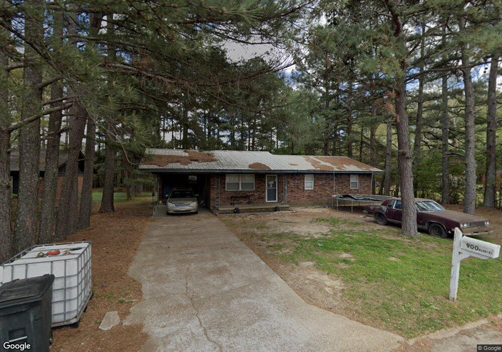
900 Manning St Newport, AR 72112
Estimated Value: $86,194 - $128,000
--
Bed
2
Baths
1,269
Sq Ft
$86/Sq Ft
Est. Value
About This Home
This home is located at 900 Manning St, Newport, AR 72112 and is currently estimated at $109,549, approximately $86 per square foot. 900 Manning St is a home located in Jackson County with nearby schools including Newport Elementary School and Newport High School.
Ownership History
Date
Name
Owned For
Owner Type
Purchase Details
Closed on
Jul 19, 2004
Bought by
Ballard Franklin E and Hope Diann
Current Estimated Value
Purchase Details
Closed on
Jun 21, 2004
Bought by
Ballard Franklin E and Hope Diann
Purchase Details
Closed on
Dec 15, 2003
Bought by
Merchants & Planters Bank
Purchase Details
Closed on
Jul 3, 2001
Bought by
Everett Rickey and Everett Francine
Purchase Details
Closed on
Mar 6, 1996
Bought by
Griffin Glenda F and % Usda Dept Of Agri
Purchase Details
Closed on
Jun 1, 1994
Bought by
Francis Robert A and Francis Naoma E
Purchase Details
Closed on
Oct 1, 1993
Bought by
Usa-Fha
Purchase Details
Closed on
Feb 1, 1990
Bought by
Roberts Tammy
Purchase Details
Closed on
Mar 1, 1987
Bought by
Roberts James and Roberts Tammy
Purchase Details
Closed on
Jan 1, 1986
Bought by
Usa-Fha
Create a Home Valuation Report for This Property
The Home Valuation Report is an in-depth analysis detailing your home's value as well as a comparison with similar homes in the area
Home Values in the Area
Average Home Value in this Area
Purchase History
| Date | Buyer | Sale Price | Title Company |
|---|---|---|---|
| Ballard Franklin E | -- | -- | |
| Ballard Franklin E | $20,000 | -- | |
| Merchants & Planters Bank | -- | -- | |
| Everett Rickey | $23,900 | -- | |
| Griffin Glenda F | -- | -- | |
| Francis Robert A | $36,000 | -- | |
| Usa-Fha | $30,000 | -- | |
| Roberts Tammy | -- | -- | |
| Roberts James | $32,300 | -- | |
| Usa-Fha | -- | -- |
Source: Public Records
Tax History Compared to Growth
Tax History
| Year | Tax Paid | Tax Assessment Tax Assessment Total Assessment is a certain percentage of the fair market value that is determined by local assessors to be the total taxable value of land and additions on the property. | Land | Improvement |
|---|---|---|---|---|
| 2024 | $341 | $13,290 | $600 | $12,690 |
| 2023 | $310 | $5,970 | $200 | $5,770 |
| 2022 | $321 | $5,970 | $200 | $5,770 |
| 2021 | $315 | $5,970 | $200 | $5,770 |
| 2020 | $311 | $5,970 | $200 | $5,770 |
| 2019 | $286 | $5,970 | $200 | $5,770 |
| 2018 | $250 | $4,910 | $200 | $4,710 |
| 2017 | $250 | $4,910 | $200 | $4,710 |
| 2015 | -- | $4,910 | $200 | $4,710 |
| 2014 | -- | $4,510 | $200 | $4,310 |
| 2013 | -- | $4,100 | $400 | $3,700 |
| 2012 | -- | $4,100 | $400 | $3,700 |
Source: Public Records
Map
Nearby Homes
- 721 Mclain St
- 604 Mclain St
- 900 Josephine St
- 623 Holden Ave
- 900 Dill St
- 910 & 914 Dill St
- 208 Forrest Dr
- 000 Forrest Dr
- 318 Wilkerson Dr
- 1311 Dill St
- 0 Holmes St Unit 25033630
- 0 Holmes St Unit 25-486
- 1407 Dill St
- 2001 S Main St
- 4 Virginia Rd
- 203 Alice Ct
- 1303 Cindy Ln
- 418 Pine St
- 1714 Dill St
- 315 Pine St