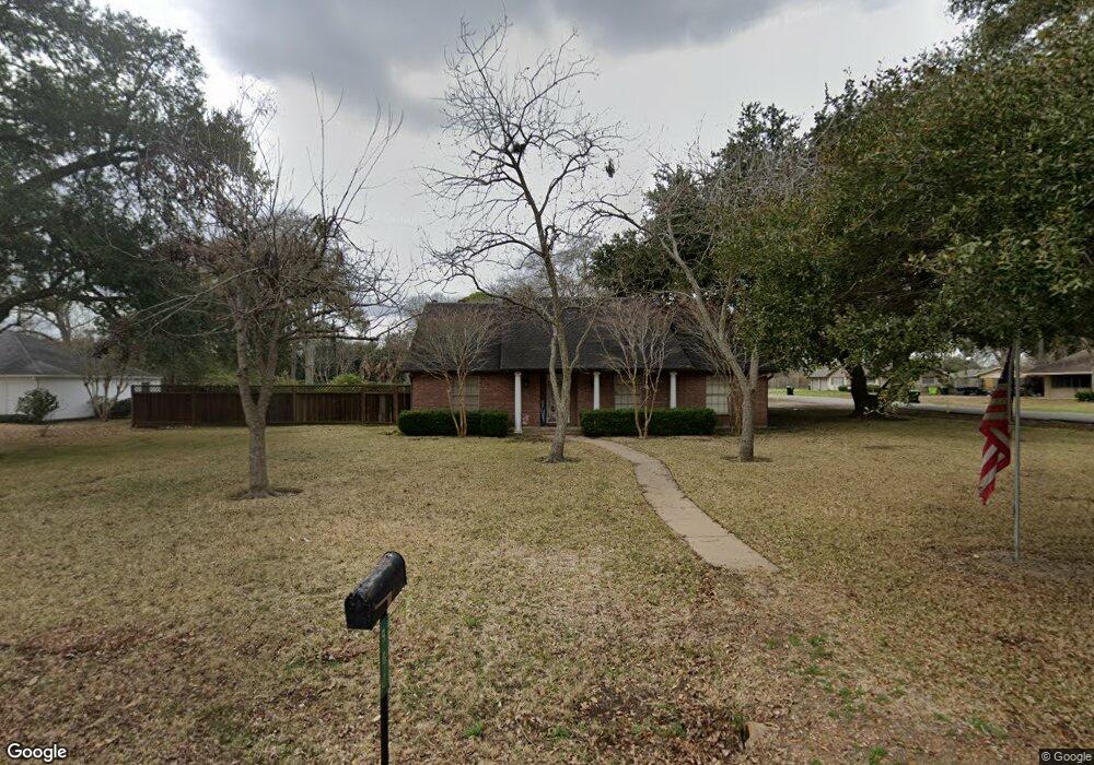
900 Victoria Dr Richmond, TX 77469
Estimated Value: $322,000 - $397,812
3
Beds
3
Baths
3,183
Sq Ft
$112/Sq Ft
Est. Value
About This Home
This home is located at 900 Victoria Dr, Richmond, TX 77469 and is currently estimated at $356,953, approximately $112 per square foot. 900 Victoria Dr is a home located in Fort Bend County with nearby schools including Jane Long Elementary School, J J Wessendorff Middle School, and Lamar Junior High School.
Ownership History
Date
Name
Owned For
Owner Type
Purchase Details
Closed on
Oct 31, 2002
Sold by
Estate Of Sam P Mccolloch
Bought by
Deleon Albert C and Deleon Diana C
Current Estimated Value
Home Financials for this Owner
Home Financials are based on the most recent Mortgage that was taken out on this home.
Original Mortgage
$112,000
Outstanding Balance
$47,808
Interest Rate
6.28%
Mortgage Type
Stand Alone First
Estimated Equity
$309,145
Create a Home Valuation Report for This Property
The Home Valuation Report is an in-depth analysis detailing your home's value as well as a comparison with similar homes in the area
Home Values in the Area
Average Home Value in this Area
Purchase History
| Date | Buyer | Sale Price | Title Company |
|---|---|---|---|
| Deleon Albert C | -- | American Title Co | |
| Deleon Albert C | -- | -- |
Source: Public Records
Mortgage History
| Date | Status | Borrower | Loan Amount |
|---|---|---|---|
| Open | Deleon Albert C | $112,000 |
Source: Public Records
Tax History Compared to Growth
Tax History
| Year | Tax Paid | Tax Assessment Tax Assessment Total Assessment is a certain percentage of the fair market value that is determined by local assessors to be the total taxable value of land and additions on the property. | Land | Improvement |
|---|---|---|---|---|
| 2025 | $3,559 | $226,411 | $45,083 | $181,328 |
| 2024 | $3,559 | $223,850 | -- | $224,917 |
| 2023 | $3,194 | $203,500 | $2,844 | $200,656 |
| 2022 | $3,657 | $185,000 | $6,480 | $178,520 |
| 2021 | $3,994 | $168,180 | $45,080 | $123,100 |
| 2020 | $4,120 | $170,930 | $45,080 | $125,850 |
| 2019 | $4,283 | $167,720 | $45,080 | $122,640 |
| 2018 | $4,162 | $161,990 | $45,080 | $116,910 |
| 2017 | $4,061 | $156,250 | $45,080 | $111,170 |
| 2016 | $4,066 | $156,460 | $45,080 | $111,380 |
| 2015 | $3,726 | $160,750 | $45,080 | $115,670 |
| 2014 | $3,986 | $164,110 | $45,080 | $119,030 |
Source: Public Records
Map
Nearby Homes
- 512 and 514 Travis St
- 6219 Deep Gulch Dr
- 6215 Deep Gulch Dr
- 6218 Deep Gulch Dr
- 1109 Frances Dr
- 606 Fannin St
- 1205 Preston St
- 800 Jackson St
- 0 Preston St
- 505 Austin St
- 107 N 10th St
- 1004 Country Club Dr
- 205 Clark St
- 206 Clark St
- 702 Morton St
- 221 Rochelle St
- 1809 Hawthorn Dr
- 1805 Hawthorn Dr
- 0 Collins Rd Unit 57997814
- 603 Calhoun St
- 904 Victoria Dr
- 1510 Travis St
- 806 Newell Dr
- 901 Victoria Dr
- 908 Victoria Dr
- 908 Victoria Dr
- 1514 Travis St
- 1404 Travis St
- 1414 Travis St
- 1503 Austin St
- 905 Victoria Dr
- 1402 Travis St
- 912 Victoria Dr
- 1517 Austin St
- 803 Newell Dr
- 1407 Austin St
- 1401 Travis St
- 909 Victoria Dr
- 1530 Austin St
- 1311 Austin St