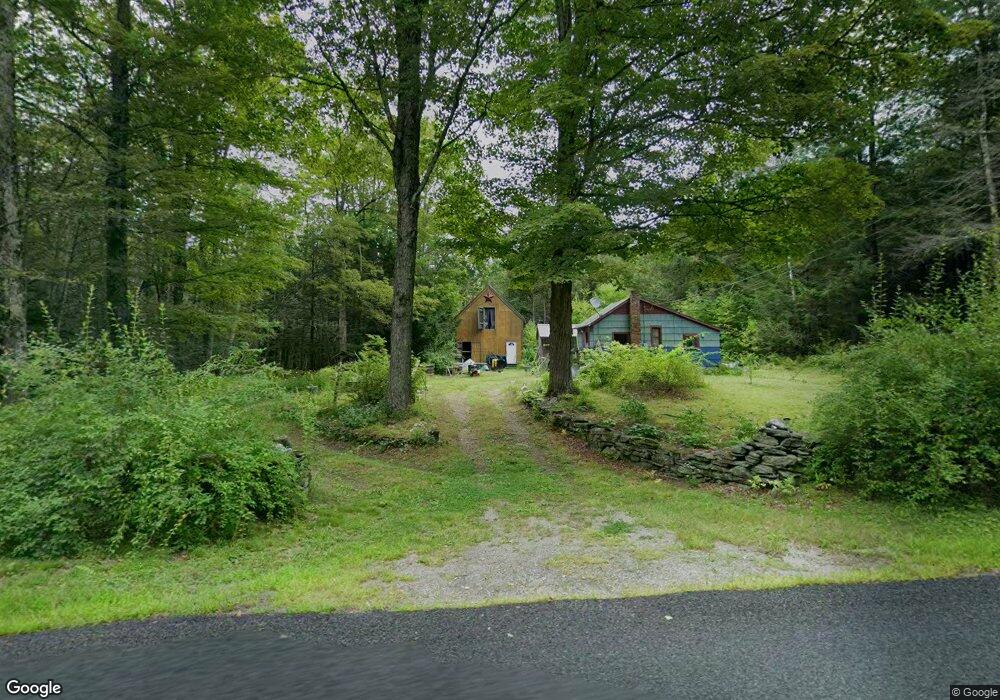
900 Watson Spruce Corner Rd Ashfield, MA 01330
Ashfield NeighborhoodEstimated Value: $103,000 - $242,000
1
Bed
1
Bath
308
Sq Ft
$514/Sq Ft
Est. Value
About This Home
This home is located at 900 Watson Spruce Corner Rd, Ashfield, MA 01330 and is currently estimated at $158,196, approximately $513 per square foot. 900 Watson Spruce Corner Rd is a home located in Franklin County with nearby schools including Mohawk Trail Regional High School.
Ownership History
Date
Name
Owned For
Owner Type
Purchase Details
Closed on
Sep 23, 2025
Sold by
Lesure Lisa Est and Rooney
Bought by
Rooney Francis C
Current Estimated Value
Purchase Details
Closed on
Jul 2, 2010
Sold by
Lesure-Ryan Daniel W and Lesure-Ryan Lisa I
Bought by
Lesure-Ryan Lisa I
Purchase Details
Closed on
Mar 21, 2001
Sold by
Lesure Robert L and Wheeler-Lesure Lynn
Bought by
Lesure-Ryan Daniel W and Lesure Ryan Lisa
Home Financials for this Owner
Home Financials are based on the most recent Mortgage that was taken out on this home.
Original Mortgage
$28,000
Interest Rate
6.93%
Mortgage Type
Purchase Money Mortgage
Create a Home Valuation Report for This Property
The Home Valuation Report is an in-depth analysis detailing your home's value as well as a comparison with similar homes in the area
Home Values in the Area
Average Home Value in this Area
Purchase History
We collect this data history from publicly available records. To have your information removed, we recommend requesting removal directly through your county’s website.
| Date | Buyer | Sale Price | Title Company |
|---|---|---|---|
| Rooney Francis C | -- | -- | |
| Lesure-Ryan Lisa I | -- | -- | |
| Lesure-Ryan Lisa I | -- | -- | |
| Lesure-Ryan Lisa I | -- | -- | |
| Lesure-Ryan Lisa I | -- | -- | |
| Lesure-Ryan Daniel W | $33,500 | -- |
Source: Public Records
Mortgage History
We collect this data history from publicly available records. To have your information removed, we recommend requesting removal directly through your county’s website.
| Date | Status | Borrower | Loan Amount |
|---|---|---|---|
| Previous Owner | Lesure-Ryan Daniel W | $28,000 |
Source: Public Records
Tax History
| Year | Tax Paid | Tax Assessment Tax Assessment Total Assessment is a certain percentage of the fair market value that is determined by local assessors to be the total taxable value of land and additions on the property. | Land | Improvement |
|---|---|---|---|---|
| 2025 | $1,650 | $122,600 | $87,200 | $35,400 |
| 2024 | $1,765 | $120,800 | $87,200 | $33,600 |
| 2023 | $1,765 | $100,200 | $69,800 | $30,400 |
| 2022 | $1,681 | $96,700 | $66,300 | $30,400 |
| 2021 | $6,363 | $96,700 | $66,300 | $30,400 |
| 2020 | $1,611 | $96,700 | $66,300 | $30,400 |
| 2019 | $1,273 | $105,700 | $62,100 | $43,600 |
| 2018 | $1,804 | $105,000 | $62,100 | $42,900 |
| 2017 | $1,698 | $104,700 | $61,200 | $43,500 |
| 2016 | $1,690 | $102,800 | $61,200 | $41,600 |
| 2015 | $1,642 | $102,800 | $61,200 | $41,600 |
| 2014 | $1,592 | $98,500 | $57,700 | $40,800 |
Source: Public Records
Map
Nearby Homes
- 333 Ranney Corner Rd
- 311 Cummington Rd
- 278 E Main St
- 14 South St
- 0 Sears Rd Unit 73373850
- 39 Hawley St
- 141 Stage Rd
- 78 Shaw Rd
- 10 Maple St
- 609 Berkshire Trail
- 0 N Bear River Rd Unit 73485981
- 0, Lot 7 East Rd
- Lot 3.2 East Rd
- 3 Hog Hollow Rd
- 43 Access Road 4
- 90 W Hawley Rd
- 198 W Hawley Rd
- 143 Charlemont Rd
- 44 Aberdeen Rd
- 60 S River Rd Unit 3
- 926 Watson Spruce Corner Rd
- 809 Watson Spruce Corner Rd
- 966 Watson Spruce Corner Rd
- 770 Watson Spruce Corner Rd
- 719 Watson Spruce Corner Rd Unit 755
- 608 Watson Spruce Corner Rd
- 697 Watson Spruce Corner Rd
- 1144 Watson Spruce Corner Rd
- 538 Watson Spruce Corner Rd
- 1239 Watson Spruce Corner Rd
- 1266 Bug Hill Rd
- 1296 Watson Spruce Corner Rd
- 1411 Bug Hill Rd
- 1294 Bug Hill Rd
- 1157 Bug Hill Rd
- 1170 Bug Hill Rd
- 1686 Bug Hill Rd
- 482 Watson Spruce Corner Rd
- 3 Old Stage Rd
- 1127 Bug Hill Rd
Your Personal Tour Guide
Ask me questions while you tour the home.