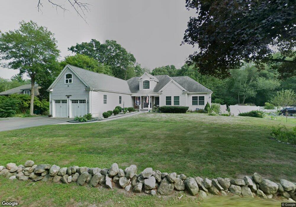
900 West St Mansfield, MA 02048
Estimated Value: $773,000 - $1,055,000
3
Beds
3
Baths
3,014
Sq Ft
$296/Sq Ft
Est. Value
About This Home
This home is located at 900 West St, Mansfield, MA 02048 and is currently estimated at $891,898, approximately $295 per square foot. 900 West St is a home with nearby schools including Everett W. Robinson Elementary School, Jordan/Jackson Elementary School, and Harold L. Qualters Middle School.
Ownership History
Date
Name
Owned For
Owner Type
Purchase Details
Closed on
Jan 13, 1999
Sold by
Briggs Mary H
Bought by
Obrien Richard J and Obrien Diane
Current Estimated Value
Purchase Details
Closed on
Dec 22, 1997
Sold by
Tri Dev T
Bought by
Eramo Building Corp
Purchase Details
Closed on
Jul 26, 1996
Sold by
Hicks Bruce A
Bought by
Vas Land Corp
Purchase Details
Closed on
Dec 27, 1993
Sold by
Home Sav Bk
Bought by
Gorman Julia Ann
Purchase Details
Closed on
Feb 16, 1990
Sold by
Guerino Carlo T
Bought by
Rogers Roland C
Purchase Details
Closed on
Dec 5, 1988
Sold by
Hayes Richard A
Bought by
Liberatore Wm M
Purchase Details
Closed on
Sep 11, 1975
Bought by
Barbero Domenic A and Barbero Karen L
Create a Home Valuation Report for This Property
The Home Valuation Report is an in-depth analysis detailing your home's value as well as a comparison with similar homes in the area
Home Values in the Area
Average Home Value in this Area
Purchase History
| Date | Buyer | Sale Price | Title Company |
|---|---|---|---|
| Obrien Richard J | $6,000 | -- | |
| Eramo Building Corp | $40,000 | -- | |
| Vas Land Corp | $35,000 | -- | |
| Gorman Julia Ann | $80,000 | -- | |
| Rogers Roland C | $5,000 | -- | |
| Liberatore Wm M | $35,000 | -- | |
| Barbero Domenic A | -- | -- |
Source: Public Records
Mortgage History
| Date | Status | Borrower | Loan Amount |
|---|---|---|---|
| Open | Barbero Domenic A | $48,500 | |
| Open | Barbero Domenic A | $250,000 |
Source: Public Records
Tax History Compared to Growth
Tax History
| Year | Tax Paid | Tax Assessment Tax Assessment Total Assessment is a certain percentage of the fair market value that is determined by local assessors to be the total taxable value of land and additions on the property. | Land | Improvement |
|---|---|---|---|---|
| 2025 | $9,739 | $739,500 | $243,400 | $496,100 |
| 2024 | $8,963 | $663,900 | $243,400 | $420,500 |
| 2023 | $8,605 | $610,700 | $243,400 | $367,300 |
| 2022 | $8,263 | $544,700 | $225,300 | $319,400 |
| 2021 | $8,609 | $560,500 | $197,200 | $363,300 |
| 2020 | $8,299 | $540,300 | $187,800 | $352,500 |
| 2019 | $8,134 | $534,400 | $156,400 | $378,000 |
| 2018 | $7,485 | $483,300 | $149,200 | $334,100 |
| 2017 | $7,471 | $497,400 | $145,000 | $352,400 |
| 2016 | $7,440 | $482,800 | $138,000 | $344,800 |
| 2015 | $6,625 | $427,400 | $138,000 | $289,400 |
Source: Public Records
Map
Nearby Homes