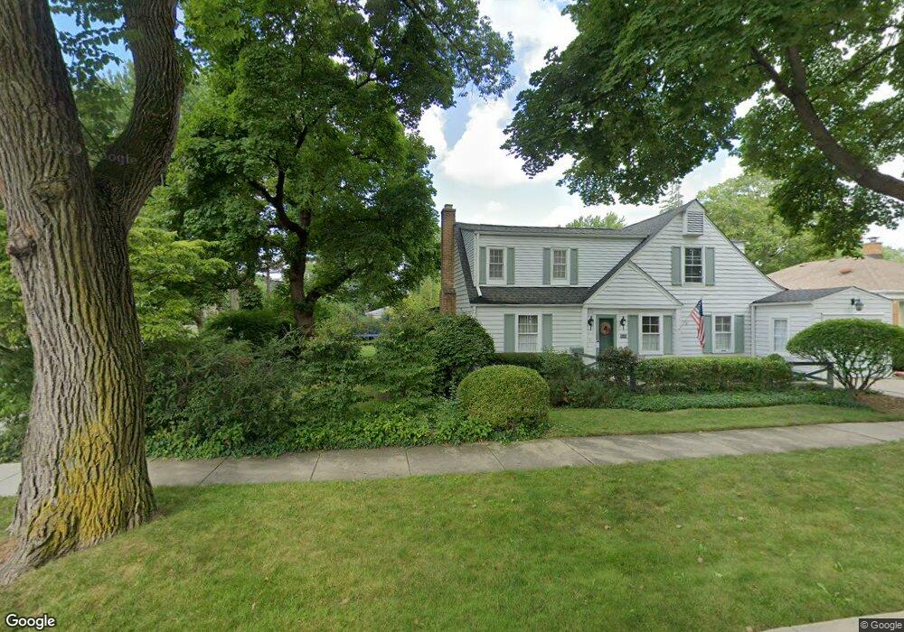
9002 Mason Ave Morton Grove, IL 60053
Estimated Value: $483,951 - $520,000
4
Beds
2
Baths
2,050
Sq Ft
$246/Sq Ft
Est. Value
About This Home
This home is located at 9002 Mason Ave, Morton Grove, IL 60053 and is currently estimated at $504,738, approximately $246 per square foot. 9002 Mason Ave is a home located in Cook County with nearby schools including Park View Elementary School and Niles West High School.
Ownership History
Date
Name
Owned For
Owner Type
Purchase Details
Closed on
Jul 17, 2015
Sold by
Chicago Title Land Trust Company
Bought by
Mette Jamie L and Mette Marc R
Current Estimated Value
Home Financials for this Owner
Home Financials are based on the most recent Mortgage that was taken out on this home.
Original Mortgage
$244,625
Outstanding Balance
$191,739
Interest Rate
4.01%
Mortgage Type
New Conventional
Estimated Equity
$312,999
Purchase Details
Closed on
Sep 29, 1993
Sold by
Ramseyer Maxine R
Bought by
First National Bank Of Niles and Trust #951
Create a Home Valuation Report for This Property
The Home Valuation Report is an in-depth analysis detailing your home's value as well as a comparison with similar homes in the area
Home Values in the Area
Average Home Value in this Area
Purchase History
| Date | Buyer | Sale Price | Title Company |
|---|---|---|---|
| Mette Jamie L | $257,500 | Chicago Title Land Trust Co | |
| First National Bank Of Niles | -- | -- |
Source: Public Records
Mortgage History
| Date | Status | Borrower | Loan Amount |
|---|---|---|---|
| Open | Mette Jamie L | $244,625 |
Source: Public Records
Tax History Compared to Growth
Tax History
| Year | Tax Paid | Tax Assessment Tax Assessment Total Assessment is a certain percentage of the fair market value that is determined by local assessors to be the total taxable value of land and additions on the property. | Land | Improvement |
|---|---|---|---|---|
| 2024 | $9,360 | $32,407 | $7,313 | $25,094 |
| 2023 | $8,918 | $32,407 | $7,313 | $25,094 |
| 2022 | $8,918 | $32,407 | $7,313 | $25,094 |
| 2021 | $7,432 | $23,172 | $4,500 | $18,672 |
| 2020 | $7,235 | $23,172 | $4,500 | $18,672 |
| 2019 | $7,372 | $26,328 | $4,500 | $21,828 |
| 2018 | $9,311 | $29,508 | $4,078 | $25,430 |
| 2017 | $9,380 | $29,508 | $4,078 | $25,430 |
| 2016 | $9,067 | $30,257 | $4,078 | $26,179 |
| 2015 | $9,202 | $28,557 | $3,515 | $25,042 |
| 2014 | $9,193 | $28,557 | $3,515 | $25,042 |
| 2013 | $7,848 | $28,557 | $3,515 | $25,042 |
Source: Public Records
Map
Nearby Homes
- 8849 Mcvicker Ave
- 8836 Mansfield Ave
- 8841 Menard Ave
- 9224 Menard Ave
- 8918 Parkside Ave
- 9314 Menard Ave
- 9320 Menard Ave
- 5536 Greenwood St
- 5644 Lyons St
- 9234 Central Ave
- 8708 Central Ave
- 5459 Suffield Ct
- 6332 Hennings Ct
- 6330 Hennings Ct
- 6334 Hennings Ct
- 6336 Hennings Ct
- 6338 Hennings Ct
- 8712 Ferris Ave
- 6340 Hennings Ct
- 5449 Arcadia St
- 9002 Mason Ave
- 9006 Mason Ave
- 9010 Mason Ave
- 9014 Mason Ave
- 8944 Mason Ave
- 9003 Austin Ave
- 9001 Austin Ave
- 9003 Mason Ave
- 9001 Mason Ave
- 9007 Mason Ave
- 9016 Mason Ave
- 9011 Mason Ave
- 8938 Mason Ave
- 8945 Austin Ave
- 9015 Austin Ave
- 9015 Mason Ave
- 8945 Mason Ave
- 9020 Mason Ave
- 9019 Mason Ave
- 9019 Austin Ave