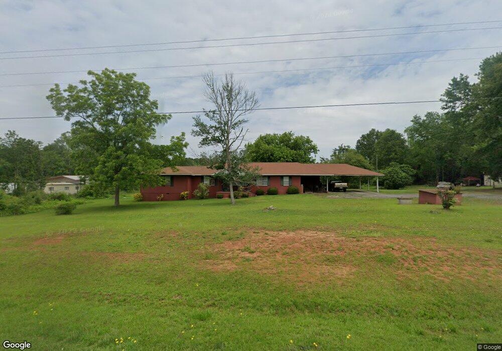
9007 Ga Highway 74 Macon, GA 31220
Estimated Value: $148,794 - $352,000
--
Bed
2
Baths
2,368
Sq Ft
$101/Sq Ft
Est. Value
About This Home
This home is located at 9007 Ga Highway 74, Macon, GA 31220 and is currently estimated at $238,931, approximately $100 per square foot. 9007 Ga Highway 74 is a home located in Bibb County with nearby schools including Skyview Elementary School, Rutland Middle School, and Rutland High School.
Ownership History
Date
Name
Owned For
Owner Type
Purchase Details
Closed on
Oct 12, 2024
Sold by
Middleton Robert
Bought by
Coates Carla M and Middleton Robert
Current Estimated Value
Purchase Details
Closed on
Dec 31, 2018
Sold by
Middleton Robert
Bought by
Middleton Robert and Coates Carla M
Purchase Details
Closed on
May 1, 2014
Sold by
Middleton Robert
Bought by
Coates Carla M
Purchase Details
Closed on
Jan 5, 1973
Sold by
Hart Johnnie
Bought by
Middleton Robert and Middleton Susie H
Create a Home Valuation Report for This Property
The Home Valuation Report is an in-depth analysis detailing your home's value as well as a comparison with similar homes in the area
Home Values in the Area
Average Home Value in this Area
Purchase History
| Date | Buyer | Sale Price | Title Company |
|---|---|---|---|
| Coates Carla M | -- | -- | |
| Middleton Robert | -- | -- | |
| Middleton Robert | -- | -- | |
| Coates Carla M | -- | -- | |
| Middleton Robert | -- | -- |
Source: Public Records
Tax History Compared to Growth
Tax History
| Year | Tax Paid | Tax Assessment Tax Assessment Total Assessment is a certain percentage of the fair market value that is determined by local assessors to be the total taxable value of land and additions on the property. | Land | Improvement |
|---|---|---|---|---|
| 2024 | $557 | $51,796 | $2,760 | $49,036 |
| 2023 | $535 | $43,716 | $2,760 | $40,956 |
| 2022 | $317 | $43,716 | $2,760 | $40,956 |
| 2021 | $1,225 | $43,716 | $2,760 | $40,956 |
| 2020 | $337 | $43,716 | $2,760 | $40,956 |
| 2019 | $339 | $43,716 | $2,760 | $40,956 |
| 2018 | $1,270 | $43,716 | $2,760 | $40,956 |
| 2017 | $1,271 | $43,716 | $2,760 | $40,956 |
| 2016 | $1,208 | $43,716 | $2,760 | $40,956 |
| 2015 | $1,145 | $43,716 | $2,760 | $40,956 |
| 2014 | $295 | $43,716 | $2,760 | $40,956 |
Source: Public Records
Map
Nearby Homes
- 137 Shady Dale Dr
- 2198 Dennis Rd
- 8294 Shelley Trail
- 104 Peninsula Ave
- 104 Peninsula Ave Unit LOT 49
- 402 Harbor Cove Dr
- 402 Harbor Cove Dr Unit 32
- 112 Peninsula Ave
- 519 Bluewater Bay Dr
- 140 Peninsula Ave
- 511 Bluewater Bay Dr
- 156 Peninsula Ave
- Plan 3040 at Barrington Place
- Plan 2700 at Barrington Place
- Plan 2620 at Barrington Place
- Plan 2100 at Barrington Place
- Plan 2604 at Barrington Place
- Plan 2316 at Barrington Place
- 1302 Barrington Place Cove
- 1405 Barrington Place Ln
- 8961 Thomaston Rd
- 8950 Thomaston Rd
- 100 NW Pointe Dr
- 104 NW Pointe Dr
- 309 Corey Ct
- 309 Corey Ct Unit 5
- 9097 Georgia 74
- 313 Corey Ct
- 9097 Ga Highway 74
- 9097 Ga Highway 74
- 0 Corey Ct
- 305 Corey Ct
- 9070 Ga Highway 74
- 9070 Ga Highway 74
- 8925 Thomaston Rd
- 9147 Thomaston Rd Hwy
- 308 Corey Ct
- 308 Corey Ct Unit 8
- 301 Corey Ct
- 312 Corey Ct