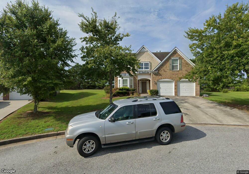
9009 Mountainview Ln Union City, GA 30291
Estimated Value: $273,000 - $344,000
4
Beds
3
Baths
2,878
Sq Ft
$106/Sq Ft
Est. Value
About This Home
This home is located at 9009 Mountainview Ln, Union City, GA 30291 and is currently estimated at $303,670, approximately $105 per square foot. 9009 Mountainview Ln is a home located in Fulton County with nearby schools including Liberty Point Elementary School, Camp Creek Middle School, and Langston Hughes High School.
Ownership History
Date
Name
Owned For
Owner Type
Purchase Details
Closed on
May 21, 2009
Sold by
Hsbc Bk Usa Stalt 2006 & 1F
Bought by
Kaiser Gail S
Current Estimated Value
Home Financials for this Owner
Home Financials are based on the most recent Mortgage that was taken out on this home.
Original Mortgage
$95,238
Outstanding Balance
$59,979
Interest Rate
4.79%
Mortgage Type
FHA
Estimated Equity
$243,691
Purchase Details
Closed on
Dec 2, 2008
Sold by
Bledsoe Dejuan and Bledsoe Lori W
Bought by
Hsbc Bank Usa Stalt 2006 & 1F
Create a Home Valuation Report for This Property
The Home Valuation Report is an in-depth analysis detailing your home's value as well as a comparison with similar homes in the area
Home Values in the Area
Average Home Value in this Area
Purchase History
| Date | Buyer | Sale Price | Title Company |
|---|---|---|---|
| Kaiser Gail S | $97,000 | -- | |
| Hsbc Bank Usa Stalt 2006 & 1F | $115,000 | -- |
Source: Public Records
Mortgage History
| Date | Status | Borrower | Loan Amount |
|---|---|---|---|
| Open | Kaiser Gail S | $95,238 |
Source: Public Records
Tax History Compared to Growth
Tax History
| Year | Tax Paid | Tax Assessment Tax Assessment Total Assessment is a certain percentage of the fair market value that is determined by local assessors to be the total taxable value of land and additions on the property. | Land | Improvement |
|---|---|---|---|---|
| 2025 | $1,438 | $120,720 | $25,680 | $95,040 |
| 2023 | $2,884 | $102,160 | $16,840 | $85,320 |
| 2022 | $1,499 | $102,160 | $16,840 | $85,320 |
| 2021 | $1,488 | $84,200 | $13,000 | $71,200 |
| 2020 | $1,391 | $70,000 | $10,440 | $59,560 |
| 2019 | $2,350 | $68,760 | $10,280 | $58,480 |
| 2018 | $1,378 | $60,920 | $9,440 | $51,480 |
| 2017 | $1,227 | $54,000 | $12,240 | $41,760 |
| 2016 | $1,225 | $54,000 | $12,240 | $41,760 |
| 2015 | $2,078 | $54,000 | $12,240 | $41,760 |
| 2014 | $745 | $37,040 | $8,200 | $28,840 |
Source: Public Records
Map
Nearby Homes
- 8273 Eastshore Dr
- 8273 Eastshore Dr Unit 2
- 4820 Station Dr Unit 6
- 4824 Station Dr Unit 8
- 4815 Station Dr Unit 33
- 4835 Station Dr Unit 27
- 4816 Station Dr Unit 4
- 4812 Station Dr Unit 2
- 4811 Station Dr Unit 35
- 9515 Lakeview Rd
- 4838 Station Lane-Lot 15
- 3320 Stonewall Ln
- 3318 Stonewall Ln
- Nelson Plan at The Enclave at Stonewall Station
- Cecil Plan at The Enclave at Stonewall Station
- 0 Koweta Rd Unit 10482619
- 0 Koweta Rd Unit 7544453
- 4811 Station Ln
- 000 Highpoint Rd
- 99 Highpoint Rd
- 9007 Mountainview Ln
- 9011 Mountainview Ln
- 8969 Crestview Cir
- 8967 Crestview Cir
- 9005 Mountainview Ln
- 8971 Crestview Cir
- 8973 Crestview Cir
- 8965 Crestview Cir
- 9013 Mountainview Ln
- 9003 Mountainview Ln
- 8975 Crestview Cir
- 8975 Crestview Cir
- 8975 Crestview Cir SE
- 8959 Crestview Cir
- 9015 Mountainview Ln
- 8957 Crestview Cir
- 8903 Crestview Cir
- 9010 Mountainview Ln
- 8903 SW Crestview Cir SW
- 8955 Crestview Cir