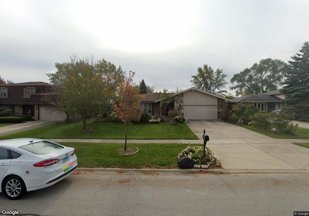
901 Andermann Ln Darien, IL 60561
Estimated Value: $483,534 - $570,000
Studio
1
Bath
2,169
Sq Ft
$240/Sq Ft
Est. Value
About This Home
This home is located at 901 Andermann Ln, Darien, IL 60561 and is currently estimated at $521,634, approximately $240 per square foot. 901 Andermann Ln is a home located in DuPage County with nearby schools including Mark Delay School, Lace Elementary School, and Eisenhower Jr High School.
Ownership History
Date
Name
Owned For
Owner Type
Purchase Details
Closed on
Jun 18, 1993
Sold by
Semon Paul H and Semon Charlene Y
Bought by
Goel Niranjan and Goel Pushpa
Current Estimated Value
Home Financials for this Owner
Home Financials are based on the most recent Mortgage that was taken out on this home.
Original Mortgage
$167,000
Interest Rate
7.25%
Create a Home Valuation Report for This Property
The Home Valuation Report is an in-depth analysis detailing your home's value as well as a comparison with similar homes in the area
Home Values in the Area
Average Home Value in this Area
Purchase History
| Date | Buyer | Sale Price | Title Company |
|---|---|---|---|
| Goel Niranjan | $217,000 | Lawyers Title |
Source: Public Records
Mortgage History
| Date | Status | Borrower | Loan Amount |
|---|---|---|---|
| Previous Owner | Goel Niranjan | $167,000 |
Source: Public Records
Tax History
| Year | Tax Paid | Tax Assessment Tax Assessment Total Assessment is a certain percentage of the fair market value that is determined by local assessors to be the total taxable value of land and additions on the property. | Land | Improvement |
|---|---|---|---|---|
| 2024 | $9,078 | $156,894 | $54,695 | $102,199 |
| 2023 | $8,703 | $144,230 | $50,280 | $93,950 |
| 2022 | $8,677 | $140,610 | $49,240 | $91,370 |
| 2021 | $8,344 | $139,010 | $48,680 | $90,330 |
| 2020 | $8,226 | $136,260 | $47,720 | $88,540 |
| 2019 | $7,940 | $130,740 | $45,790 | $84,950 |
| 2018 | $7,394 | $123,400 | $45,540 | $77,860 |
| 2017 | $7,157 | $116,490 | $43,840 | $72,650 |
| 2016 | $6,957 | $111,180 | $41,840 | $69,340 |
| 2015 | $6,838 | $104,600 | $39,360 | $65,240 |
| 2014 | $7,022 | $105,750 | $38,270 | $67,480 |
| 2013 | $6,786 | $105,250 | $38,090 | $67,160 |
Source: Public Records
Map
Nearby Homes
- 7816 Dorchester Ln
- 7713 Brookhaven Ave
- 709 79th St Unit 403
- 801 79th St Unit 310
- 801 79th St Unit 103
- Lot 1, 2, 3, 4 & 5 Nantucket Dr
- 7525 Nantucket Dr Unit 210
- 7725 Sawyer Rd
- 7502 Farmingdale Dr Unit 206
- 320 Sheridan Dr Unit 2C
- 7832 Adams St
- 1052 Ripple Ridge
- 8313 Highpoint Cir Unit F
- 7209 Grant St
- 1447 Coventry Ct
- 1370 Marco Ct
- 1390 Marco Ct
- 8144 Sunset Rd
- 7925 William Dr
- 1109 71st St