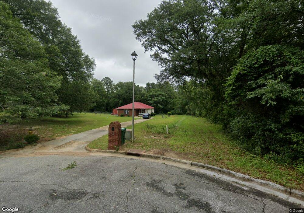
901 Ashland Ct Albany, GA 31701
Estimated Value: $71,000 - $145,000
5
Beds
2
Baths
1,743
Sq Ft
$69/Sq Ft
Est. Value
About This Home
This home is located at 901 Ashland Ct, Albany, GA 31701 and is currently estimated at $120,499, approximately $69 per square foot. 901 Ashland Ct is a home located in Dougherty County with nearby schools including Martin Luther King Jr. Elementary School, Southside Middle School, and Monroe High School.
Ownership History
Date
Name
Owned For
Owner Type
Purchase Details
Closed on
Jan 24, 2005
Sold by
Flint River Habitat For Humani
Bought by
Cole Pamela
Current Estimated Value
Purchase Details
Closed on
Oct 22, 2003
Sold by
Williams Betty J Flint River Hum Att In
Bought by
Flint River Habitat For Humanity Inc
Purchase Details
Closed on
May 20, 1999
Sold by
Dougherty County
Bought by
Williams Betty J
Purchase Details
Closed on
Feb 27, 1998
Sold by
Forest Park S and Forest D
Bought by
Dougherty County
Create a Home Valuation Report for This Property
The Home Valuation Report is an in-depth analysis detailing your home's value as well as a comparison with similar homes in the area
Home Values in the Area
Average Home Value in this Area
Purchase History
| Date | Buyer | Sale Price | Title Company |
|---|---|---|---|
| Cole Pamela | $66,300 | -- | |
| Flint River Habitat For Humanity Inc | -- | -- | |
| Williams Betty J | -- | -- | |
| Dougherty County | -- | -- |
Source: Public Records
Tax History Compared to Growth
Tax History
| Year | Tax Paid | Tax Assessment Tax Assessment Total Assessment is a certain percentage of the fair market value that is determined by local assessors to be the total taxable value of land and additions on the property. | Land | Improvement |
|---|---|---|---|---|
| 2024 | $1,655 | $36,680 | $2,000 | $34,680 |
| 2023 | $777 | $36,680 | $2,000 | $34,680 |
| 2022 | $1,622 | $36,680 | $2,000 | $34,680 |
| 2021 | $1,504 | $36,680 | $2,000 | $34,680 |
| 2020 | $1,507 | $36,680 | $2,000 | $34,680 |
| 2019 | $1,513 | $36,680 | $2,000 | $34,680 |
| 2018 | $1,519 | $36,680 | $2,000 | $34,680 |
| 2017 | $1,415 | $36,680 | $2,000 | $34,680 |
| 2016 | $1,416 | $36,680 | $2,000 | $34,680 |
| 2015 | $1,420 | $36,680 | $2,000 | $34,680 |
| 2014 | $1,443 | $37,680 | $3,000 | $34,680 |
Source: Public Records
Map
Nearby Homes
- 6102 Newton Rd
- 620 Marshall Ln
- 617 Willard Ave
- 2307 Evergreen Dr
- 613 Cochran Ave
- 528 Wells Ave
- 635 Harmon Ave
- 413 Wadkins Ave
- 607 Harmon Ave
- 1627 Mcarthur St
- 314 Tremont Ave
- 2504 S Madison St
- 2126 Martin Luther King Junior Dr
- 306 Tremont Ave
- 612 Louis Ave
- 2601 S Jackson St
- 1716 S Madison St
- 1401 S Cleveland St
- 2803 Spelman Dr
- 1304 S Cleveland St
- 903 Ashland Ct
- 902 Oakdale Ct
- 904 Oakdale Ct
- 906 Oakdale Ct
- 905 Ashland Ct
- 908 Oakdale Ct
- 907 Ashland Ct
- 904 Ashland Ct
- 2524 Forsythe St
- 903 Oakdale Ct
- 905 Oakdale Ct
- 901 Oakdale Ct
- 907 Oakdale Ct
- 2538 Forsythe St
- 909 Oakdale Ct
- 2520 Forsythe St
- 2529 Forsythe St
- 2531 Forsythe St
- 2527 Forsythe St
- 2533 Forsythe St