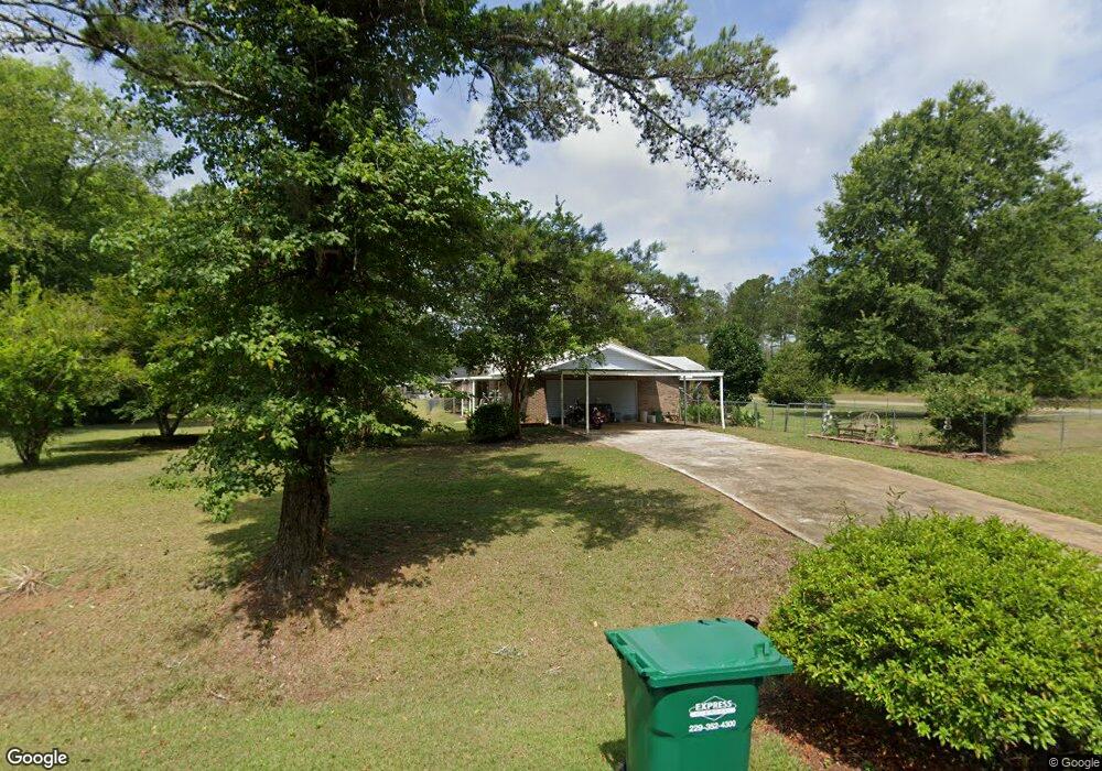
901 Benchmark Dr Albany, GA 31721
Estimated Value: $128,000 - $188,000
3
Beds
2
Baths
1,323
Sq Ft
$114/Sq Ft
Est. Value
About This Home
This home is located at 901 Benchmark Dr, Albany, GA 31721 and is currently estimated at $151,261, approximately $114 per square foot. 901 Benchmark Dr is a home located in Dougherty County with nearby schools including Live Oak Elementary School, Merry Acres Middle School, and Westover High School.
Ownership History
Date
Name
Owned For
Owner Type
Purchase Details
Closed on
Oct 19, 2000
Sold by
Ogletree Taz E and Ogletree Audrea F
Bought by
Pollard John and Pollard Teresa
Current Estimated Value
Purchase Details
Closed on
Jan 17, 2000
Sold by
Ogletree Joyce C
Bought by
Ogletree Taz E and Ogletree Audrea E
Purchase Details
Closed on
Mar 18, 1999
Sold by
Ogletree Joyce C
Bought by
Ogletree Taz E and Ogletree Audrea F
Purchase Details
Closed on
Sep 16, 1998
Sold by
Ogletree Joyce C
Bought by
Ogletree Taz E and Ogletree Audrea F
Purchase Details
Closed on
Jun 1, 1977
Sold by
Brookstore Inc
Bought by
Ogletree Joyce
Create a Home Valuation Report for This Property
The Home Valuation Report is an in-depth analysis detailing your home's value as well as a comparison with similar homes in the area
Home Values in the Area
Average Home Value in this Area
Purchase History
| Date | Buyer | Sale Price | Title Company |
|---|---|---|---|
| Pollard John | $75,000 | -- | |
| Ogletree Taz E | -- | -- | |
| Ogletree Taz E | -- | -- | |
| Ogletree Taz E | -- | -- | |
| Ogletree Joyce | -- | -- |
Source: Public Records
Tax History Compared to Growth
Tax History
| Year | Tax Paid | Tax Assessment Tax Assessment Total Assessment is a certain percentage of the fair market value that is determined by local assessors to be the total taxable value of land and additions on the property. | Land | Improvement |
|---|---|---|---|---|
| 2024 | $1,427 | $31,920 | $3,400 | $28,520 |
| 2023 | $555 | $31,920 | $3,400 | $28,520 |
| 2022 | $1,399 | $31,920 | $3,400 | $28,520 |
| 2021 | $1,297 | $31,920 | $3,400 | $28,520 |
| 2020 | $1,300 | $31,920 | $3,400 | $28,520 |
| 2019 | $1,305 | $31,920 | $3,400 | $28,520 |
| 2018 | $1,311 | $31,920 | $3,400 | $28,520 |
| 2017 | $1,221 | $31,920 | $3,400 | $28,520 |
| 2016 | $1,222 | $31,920 | $3,400 | $28,520 |
| 2015 | $1,225 | $31,920 | $3,400 | $28,520 |
| 2014 | $1,210 | $31,920 | $3,400 | $28,520 |
Source: Public Records
Map
Nearby Homes
- 3524 Moss Island Ct
- 627 Longbow Dr
- 611 Bison Ln
- 621 Aztec Ln
- 219 Lockett Station Rd
- 502 Navajo Ct
- 512 Longbow Dr
- 4412 Lacosta Dr
- 834 Lockett Station Rd
- 838 Lockett Station Rd
- 902 Lockett Station Rd
- 906 Lockett Station Rd
- 300 Las Brisas Ln
- 292 Las Brisas Ln
- 301 Las Brisas Ln
- 335 Ironhorse Ct
- 304 Turnberry Ct
- 305 Turnberry Ct
- 300 Turnberry Ct
- 308 Turnberry Ct
- 3502 Hollowtree Dr
- 907 Benchmark Dr
- 911 Benchmark Dr
- 3508 Hollowtree Dr
- 912 Benchmark Dr
- 3510 Hollowtree Dr
- 3530 Moss Island Ct
- 906 Stoneridge Dr
- 3528 Moss Island Ct
- 3436 Brook Hollow Pkwy
- 3436 Brook Hollow Pkwy Unit 12
- 3500 Brookhollow Pkwy
- 3436 Brookhollow Pkwy
- 3520 Brookhollow Pkwy
- 3524 Brookhollow Pkwy
- 3422 Brookhollow Pkwy
- 3516 Brookhollow Pkwy
- 3428 Brookhollow Pkwy
- 3522 Brookhollow Pkwy
- 3420 Brookhollow Pkwy