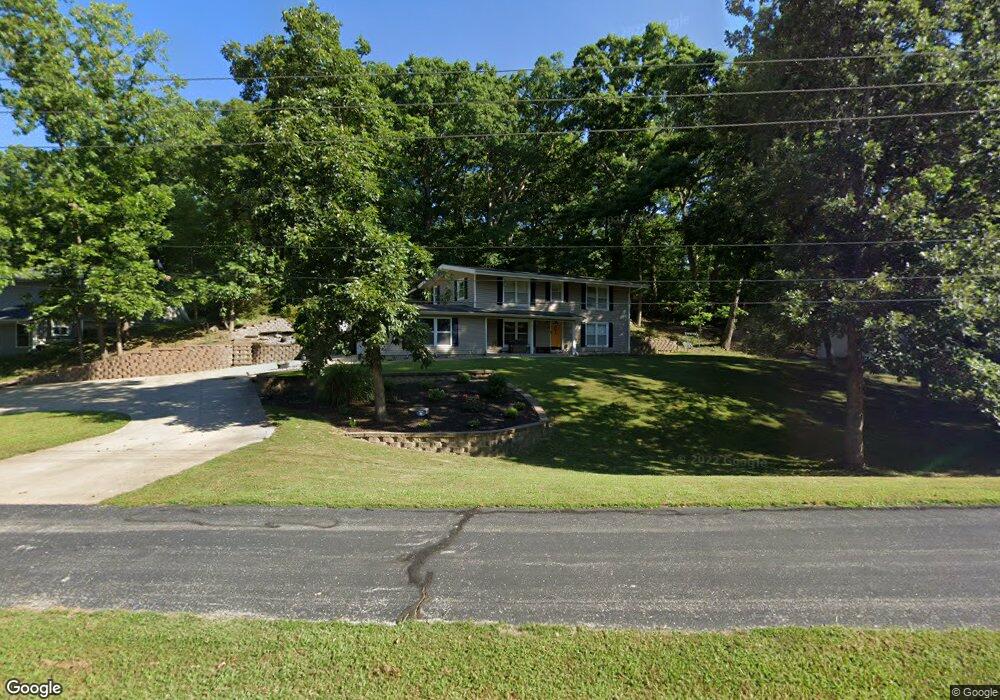
901 Beuth Rd Moberly, MO 65270
Estimated Value: $201,684 - $298,000
3
Beds
2
Baths
1,920
Sq Ft
$122/Sq Ft
Est. Value
About This Home
This home is located at 901 Beuth Rd, Moberly, MO 65270 and is currently estimated at $234,171, approximately $121 per square foot. 901 Beuth Rd is a home located in Randolph County with nearby schools including Moberly Senior High School, St. Pius X. Catholic School, and Maranatha Seventh-day Adventist School.
Ownership History
Date
Name
Owned For
Owner Type
Purchase Details
Closed on
Aug 21, 2020
Sold by
Hardwick Darren
Bought by
Thrasher Deanna E
Current Estimated Value
Home Financials for this Owner
Home Financials are based on the most recent Mortgage that was taken out on this home.
Original Mortgage
$120,000
Outstanding Balance
$106,448
Interest Rate
3%
Mortgage Type
New Conventional
Estimated Equity
$127,723
Purchase Details
Closed on
Jul 9, 2015
Sold by
Cross Diana and Cross James R
Bought by
Hardwick Darren
Purchase Details
Closed on
Nov 1, 2013
Sold by
Smith Glenn F and Smith Laura A
Bought by
Cross James R
Home Financials for this Owner
Home Financials are based on the most recent Mortgage that was taken out on this home.
Original Mortgage
$91,200
Interest Rate
4.28%
Create a Home Valuation Report for This Property
The Home Valuation Report is an in-depth analysis detailing your home's value as well as a comparison with similar homes in the area
Home Values in the Area
Average Home Value in this Area
Purchase History
| Date | Buyer | Sale Price | Title Company |
|---|---|---|---|
| Thrasher Deanna E | -- | Misc Company | |
| Hardwick Darren | -- | None Available | |
| Cross James R | -- | -- |
Source: Public Records
Mortgage History
| Date | Status | Borrower | Loan Amount |
|---|---|---|---|
| Open | Thrasher Deanna E | $120,000 | |
| Previous Owner | Cross James R | $91,200 |
Source: Public Records
Tax History
| Year | Tax Paid | Tax Assessment Tax Assessment Total Assessment is a certain percentage of the fair market value that is determined by local assessors to be the total taxable value of land and additions on the property. | Land | Improvement |
|---|---|---|---|---|
| 2025 | $1,970 | $29,320 | $3,714 | $25,606 |
| 2024 | $20 | $27,050 | $3,230 | $23,820 |
| 2023 | $2,000 | $27,050 | $3,230 | $23,820 |
| 2022 | $1,867 | $25,920 | $3,230 | $22,690 |
| 2020 | $1,347 | $18,720 | $2,281 | $16,439 |
| 2019 | $1,344 | $18,720 | $2,281 | $16,439 |
| 2018 | $1,340 | $18,720 | $2,281 | $16,439 |
| 2017 | $1,305 | $18,270 | $0 | $0 |
| 2016 | $1,243 | $17,490 | $0 | $0 |
| 2014 | -- | $15,970 | $0 | $0 |
| 2013 | -- | $15,970 | $0 | $0 |
| 2012 | -- | $15,910 | $0 | $0 |
Source: Public Records
Map
Nearby Homes
- 4 Fair Oaks
- 800 Homestead Dr
- 709 Gilman St
- 1339 Overland Ln
- LOT 2 County Rd
- 501 W Longview St
- 707 S 5th St
- 411 Shumate Ave
- 632 W Logan St
- 612 S 4th St
- 1000 S Williams St
- 419 S 4th St
- 508 S Williams St
- 309 S 4th St
- 710 W Rollins St
- 1215 Shepherds Dr
- 953 W Rollins St
- 216 S 5th St
- 816 W Reed St
- 1612 Parkwood Dr