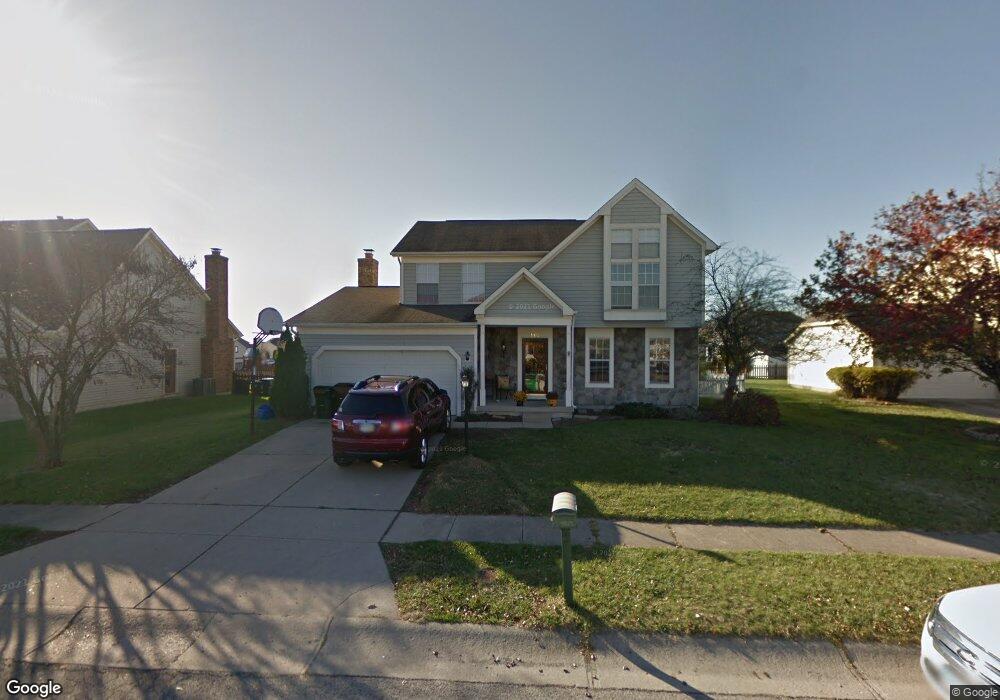
901 Decker Dr Miamisburg, OH 45342
Estimated Value: $340,000 - $350,868
4
Beds
3
Baths
2,024
Sq Ft
$172/Sq Ft
Est. Value
About This Home
This home is located at 901 Decker Dr, Miamisburg, OH 45342 and is currently estimated at $347,217, approximately $171 per square foot. 901 Decker Dr is a home located in Montgomery County with nearby schools including Miamisburg High School and Bethel Baptist School.
Ownership History
Date
Name
Owned For
Owner Type
Purchase Details
Closed on
Jun 24, 2005
Sold by
Short David F and Short Sharon G
Bought by
Sutter David Andrew and Sutter Heather Nicole
Current Estimated Value
Home Financials for this Owner
Home Financials are based on the most recent Mortgage that was taken out on this home.
Original Mortgage
$159,975
Outstanding Balance
$82,763
Interest Rate
5.62%
Mortgage Type
Fannie Mae Freddie Mac
Estimated Equity
$264,454
Purchase Details
Closed on
May 28, 1999
Sold by
Conley Family Limited Partnership
Bought by
Short David F and Short Sharon G
Home Financials for this Owner
Home Financials are based on the most recent Mortgage that was taken out on this home.
Original Mortgage
$128,700
Interest Rate
6.94%
Purchase Details
Closed on
Feb 4, 1994
Sold by
Cluxton Roger B and Cluxton Jennifer V
Bought by
Conley Ralph
Create a Home Valuation Report for This Property
The Home Valuation Report is an in-depth analysis detailing your home's value as well as a comparison with similar homes in the area
Home Values in the Area
Average Home Value in this Area
Purchase History
| Date | Buyer | Sale Price | Title Company |
|---|---|---|---|
| Sutter David Andrew | $177,800 | -- | |
| Short David F | $160,900 | -- | |
| Conley Ralph | -- | -- |
Source: Public Records
Mortgage History
| Date | Status | Borrower | Loan Amount |
|---|---|---|---|
| Open | Sutter David Andrew | $159,975 | |
| Previous Owner | Short David F | $128,700 | |
| Closed | Sutter David Andrew | $17,775 |
Source: Public Records
Tax History Compared to Growth
Tax History
| Year | Tax Paid | Tax Assessment Tax Assessment Total Assessment is a certain percentage of the fair market value that is determined by local assessors to be the total taxable value of land and additions on the property. | Land | Improvement |
|---|---|---|---|---|
| 2024 | $6,088 | $93,850 | $19,550 | $74,300 |
| 2023 | $6,088 | $93,850 | $19,550 | $74,300 |
| 2022 | $5,310 | $70,570 | $14,700 | $55,870 |
| 2021 | $4,695 | $70,570 | $14,700 | $55,870 |
| 2020 | $4,692 | $70,570 | $14,700 | $55,870 |
| 2019 | $4,200 | $58,020 | $10,500 | $47,520 |
| 2018 | $4,214 | $58,020 | $10,500 | $47,520 |
| 2017 | $4,185 | $58,020 | $10,500 | $47,520 |
| 2016 | $3,973 | $53,080 | $10,500 | $42,580 |
| 2015 | $3,895 | $53,080 | $10,500 | $42,580 |
| 2014 | $3,895 | $53,080 | $10,500 | $42,580 |
| 2012 | -- | $60,760 | $13,300 | $47,460 |
Source: Public Records
Map
Nearby Homes
- 2141 Rosina Dr
- 736 Decker Dr
- 712 Decker Dr
- 1157 Bonniebrook Dr
- 2279 Rosina Dr
- 2127 Carrington Ln
- 628 Jamestown Dr
- 1131 Castleton Ct
- 1 Pendle Point
- 1734 Rosina Dr
- 3902 Augusta Rd
- 1563 Vista Ridge Dr Unit 1561
- 1350 Vista Ridge Dr
- 1808 Burnside Dr
- 9228 Sawgrass Dr
- 9220 Sawgrass Dr
- 766 Dunaway St
- 807 Dunaway St
- 615 Burnside Dr
- 902 Althea Dr
- 913 Decker Dr
- 813 Decker Dr
- 844 Jamestown Dr
- 834 Jamestown Dr
- 2200 Clearbrook Ct
- 925 Decker Dr
- 912 Decker Dr
- 824 Jamestown Dr
- 814 Decker Dr
- 924 Decker Dr
- 2206 Clearbrook Ct
- 2207 Clearbrook Ct
- 809 Decker Dr
- 814 Jamestown Dr
- 2207 Rosina Dr
- 833 Jamestown Dr
- 853 Jamestown Dr
- 1001 Decker Dr
- 2213 Clearbrook Ct
- 2212 Clearbrook Ct