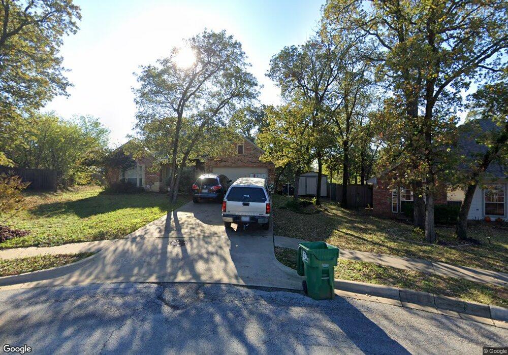
901 Dudley St Denton, TX 76205
Denia NeighborhoodEstimated Value: $319,000 - $338,000
4
Beds
2
Baths
1,641
Sq Ft
$202/Sq Ft
Est. Value
About This Home
This home is located at 901 Dudley St, Denton, TX 76205 and is currently estimated at $331,112, approximately $201 per square foot. 901 Dudley St is a home located in Denton County with nearby schools including Borman Elementary School, McMath Middle School, and Denton High School.
Ownership History
Date
Name
Owned For
Owner Type
Purchase Details
Closed on
Jan 20, 2004
Sold by
Taylor John M
Bought by
Taylor Lori L
Current Estimated Value
Home Financials for this Owner
Home Financials are based on the most recent Mortgage that was taken out on this home.
Original Mortgage
$18,769
Interest Rate
5.9%
Mortgage Type
Stand Alone Refi Refinance Of Original Loan
Purchase Details
Closed on
Apr 30, 2003
Sold by
Mccullar Realty Inc
Bought by
Taylor John M
Home Financials for this Owner
Home Financials are based on the most recent Mortgage that was taken out on this home.
Original Mortgage
$20,760
Interest Rate
5.8%
Mortgage Type
Purchase Money Mortgage
Create a Home Valuation Report for This Property
The Home Valuation Report is an in-depth analysis detailing your home's value as well as a comparison with similar homes in the area
Home Values in the Area
Average Home Value in this Area
Purchase History
| Date | Buyer | Sale Price | Title Company |
|---|---|---|---|
| Taylor Lori L | -- | Commonwealth Land Title | |
| Taylor John M | -- | -- | |
| Taylor John M | -- | -- |
Source: Public Records
Mortgage History
| Date | Status | Borrower | Loan Amount |
|---|---|---|---|
| Closed | Taylor Lori L | $18,769 | |
| Closed | Taylor John M | $20,760 |
Source: Public Records
Tax History Compared to Growth
Tax History
| Year | Tax Paid | Tax Assessment Tax Assessment Total Assessment is a certain percentage of the fair market value that is determined by local assessors to be the total taxable value of land and additions on the property. | Land | Improvement |
|---|---|---|---|---|
| 2025 | $4,422 | $320,126 | $58,264 | $285,921 |
| 2024 | $5,617 | $291,024 | $0 | $0 |
| 2023 | $3,855 | $264,567 | $58,264 | $272,061 |
| 2022 | $5,106 | $240,515 | $58,264 | $241,966 |
| 2021 | $4,861 | $253,400 | $42,578 | $210,822 |
| 2020 | $4,543 | $198,773 | $42,578 | $156,195 |
| 2019 | $4,743 | $198,773 | $42,578 | $156,195 |
| 2018 | $4,714 | $195,153 | $42,578 | $152,575 |
| 2017 | $4,442 | $179,724 | $33,614 | $160,343 |
| 2016 | $4,038 | $163,385 | $33,614 | $136,269 |
| 2015 | $3,113 | $148,532 | $33,614 | $119,001 |
| 2014 | $3,113 | $135,029 | $33,614 | $108,013 |
| 2013 | -- | $122,754 | $33,614 | $89,140 |
Source: Public Records
Map
Nearby Homes
- 631 Acme St
- 2305 Bernard St
- 2314 Leslie St
- 2302 Mercedes Rd
- 2421 Mercedes Rd
- 2605 Mccormick St
- 2609 Mccormick St
- 1211 Lindsey St
- 1523 Oakwood Dr
- 2617 Mccormick St
- 2513 Goldfinch Dr
- 2621 Mccormick St
- 1619 Mccormick St
- 2700 Mccormick St
- 2512 Goldfinch Dr
- 2516 Goldfinch Dr
- 2600 Goldfinch Dr
- 2708 Mccormick St
- 2700 Goldfinch Dr
- 2713 Goldfinch Dr
- 900 Dudley St
- 905 Dudley St
- 2213 Leslie St
- 2124 Bernard St
- 2120 Bernard St
- 2200 Bernard St
- 2217 Leslie St
- 2116 Bernard St
- 909 Dudley St
- 904 Dudley St
- 2204 Bernard St
- 2113 Leslie St
- 2112 Bernard St
- 913 Dudley St
- 2214 Leslie St
- 2303 Leslie St
- 2210 Bernard St
- 2108 Bernard St
- 2109 Leslie St
- 2127 Bernard St