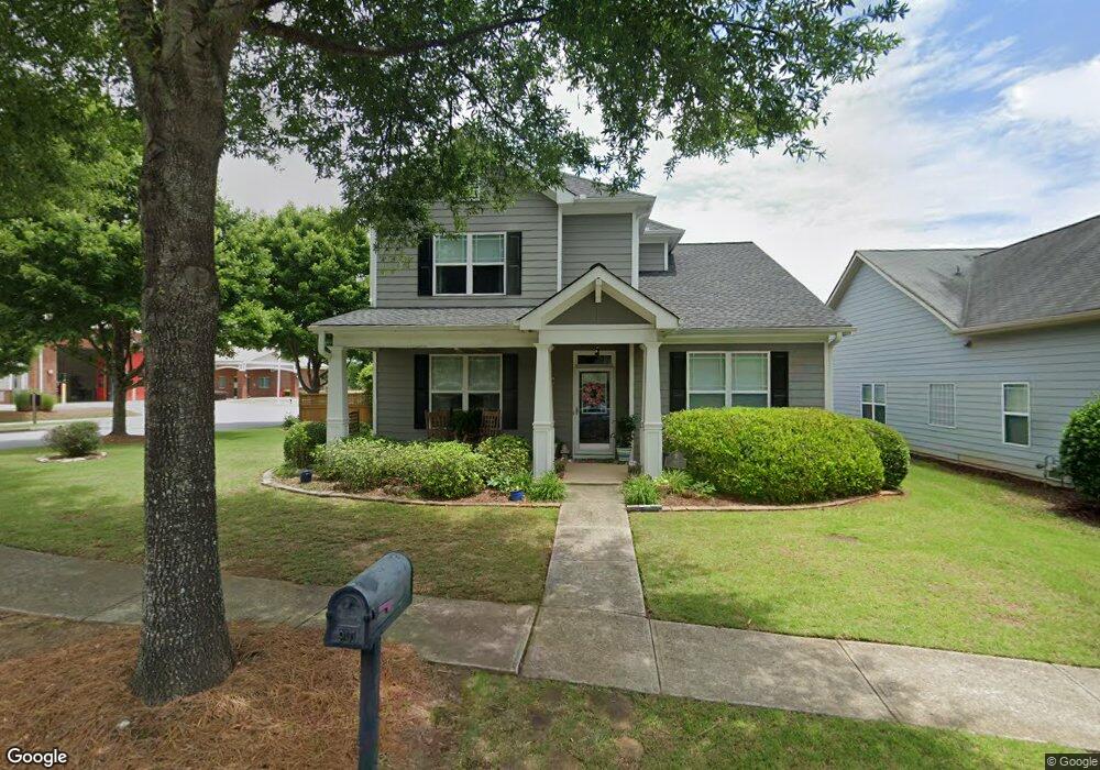
901 Duncan Terrace Canton, GA 30115
Estimated Value: $440,138 - $443,000
3
Beds
3
Baths
2,003
Sq Ft
$220/Sq Ft
Est. Value
About This Home
This home is located at 901 Duncan Terrace, Canton, GA 30115 and is currently estimated at $441,569, approximately $220 per square foot. 901 Duncan Terrace is a home located in Cherokee County with nearby schools including Indian Knoll Elementary School, Rusk Middle School, and Sequoyah High School.
Ownership History
Date
Name
Owned For
Owner Type
Purchase Details
Closed on
Feb 25, 2010
Sold by
Brothers Joseph F and Brothers Judy S
Bought by
Standridge Marion F and Standridge Brenda A
Current Estimated Value
Home Financials for this Owner
Home Financials are based on the most recent Mortgage that was taken out on this home.
Original Mortgage
$183,767
Outstanding Balance
$120,776
Interest Rate
4.97%
Mortgage Type
VA
Estimated Equity
$320,793
Purchase Details
Closed on
Aug 31, 2006
Sold by
Patrick Malloy Communities Llc
Bought by
Brothers Joseph F and Brothers Judy S
Home Financials for this Owner
Home Financials are based on the most recent Mortgage that was taken out on this home.
Original Mortgage
$197,900
Interest Rate
7%
Mortgage Type
New Conventional
Create a Home Valuation Report for This Property
The Home Valuation Report is an in-depth analysis detailing your home's value as well as a comparison with similar homes in the area
Home Values in the Area
Average Home Value in this Area
Purchase History
| Date | Buyer | Sale Price | Title Company |
|---|---|---|---|
| Standridge Marion F | $179,900 | -- | |
| Brothers Joseph F | $198,000 | -- |
Source: Public Records
Mortgage History
| Date | Status | Borrower | Loan Amount |
|---|---|---|---|
| Open | Standridge Marion F | $183,767 | |
| Previous Owner | Brothers Joseph F | $197,900 |
Source: Public Records
Tax History
| Year | Tax Paid | Tax Assessment Tax Assessment Total Assessment is a certain percentage of the fair market value that is determined by local assessors to be the total taxable value of land and additions on the property. | Land | Improvement |
|---|---|---|---|---|
| 2025 | $4,180 | $165,440 | $34,000 | $131,440 |
| 2024 | $810 | $165,160 | $34,000 | $131,160 |
| 2023 | $773 | $162,600 | $34,000 | $128,600 |
| 2022 | $785 | $129,880 | $28,000 | $101,880 |
| 2021 | $360 | $100,800 | $21,200 | $79,600 |
| 2020 | $726 | $96,200 | $20,000 | $76,200 |
| 2019 | $360 | $89,680 | $20,000 | $69,680 |
| 2018 | $712 | $81,160 | $17,600 | $63,560 |
| 2017 | $680 | $200,100 | $17,600 | $62,440 |
| 2016 | $393 | $197,800 | $16,000 | $63,120 |
| 2015 | $402 | $183,400 | $14,000 | $59,360 |
| 2014 | $400 | $176,700 | $14,000 | $56,680 |
Source: Public Records
Map
Nearby Homes
- 405 Royal Crescent Ln E
- 411 Royal Crescent Ln E
- 241 Royal Crescent Terrace
- 646 Royal Crest Ct
- 626 Royal Crest Ct
- 642 Royal Crest Ct
- Rutherford Plan at
- Turner Plan at
- 508 Hayes Ln
- 501 Hayes Ln
- 207 Reserve Crossing
- 243 Harmony Lake Dr
- 408 Long Branch Way
- 212 Reserve Crossing
- 3583 Hickory Flat Hwy
- 432 Edgewater Chase
- 129 Prescott Manor Dr
- 3581 Hickory Flat Hwy
- 120 Prescott Manor Dr
- The Whitmore Plan at Legacy Downs
- 905 Duncan Terrace
- 299 Harmony Lake Dr
- 907 Duncan Terrace
- 702 St James Place Unit 101
- 702 St James Place
- 144 Harmony Lake Dr
- 0 Bart Manous Rd
- 0 Bart Manous Rd Unit 3206308
- 0 Bart Manous Rd Unit 4340756
- 0 Bart Manous Rd Unit 8636075
- 704 St James Place Unit 704
- 704 St James Place
- 909 Duncan Terrace
- 706 St James Place
- 708 St James Place
- 142 Harmony Lake Dr Unit DR
- 142 Harmony Lake Dr Unit DRIVE
- 142 Harmony Lake Dr
- 101 Harmony Lake Dr
- 710 Saint James Place
Your Personal Tour Guide
Ask me questions while you tour the home.