Estimated Value: $85,000 - $101,000
3
Beds
1
Bath
1,044
Sq Ft
$92/Sq Ft
Est. Value
About This Home
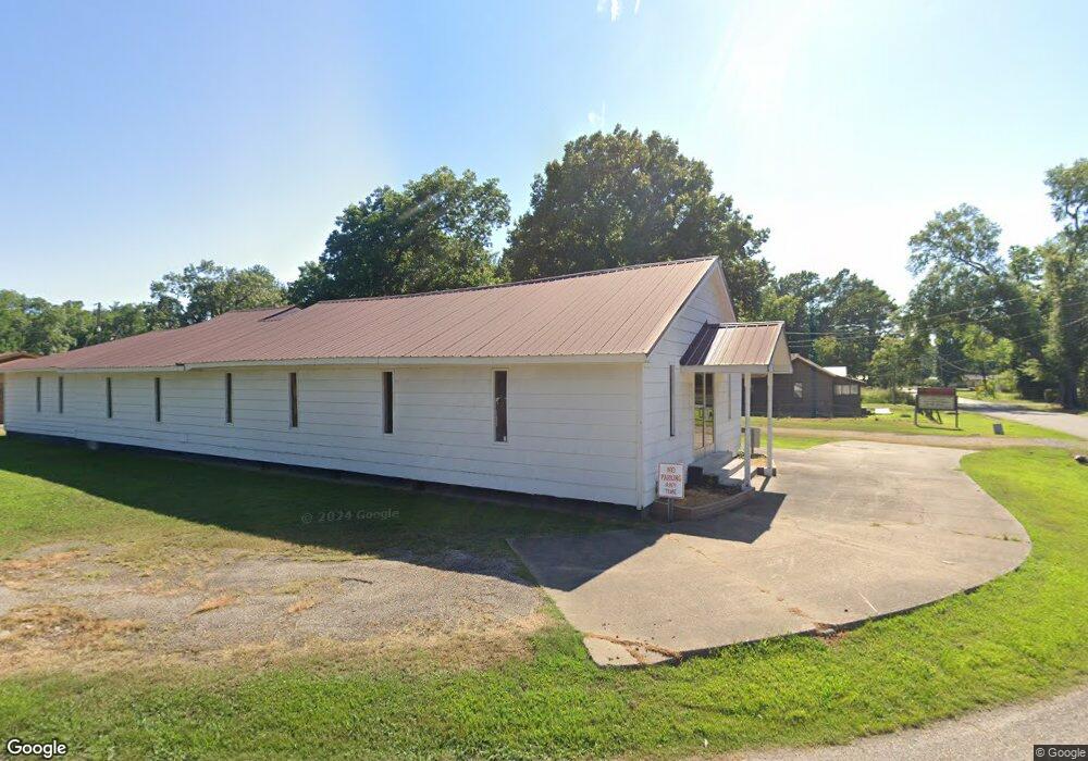
This home is located at 901 Forrest Ave E, Wynne, AR 72396 and is currently estimated at $95,932, approximately $91 per square foot. 901 Forrest Ave E is a home located in Cross County with nearby schools including Wynne Primary School, Wynne Intermediate School, and Wynne Junior High School.
Ownership History
Date
Name
Owned For
Owner Type
Purchase Details
Closed on
May 21, 2020
Sold by
Black Reef Trust
Bought by
Needham Wesley
Current Estimated Value
Home Financials for this Owner
Home Financials are based on the most recent Mortgage that was taken out on this home.
Original Mortgage
$46,400
Interest Rate
3.1%
Mortgage Type
New Conventional
Purchase Details
Closed on
Jan 6, 2007
Sold by
Wilson & Associates Pllc
Bought by
Wilmington Savings Fund Society
Create a Home Valuation Report for This Property
The Home Valuation Report is an in-depth analysis detailing your home's value as well as a comparison with similar homes in the area
Home Values in the Area
Average Home Value in this Area
Purchase History
| Date | Buyer | Sale Price | Title Company |
|---|---|---|---|
| Needham Wesley | $50,000 | None Available | |
| Wilmington Savings Fund Society | -- | None Available |
Source: Public Records
Mortgage History
| Date | Status | Borrower | Loan Amount |
|---|---|---|---|
| Previous Owner | Needham Wesley | $46,400 |
Source: Public Records
Tax History Compared to Growth
Tax History
| Year | Tax Paid | Tax Assessment Tax Assessment Total Assessment is a certain percentage of the fair market value that is determined by local assessors to be the total taxable value of land and additions on the property. | Land | Improvement |
|---|---|---|---|---|
| 2024 | $200 | $14,180 | $4,370 | $9,810 |
| 2023 | $277 | $14,180 | $4,370 | $9,810 |
| 2022 | $702 | $14,180 | $4,370 | $9,810 |
| 2021 | $702 | $14,180 | $4,370 | $9,810 |
| 2020 | $702 | $14,180 | $4,370 | $9,810 |
| 2019 | $0 | $12,860 | $3,960 | $8,900 |
| 2018 | $0 | $12,860 | $3,960 | $8,900 |
| 2017 | $0 | $12,860 | $3,960 | $8,900 |
| 2016 | -- | $12,860 | $3,960 | $8,900 |
| 2015 | -- | $12,860 | $3,960 | $8,900 |
| 2014 | -- | $6,460 | $2,706 | $3,754 |
Source: Public Records
Map
Nearby Homes
- 813 Childress Dr
- 0 Cr 760
- 624 C St
- 1002 Brittney Cir
- 0 Brittney Cir Unit 43670
- 0 Brittney Cir Unit 25030957
- 714 Church St N
- 513 Forrest Ave E
- 514 Poplar Ave E
- 607 Bruce St N
- 136 Matthew Addition Cove
- 704 Front St S
- 411 N Bruce St
- 810 Forrest Ave E
- 106 Eldridge Ct
- 903 Levesque Ave E
- 919 Hamilton Ave E
- 908 Block St S
- 1008 Languille Ave E
- 1783 Hart
- 931 Forrest Ave W
- 961 Forrest Ave W
- 804 Forrest Ave W
- 707 J St
- J St
- 713 J St
- 717 J St
- 809 Forrest Ave W
- 1001 Forrest Ave W
- 807 Forrest Ave W
- 719 J St
- 720 Forrest Ave W
- 719 Jackson Ave W
- 904 Poplar Ave W
- 1005 B W Forrest
- 1005 Forrest Ave W
- 613 J St
- 1003 Forrest Ave W
- 805 Languille Ave W
- 722 Jackson Ave W