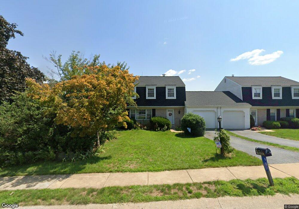
901 Hornig Rd Lancaster, PA 17601
Hornig NeighborhoodEstimated Value: $317,000 - $384,454
3
Beds
3
Baths
1,704
Sq Ft
$209/Sq Ft
Est. Value
About This Home
This home is located at 901 Hornig Rd, Lancaster, PA 17601 and is currently estimated at $355,614, approximately $208 per square foot. 901 Hornig Rd is a home located in Lancaster County with nearby schools including Fritz Elementary School, Gerald G. Huesken Middle School, and Conestoga Valley High School.
Ownership History
Date
Name
Owned For
Owner Type
Purchase Details
Closed on
Jul 8, 1999
Sold by
Gehman David E and Gehman Nona B
Bought by
Friendship Community
Current Estimated Value
Home Financials for this Owner
Home Financials are based on the most recent Mortgage that was taken out on this home.
Original Mortgage
$2,150,000
Outstanding Balance
$584,648
Interest Rate
7.19%
Estimated Equity
-$229,034
Create a Home Valuation Report for This Property
The Home Valuation Report is an in-depth analysis detailing your home's value as well as a comparison with similar homes in the area
Home Values in the Area
Average Home Value in this Area
Purchase History
| Date | Buyer | Sale Price | Title Company |
|---|---|---|---|
| Friendship Community | $190,000 | -- |
Source: Public Records
Mortgage History
| Date | Status | Borrower | Loan Amount |
|---|---|---|---|
| Open | Friendship Community | $2,150,000 |
Source: Public Records
Tax History Compared to Growth
Tax History
| Year | Tax Paid | Tax Assessment Tax Assessment Total Assessment is a certain percentage of the fair market value that is determined by local assessors to be the total taxable value of land and additions on the property. | Land | Improvement |
|---|---|---|---|---|
| 2025 | $3,432 | $169,500 | $50,000 | $119,500 |
| 2024 | $3,432 | $169,500 | $50,000 | $119,500 |
| 2023 | $3,352 | $169,500 | $50,000 | $119,500 |
| 2022 | $3,269 | $169,500 | $50,000 | $119,500 |
| 2021 | $3,154 | $169,500 | $50,000 | $119,500 |
| 2020 | $3,154 | $169,500 | $50,000 | $119,500 |
| 2019 | $3,086 | $169,500 | $50,000 | $119,500 |
| 2018 | $4,349 | $169,500 | $50,000 | $119,500 |
| 2017 | $2,613 | $120,700 | $40,200 | $80,500 |
| 2016 | $2,582 | $120,700 | $40,200 | $80,500 |
| 2015 | $660 | $120,700 | $40,200 | $80,500 |
| 2014 | $1,695 | $120,700 | $40,200 | $80,500 |
Source: Public Records
Map
Nearby Homes
- Charleston Plan at Devon Creek - Terraces
- Wyndham Plan at Devon Creek - Cottages
- Preston Plan at Devon Creek - Cottages
- Livingston Plan at Devon Creek - Cottages
- 2183 Kolb Dr
- 2221 Brentford St
- 2154 Meadow Ridge Dr
- 2024 Meadow Ridge Dr
- 2234 Coach Light Ln
- 2043 Stonecrest Dr
- 2007 Meadow Ridge Dr
- 1461 Hunsicker Rd
- 1339 Beaconfield Ln
- 1326 Stillwater Rd
- 1400 Hunsicker Rd
- 2010 Landis Valley Rd
- 1325 Olde Saybrook Rd
- 1981 Landis Valley Rd
- 2111 Landis Valley Rd
- 0 Butter Rd
- 903 Hornig Rd
- 899 Hornig Rd
- 905 Hornig Rd
- 897 Hornig Rd
- 892 Fenton Ave
- 890 Fenton Ave
- 907 Hornig Rd
- 894 Fenton Ave
- 895 Hornig Rd
- 886 Fenton Ave
- 0 Cadwell Unit 1003801777
- 0 Cadwell Unit 1003801745
- 0 Cadwell Unit 210353
- 0 Cadwell Unit 210351
- 909 Hornig Rd
- 893 Hornig Rd
- 894 Hornig Rd
- 896 Hornig Rd
- 2200 Brentford St
- 900 Fenton Ave Unit PRESCOTT