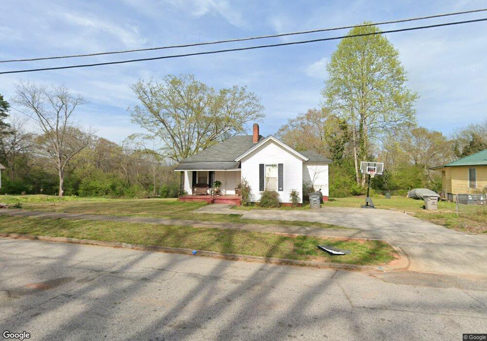
901 Houston St Lagrange, GA 30240
Estimated Value: $58,000 - $142,000
2
Beds
1
Bath
1,032
Sq Ft
$84/Sq Ft
Est. Value
About This Home
This home is located at 901 Houston St, Lagrange, GA 30240 and is currently estimated at $86,289, approximately $83 per square foot. 901 Houston St is a home located in Troup County with nearby schools including Berta Weathersbee Elementary School, Whitesville Road Elementary School, and Rosemont Elementary School.
Ownership History
Date
Name
Owned For
Owner Type
Purchase Details
Closed on
Jan 24, 2003
Sold by
Sovereign Bank
Bought by
Edelson Stephen L
Current Estimated Value
Purchase Details
Closed on
Mar 11, 2002
Sold by
Pamela Lee Dobbs
Bought by
Sovereign Bank
Purchase Details
Closed on
May 30, 1997
Sold by
Jewell Ellis
Bought by
Pamela Lee Dobbs
Purchase Details
Closed on
Jun 1, 1987
Bought by
Jewell Ellis
Purchase Details
Closed on
Nov 1, 1966
Create a Home Valuation Report for This Property
The Home Valuation Report is an in-depth analysis detailing your home's value as well as a comparison with similar homes in the area
Home Values in the Area
Average Home Value in this Area
Purchase History
| Date | Buyer | Sale Price | Title Company |
|---|---|---|---|
| Edelson Stephen L | $18,000 | -- | |
| Sovereign Bank | $21,200 | -- | |
| Pamela Lee Dobbs | $28,000 | -- | |
| Jewell Ellis | -- | -- | |
| -- | -- | -- |
Source: Public Records
Tax History Compared to Growth
Tax History
| Year | Tax Paid | Tax Assessment Tax Assessment Total Assessment is a certain percentage of the fair market value that is determined by local assessors to be the total taxable value of land and additions on the property. | Land | Improvement |
|---|---|---|---|---|
| 2024 | $596 | $21,840 | $2,000 | $19,840 |
| 2023 | $541 | $19,840 | $2,000 | $17,840 |
| 2022 | $528 | $18,920 | $2,000 | $16,920 |
| 2021 | $428 | $14,200 | $2,000 | $12,200 |
| 2020 | $428 | $14,200 | $2,000 | $12,200 |
| 2019 | $405 | $13,440 | $2,000 | $11,440 |
| 2018 | $392 | $13,012 | $2,052 | $10,960 |
| 2017 | $392 | $13,012 | $2,052 | $10,960 |
| 2016 | $376 | $12,468 | $2,052 | $10,416 |
| 2015 | $377 | $12,468 | $2,052 | $10,416 |
| 2014 | $361 | $11,920 | $2,052 | $9,868 |
| 2013 | -- | $12,644 | $2,052 | $10,592 |
Source: Public Records
Map
Nearby Homes
- 109 Garfield St
- The Rhodes Plan at Crown Street Cottages
- The Truitt Plan at Crown Street Cottages
- The Callaway Plan at Crown Street Cottages
- 802 Monroe St
- 102 Crown St Unit LOT 1
- 101 Crown St Unit LOT 5
- 119 Jones St
- 612 S Lee St
- 205 Grady St
- 202 Parker Ln
- 610 Wilburn Ave
- 608 Wilburn Ave
- 701 Jefferson St
- 102 Parker St
- 1402 Forrest Ave
- 507 S Lee St
- 107 Clark St
- 167 S Kight Dr
- 211 Moores Hill
- 900 Houston St
- 903 Houston St
- 815 Houston St
- 904 Houston St
- 905 Houston St
- 813 Houston St
- 902 Stonewall St
- 810 Stonewall St
- 814 Houston St
- 900 Stonewall St
- 906 Houston St
- 904 Stonewall St
- 907 Houston St
- 811 Houston St
- 808 Stonewall St
- 812 Houston St
- 903 Troup St
- 908 Houston St
- 905 Troup St
- 906 Stonewall St