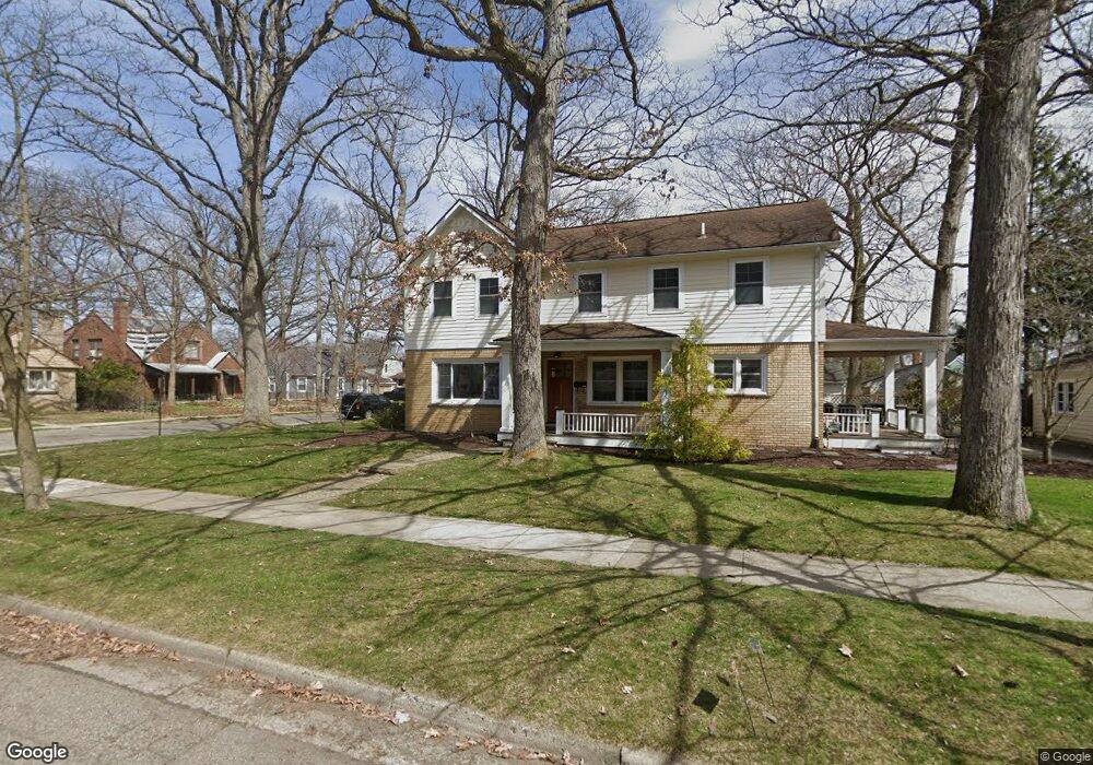
901 Hutchins Ave Ann Arbor, MI 48103
Old West Side NeighborhoodEstimated Value: $538,000 - $720,864
3
Beds
3
Baths
2,004
Sq Ft
$319/Sq Ft
Est. Value
About This Home
This home is located at 901 Hutchins Ave, Ann Arbor, MI 48103 and is currently estimated at $638,966, approximately $318 per square foot. 901 Hutchins Ave is a home located in Washtenaw County with nearby schools including Bach Elementary School, Slauson Middle School, and Pioneer High School.
Ownership History
Date
Name
Owned For
Owner Type
Purchase Details
Closed on
Feb 25, 2003
Sold by
Lewis Mary H
Bought by
Nutt Craig and Nutt Laura
Current Estimated Value
Home Financials for this Owner
Home Financials are based on the most recent Mortgage that was taken out on this home.
Original Mortgage
$164,700
Outstanding Balance
$71,218
Interest Rate
5.96%
Mortgage Type
Unknown
Estimated Equity
$567,748
Purchase Details
Closed on
Jul 21, 2000
Sold by
Lewis Mary H
Bought by
Lewis Mary H Trust
Create a Home Valuation Report for This Property
The Home Valuation Report is an in-depth analysis detailing your home's value as well as a comparison with similar homes in the area
Home Values in the Area
Average Home Value in this Area
Purchase History
| Date | Buyer | Sale Price | Title Company |
|---|---|---|---|
| Nutt Craig | $196,000 | -- | |
| Lewis Mary H Trust | -- | -- |
Source: Public Records
Mortgage History
| Date | Status | Borrower | Loan Amount |
|---|---|---|---|
| Open | Nutt Craig | $164,700 |
Source: Public Records
Tax History Compared to Growth
Tax History
| Year | Tax Paid | Tax Assessment Tax Assessment Total Assessment is a certain percentage of the fair market value that is determined by local assessors to be the total taxable value of land and additions on the property. | Land | Improvement |
|---|---|---|---|---|
| 2025 | $8,550 | $325,100 | $0 | $0 |
| 2024 | $8,339 | $284,000 | $0 | $0 |
| 2023 | $7,689 | $259,300 | $0 | $0 |
| 2022 | $7,170 | $240,900 | $0 | $0 |
| 2021 | $8,181 | $235,000 | $0 | $0 |
| 2020 | $8,016 | $236,100 | $0 | $0 |
| 2019 | $7,629 | $210,100 | $210,100 | $0 |
| 2018 | $7,521 | $203,600 | $0 | $0 |
| 2017 | $7,316 | $198,900 | $0 | $0 |
| 2016 | $6,232 | $146,306 | $0 | $0 |
| 2015 | $6,722 | $145,869 | $0 | $0 |
| 2014 | $6,722 | $141,312 | $0 | $0 |
| 2013 | -- | $141,312 | $0 | $0 |
Source: Public Records
Map
Nearby Homes
- 1134 Hutchins Ave
- 407 Pauline Blvd
- 614 S 7th St
- 552 5th St
- 1215 Prescott Ave
- 533 5th St
- 103 W Davis Ave
- 220 W Mosley St
- 814 W Jefferson St
- 401 Berkley Ave
- 460 W Stadium Blvd
- 462 W Stadium Blvd
- 1435 Woodland Dr
- 717 W Liberty St
- 441 S Ashley St Unit 405
- 140 Ashley Mews Dr Unit 27
- 1524 Marian Ave
- 285 Mulholland St Unit 3
- 1836 Virnankay Cir
- 404 W Liberty St
- 707 W Davis Ave
- 801 W Davis Ave
- 705 W Davis Ave
- 905 Hutchins Ave
- 708 W Davis Ave
- 706 W Davis Ave
- 703 W Davis Ave
- 907 Hutchins Ave
- 805 W Davis Ave
- 704 W Davis Ave
- 906 Hutchins Ave
- 906 5th St
- 909 Hutchins Ave
- 814 5th St
- 804 W Davis Ave
- 800 W Davis Ave
- 908 Hutchins Ave
- 701 W Davis Ave
- 908 5th St
- 809 W Davis Ave