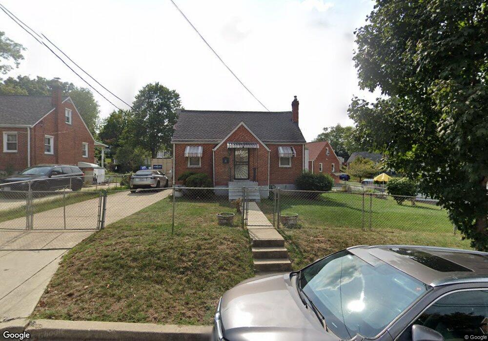
901 Karlson Ave Hyattsville, MD 20783
Estimated Value: $344,451 - $452,000
--
Bed
2
Baths
1,229
Sq Ft
$331/Sq Ft
Est. Value
About This Home
This home is located at 901 Karlson Ave, Hyattsville, MD 20783 and is currently estimated at $406,363, approximately $330 per square foot. 901 Karlson Ave is a home located in Prince George's County with nearby schools including Ridgecrest Elementary School, Nicholas Orem Middle School, and High Point High School.
Ownership History
Date
Name
Owned For
Owner Type
Purchase Details
Closed on
May 6, 1994
Sold by
Stewart Stonewall J
Bought by
Dash Aaron
Current Estimated Value
Home Financials for this Owner
Home Financials are based on the most recent Mortgage that was taken out on this home.
Original Mortgage
$103,050
Interest Rate
7.7%
Purchase Details
Closed on
Dec 28, 1971
Sold by
Curtiss Nelson W
Bought by
Stewart Stonewall J and Stewart Beulah M
Create a Home Valuation Report for This Property
The Home Valuation Report is an in-depth analysis detailing your home's value as well as a comparison with similar homes in the area
Home Values in the Area
Average Home Value in this Area
Purchase History
| Date | Buyer | Sale Price | Title Company |
|---|---|---|---|
| Dash Aaron | $108,500 | -- | |
| Stewart Stonewall J | $24,500 | -- |
Source: Public Records
Mortgage History
| Date | Status | Borrower | Loan Amount |
|---|---|---|---|
| Closed | Dash Aaron | $103,050 |
Source: Public Records
Tax History Compared to Growth
Tax History
| Year | Tax Paid | Tax Assessment Tax Assessment Total Assessment is a certain percentage of the fair market value that is determined by local assessors to be the total taxable value of land and additions on the property. | Land | Improvement |
|---|---|---|---|---|
| 2025 | $4,100 | $358,000 | -- | -- |
| 2024 | $4,100 | $345,200 | $115,300 | $229,900 |
| 2023 | $3,961 | $329,033 | $0 | $0 |
| 2022 | $3,789 | $312,867 | $0 | $0 |
| 2021 | $3,603 | $296,700 | $100,100 | $196,600 |
| 2020 | $3,466 | $287,833 | $0 | $0 |
| 2019 | $3,322 | $278,967 | $0 | $0 |
| 2018 | $3,172 | $270,100 | $75,100 | $195,000 |
| 2017 | $3,034 | $235,100 | $0 | $0 |
| 2016 | -- | $200,100 | $0 | $0 |
| 2015 | $2,737 | $165,100 | $0 | $0 |
| 2014 | $2,737 | $165,100 | $0 | $0 |
Source: Public Records
Map
Nearby Homes
- 6603 Medwick Dr
- 6602 8th Ave
- 6502 Knollbrook Dr
- 1113 Burketon Rd
- 6418 Elliott Place
- 6412 Elliott Place
- 1204 Raydale Rd
- 710 Somerset Place
- 505 Belford Place
- 6813 10th Ave
- 6604 Gude Ave
- 1611 Dayton Rd
- 819 Chillum Rd
- 1011 Hopewell Ave
- 6914 New Hampshire Ave
- 702 Auburn Ave
- 6624 Poplar Ave
- 6418 Sligo Mill Rd
- 6519 Parkway Ct
- 0 Peabody St NE Unit DCDC2149022