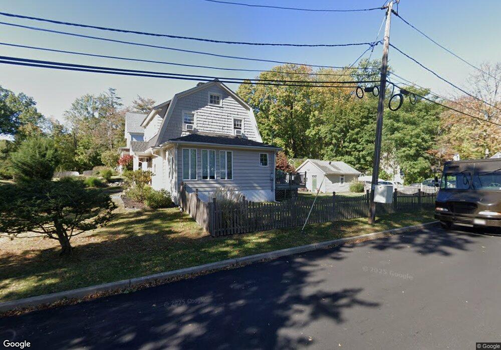
901 Leland Ave Unit 5 Plainfield, NJ 07062
Estimated Value: $500,953 - $570,000
--
Bed
--
Bath
1,296
Sq Ft
$415/Sq Ft
Est. Value
About This Home
This home is located at 901 Leland Ave Unit 5, Plainfield, NJ 07062 and is currently estimated at $537,488, approximately $414 per square foot. 901 Leland Ave Unit 5 is a home located in Union County with nearby schools including Frederic W. Cook School, Emerson Community School, and Maxson Middle School.
Ownership History
Date
Name
Owned For
Owner Type
Purchase Details
Closed on
Apr 22, 2009
Sold by
Disarno James J and Disarno Lauren B
Bought by
Stampfl Joseph W and Stampfl Veronica I
Current Estimated Value
Home Financials for this Owner
Home Financials are based on the most recent Mortgage that was taken out on this home.
Original Mortgage
$289,656
Outstanding Balance
$182,321
Interest Rate
4.86%
Mortgage Type
FHA
Estimated Equity
$355,167
Purchase Details
Closed on
Aug 23, 2002
Sold by
Walsh Rebecca
Bought by
Disarno James and Disarno Lauren
Home Financials for this Owner
Home Financials are based on the most recent Mortgage that was taken out on this home.
Original Mortgage
$223,250
Interest Rate
6.39%
Purchase Details
Closed on
Dec 8, 1999
Sold by
Bicknell John S and Bicknell Lois
Bought by
Walsh Rebecca
Home Financials for this Owner
Home Financials are based on the most recent Mortgage that was taken out on this home.
Original Mortgage
$131,813
Interest Rate
7.71%
Mortgage Type
FHA
Create a Home Valuation Report for This Property
The Home Valuation Report is an in-depth analysis detailing your home's value as well as a comparison with similar homes in the area
Home Values in the Area
Average Home Value in this Area
Purchase History
| Date | Buyer | Sale Price | Title Company |
|---|---|---|---|
| Stampfl Joseph W | $295,000 | None Available | |
| Disarno James | $235,000 | -- | |
| Walsh Rebecca | $132,900 | -- |
Source: Public Records
Mortgage History
| Date | Status | Borrower | Loan Amount |
|---|---|---|---|
| Open | Stampfl Joseph W | $289,656 | |
| Previous Owner | Disarno James | $223,250 | |
| Previous Owner | Walsh Rebecca | $131,813 |
Source: Public Records
Tax History Compared to Growth
Tax History
| Year | Tax Paid | Tax Assessment Tax Assessment Total Assessment is a certain percentage of the fair market value that is determined by local assessors to be the total taxable value of land and additions on the property. | Land | Improvement |
|---|---|---|---|---|
| 2025 | $9,876 | $113,100 | $54,500 | $58,600 |
| 2024 | $9,779 | $113,100 | $54,500 | $58,600 |
| 2023 | $9,779 | $113,100 | $54,500 | $58,600 |
| 2022 | $9,567 | $113,100 | $54,500 | $58,600 |
| 2021 | $9,483 | $113,100 | $54,500 | $58,600 |
| 2020 | $9,456 | $113,100 | $54,500 | $58,600 |
| 2019 | $9,456 | $113,100 | $54,500 | $58,600 |
| 2018 | $9,258 | $113,100 | $54,500 | $58,600 |
| 2017 | $9,032 | $113,100 | $54,500 | $58,600 |
| 2016 | $8,848 | $113,100 | $54,500 | $58,600 |
| 2015 | $8,587 | $113,100 | $54,500 | $58,600 |
| 2014 | $8,354 | $113,100 | $54,500 | $58,600 |
Source: Public Records
Map
Nearby Homes
- 1158 Woodmere Place
- 848 Adam Cir
- 810 Leland Ave Unit 14
- 842 Berkeley Ave
- 939-45 Post Dr
- 714 Dixie Ln
- 1138-40 Gresham Rd
- 1224 Sunnyfield Ln
- 771 Ravine Rd
- 767 Ravine Rd Unit 73
- 1232 Sunnyfield Ln
- 1009 Mayfair Way
- 633 Woodland Ave Unit 37
- 1505 Charlotte Rd
- 481 Terrill Rd
- 1627 Prospect Ave Unit 47
- 724 Central St
- 1107-11 North Ave
- 1107 North Ave Unit 11
- 15 La Grande Ave
- 881 Leland Ave Unit 85
- 1213 Oxford Ave Unit 17
- 911 Leland Ave Unit 17
- 873 Leland Ave Unit 79
- 879 Leland Ave
- 1219 Oxford Ave Unit 21
- 1212 Oxford Ave Unit 14
- 919 Leland Ave Unit 21
- 900 Leland Ave Unit 4
- 906 Leland Ave Unit 8
- 1216 Oxford Ave Unit 1220
- 910 Leland Ave Unit 12
- 867 Leland Ave Unit 71
- 914 Leland Ave Unit 16
- 874 Leland Ave Unit 78
- 1223 Oxford Ave Unit 25
- 1222 Oxford Ave Unit 1224
- 918 Leland Ave Unit 22
- 920 Leland Ave
- 868 Leland Ave Unit 72