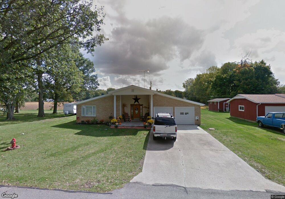
901 Maple St Middletown, IN 47356
Estimated Value: $205,000 - $232,702
3
Beds
1
Bath
1,777
Sq Ft
$122/Sq Ft
Est. Value
About This Home
This home is located at 901 Maple St, Middletown, IN 47356 and is currently estimated at $215,926, approximately $121 per square foot. 901 Maple St is a home located in Henry County with nearby schools including Shenandoah Elementary School, Shenandoah Middle School, and Shenandoah High School.
Ownership History
Date
Name
Owned For
Owner Type
Purchase Details
Closed on
Jul 10, 2012
Sold by
Norfleet Kenneth
Bought by
Norfleet Jimmy Ray
Current Estimated Value
Purchase Details
Closed on
Nov 28, 2011
Sold by
Kramer Rhet Jay and Debolt Thyra Lynn
Bought by
Norfleet Kenneth
Create a Home Valuation Report for This Property
The Home Valuation Report is an in-depth analysis detailing your home's value as well as a comparison with similar homes in the area
Home Values in the Area
Average Home Value in this Area
Purchase History
| Date | Buyer | Sale Price | Title Company |
|---|---|---|---|
| Norfleet Jimmy Ray | -- | None Available | |
| Norfleet Kenneth | -- | None Available |
Source: Public Records
Tax History
| Year | Tax Paid | Tax Assessment Tax Assessment Total Assessment is a certain percentage of the fair market value that is determined by local assessors to be the total taxable value of land and additions on the property. | Land | Improvement |
|---|---|---|---|---|
| 2024 | $886 | $175,100 | $23,000 | $152,100 |
| 2023 | $1,086 | $158,100 | $15,900 | $142,200 |
| 2022 | $1,142 | $152,200 | $15,900 | $136,300 |
| 2021 | $463 | $113,100 | $13,900 | $99,200 |
| 2020 | $383 | $109,700 | $13,900 | $95,800 |
| 2019 | $336 | $107,100 | $13,900 | $93,200 |
| 2018 | $292 | $106,200 | $13,900 | $92,300 |
| 2017 | $269 | $106,200 | $13,900 | $92,300 |
| 2016 | $228 | $104,200 | $13,600 | $90,600 |
| 2014 | $181 | $102,200 | $14,000 | $88,200 |
| 2013 | $181 | $99,500 | $14,500 | $85,000 |
Source: Public Records
Map
Nearby Homes
- 247 N 8th St
- 687 W Mill St
- 508 N 5th St
- 1190 Cottage Ave
- 1456 Congress St
- 6912 N County Road 700 W
- 4998 67
- 6378 N County Road 940 W
- 6875 N Spruce St
- 6671 N County Road 525 W
- 3346 E State Road 236
- 5120 Linden St
- 9001 S County Road 700 W
- 0 W Commerce Rd Unit 202540549
- 7255 W US Highway 36
- 2300 Larita Ln
- 5405 Emerson Way
- 14914 W 6th St
- 8900 W Sater St
- No Street Number N County Road 525 W
Your Personal Tour Guide
Ask me questions while you tour the home.