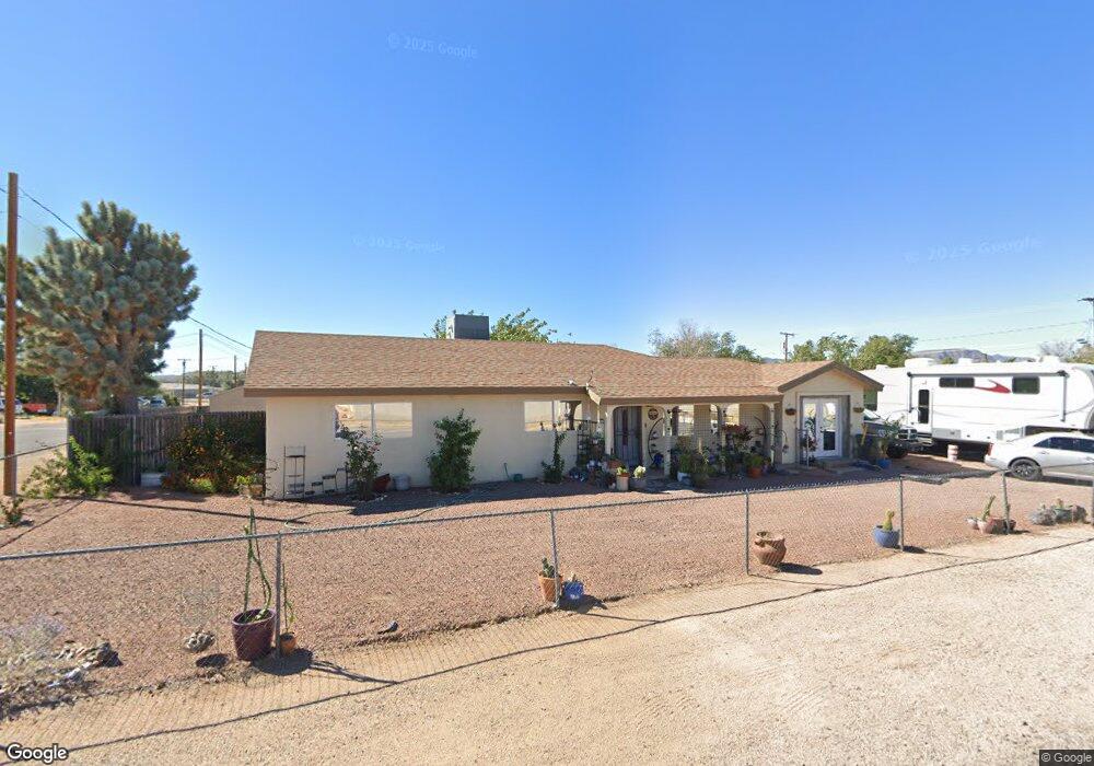
901 Monroe St Kingman, AZ 86401
Estimated Value: $198,616 - $227,000
--
Bed
2
Baths
1,525
Sq Ft
$140/Sq Ft
Est. Value
About This Home
This home is located at 901 Monroe St, Kingman, AZ 86401 and is currently estimated at $214,154, approximately $140 per square foot. 901 Monroe St is a home located in Mohave County with nearby schools including Hualapai Elementary School, White Cliffs Middle School, and Lee Williams High School.
Ownership History
Date
Name
Owned For
Owner Type
Purchase Details
Closed on
Feb 12, 2024
Sold by
Mayberry Jennifer Nicole and Thevenin Kathy Lavaun
Bought by
Smith Kaelyn and Smith Kyle
Current Estimated Value
Home Financials for this Owner
Home Financials are based on the most recent Mortgage that was taken out on this home.
Original Mortgage
$186,655
Outstanding Balance
$183,356
Interest Rate
6.61%
Mortgage Type
New Conventional
Estimated Equity
$30,798
Purchase Details
Closed on
Dec 2, 2004
Sold by
Crawford William D
Bought by
Crawford William D and Crawford Brenda G
Create a Home Valuation Report for This Property
The Home Valuation Report is an in-depth analysis detailing your home's value as well as a comparison with similar homes in the area
Home Values in the Area
Average Home Value in this Area
Purchase History
| Date | Buyer | Sale Price | Title Company |
|---|---|---|---|
| Smith Kaelyn | $200,000 | Pioneer Title | |
| Crawford William D | -- | Chicago Title Insurance Co |
Source: Public Records
Mortgage History
| Date | Status | Borrower | Loan Amount |
|---|---|---|---|
| Open | Smith Kaelyn | $186,655 |
Source: Public Records
Tax History Compared to Growth
Tax History
| Year | Tax Paid | Tax Assessment Tax Assessment Total Assessment is a certain percentage of the fair market value that is determined by local assessors to be the total taxable value of land and additions on the property. | Land | Improvement |
|---|---|---|---|---|
| 2026 | $154 | -- | -- | -- |
| 2025 | -- | $16,910 | $0 | $0 |
| 2024 | $0 | $22,391 | $0 | $0 |
| 2023 | $0 | $14,186 | $0 | $0 |
| 2022 | $0 | $10,524 | $0 | $0 |
| 2021 | $0 | $9,105 | $0 | $0 |
| 2019 | $0 | $7,782 | $0 | $0 |
| 2018 | $0 | $6,903 | $0 | $0 |
| 2017 | $0 | $6,040 | $0 | $0 |
| 2016 | $0 | $4,961 | $0 | $0 |
| 2015 | -- | $3,744 | $0 | $0 |
Source: Public Records
Map
Nearby Homes
- Lot 14 Phoenix Ave
- 2607 Phoenix Ave
- 2631 Harrod Ave
- 005 Walapai Mining District
- 2444 Wallapai Ave
- 2639 Wallapai Ave
- 2640 Chambers Ave
- 2720 Southern Ave
- 2616 Wikieup Ave
- 1098 Railroad St
- 2823 Wallapai Ave
- 2647 Superba Ave
- 2816 Georgia Ave
- 2642 Pasadena Ave
- 2700 Hualapai Mountain Rd
- 311-12-133 Harrison St
- 2131 Ashfork Ave
- 0000 E Mission Blvd
- 3118 Southern Ave
- 2339 Ashfork Ave
- 2546 Harrod Ave
- 2542 Harrod Ave
- phoenix Phoenix Ave
- 0 Phoenix Ave
- 2533 Phoenix Ave
- 2538 Harrod Ave
- 2603 Phoenix Ave
- 2534 Harrod Ave
- 2546 Phoenix Ave
- 2604 Harrod Ave
- 2540 Phoenix Ave
- 2529 Phoenix Ave
- 2400Blk Harrod Ave
- 0 Harrod Ave
- 2530 Harrod Ave
- 2608 Harrod Ave
- 2536 Phoenix Ave
- 2604 Phoenix Ave
- 2525 Phoenix Ave
- 2611 Phoenix Ave