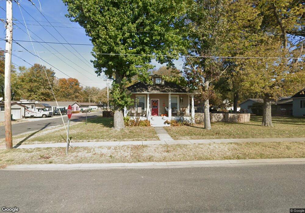
901 N 1st St Breese, IL 62230
Estimated Value: $159,000 - $176,000
3
Beds
1
Bath
1,350
Sq Ft
$122/Sq Ft
Est. Value
About This Home
This home is located at 901 N 1st St, Breese, IL 62230 and is currently estimated at $164,075, approximately $121 per square foot. 901 N 1st St is a home located in Clinton County with nearby schools including Breese ESD #12, Beckemeyer Elementary School, and Central Community High School.
Ownership History
Date
Name
Owned For
Owner Type
Purchase Details
Closed on
Apr 8, 2011
Sold by
Fingerhut Angela C and Fingerhut Martin A
Bought by
Hilmes Randy and Hilmes Janice
Current Estimated Value
Home Financials for this Owner
Home Financials are based on the most recent Mortgage that was taken out on this home.
Original Mortgage
$94,620
Interest Rate
4.25%
Mortgage Type
Future Advance Clause Open End Mortgage
Purchase Details
Closed on
Feb 8, 2008
Sold by
Broaddus Inc
Bought by
Louis Angela C
Home Financials for this Owner
Home Financials are based on the most recent Mortgage that was taken out on this home.
Original Mortgage
$104,663
Interest Rate
5.9%
Mortgage Type
New Conventional
Purchase Details
Closed on
May 30, 2007
Sold by
Ess Ronald P and Ess James L
Bought by
Broaddus Inc
Home Financials for this Owner
Home Financials are based on the most recent Mortgage that was taken out on this home.
Original Mortgage
$87,700
Interest Rate
6.9%
Mortgage Type
Purchase Money Mortgage
Create a Home Valuation Report for This Property
The Home Valuation Report is an in-depth analysis detailing your home's value as well as a comparison with similar homes in the area
Home Values in the Area
Average Home Value in this Area
Purchase History
| Date | Buyer | Sale Price | Title Company |
|---|---|---|---|
| Hilmes Randy | $109,000 | None Available | |
| Louis Angela C | $108,000 | None Available | |
| Broaddus Inc | $57,000 | None Available |
Source: Public Records
Mortgage History
| Date | Status | Borrower | Loan Amount |
|---|---|---|---|
| Closed | Hilmes Randy | $94,620 | |
| Previous Owner | Louis Angela C | $104,663 | |
| Previous Owner | Broaddus Inc | $87,700 |
Source: Public Records
Tax History Compared to Growth
Tax History
| Year | Tax Paid | Tax Assessment Tax Assessment Total Assessment is a certain percentage of the fair market value that is determined by local assessors to be the total taxable value of land and additions on the property. | Land | Improvement |
|---|---|---|---|---|
| 2024 | $2,989 | $43,480 | $12,150 | $31,330 |
| 2023 | $2,989 | $41,020 | $11,460 | $29,560 |
| 2022 | $2,976 | $37,290 | $10,420 | $26,870 |
| 2021 | $2,721 | $35,510 | $9,920 | $25,590 |
| 2020 | $2,675 | $34,150 | $9,540 | $24,610 |
| 2019 | $2,635 | $34,150 | $9,540 | $24,610 |
| 2018 | $2,676 | $32,916 | $9,339 | $23,577 |
| 2017 | $2,606 | $31,650 | $8,980 | $22,670 |
| 2016 | $2,592 | $31,650 | $8,980 | $22,670 |
| 2015 | $1,850 | $31,650 | $8,980 | $22,670 |
| 2013 | $1,850 | $32,260 | $8,980 | $23,280 |
Source: Public Records
Map
Nearby Homes
- 290 N Elm St
- 325 N Walnut St
- 923 N 6th St
- 436 S 2nd St
- 620 S 6th St
- 429 S 6th St
- 330 S 5th St
- 126 Jefferson Dr
- 13898 Lincoln Dr
- 13964 Best One Dr
- 10675 Buckingham Ct
- 14501 Saint Rose Rd
- 751 E 4th St
- 315 Briarwood Ln
- 560 W 4th St
- 10 S Hull St
- 8130 Main St
- 15556 Old State Rd
- 1102 Cherry St
- 16743 Ashland Ct