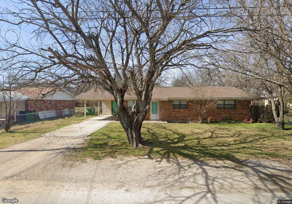
901 N Miller St Decatur, TX 76234
Estimated Value: $212,961 - $284,000
3
Beds
2
Baths
1,215
Sq Ft
$195/Sq Ft
Est. Value
About This Home
This home is located at 901 N Miller St, Decatur, TX 76234 and is currently estimated at $236,740, approximately $194 per square foot. 901 N Miller St is a home located in Wise County with nearby schools including Decatur High School and Victory Christian Academy.
Ownership History
Date
Name
Owned For
Owner Type
Purchase Details
Closed on
Oct 1, 2013
Sold by
Peacock Traci Bailey
Bought by
Gokey Michael A and Gokey Marilyn
Current Estimated Value
Purchase Details
Closed on
Sep 25, 2013
Sold by
Bailey Clayton William
Bought by
Peacock Traci Bailey
Purchase Details
Closed on
Jul 24, 2006
Sold by
Doyle Ann M
Bought by
Bailey Traci
Purchase Details
Closed on
Mar 30, 2001
Sold by
Markham Anthony L and Markham Vicki
Bought by
Gokey Michael and Gokey Marilyn
Purchase Details
Closed on
Nov 1, 2000
Sold by
Grimes Ava Mrs
Bought by
Gokey Michael and Gokey Marilyn
Create a Home Valuation Report for This Property
The Home Valuation Report is an in-depth analysis detailing your home's value as well as a comparison with similar homes in the area
Home Values in the Area
Average Home Value in this Area
Purchase History
| Date | Buyer | Sale Price | Title Company |
|---|---|---|---|
| Gokey Michael A | -- | None Available | |
| Peacock Traci Bailey | -- | None Available | |
| Bailey Traci | -- | Wise County Title | |
| Gokey Michael | -- | -- | |
| Gokey Michael | -- | -- |
Source: Public Records
Tax History Compared to Growth
Tax History
| Year | Tax Paid | Tax Assessment Tax Assessment Total Assessment is a certain percentage of the fair market value that is determined by local assessors to be the total taxable value of land and additions on the property. | Land | Improvement |
|---|---|---|---|---|
| 2025 | $3,749 | $220,084 | $70,242 | $149,842 |
| 2024 | $3,749 | $205,984 | $52,930 | $153,054 |
| 2023 | $3,709 | $204,493 | $52,930 | $151,563 |
| 2022 | $3,395 | $155,008 | $35,707 | $119,301 |
| 2021 | $2,980 | $130,560 | $35,710 | $94,850 |
| 2020 | $2,883 | $122,900 | $33,450 | $89,450 |
| 2019 | $2,996 | $120,890 | $33,450 | $87,440 |
| 2018 | $2,690 | $104,050 | $13,530 | $90,520 |
| 2017 | $2,276 | $87,700 | $13,530 | $74,170 |
| 2016 | $2,280 | $87,830 | $13,530 | $74,300 |
| 2015 | -- | $83,210 | $13,530 | $69,680 |
| 2014 | -- | $83,210 | $13,530 | $69,680 |
Source: Public Records
Map
Nearby Homes
- 802 N Church St
- 700 N Church St
- 903 N Miller St
- 114 Sondra Lin Blvd
- 307 E Vernon St
- 602 N Cates St
- 304 Cyndilu Ln
- 407 N Lane St
- TBD Farm To Market 51
- 1 S Martin Extension
- 305 E Shoemaker St
- 606 W Mulberry St
- 506 E Main St
- 401 S Holman St
- 601 W Brady St
- 709 S Church St
- 204 W Collins St
- 805 Hollyn Dr
- 809 Hollyn Dr
- 813 Hollyn Dr
- 805 N Miller St
- 808 N Church St
- 806 N Church St
- 900 N Miller St
- 904 N Church St
- 803 N Miller St
- 808 N Miller St
- 902 N Miller St
- 905 N Miller St
- 804 N Church St
- 904 N Miller St
- 906 N Church St
- 906 N Miller St
- 802 N Church St
- 901 N Church St
- 805 N Church St
- 903 N Church St
- 138 Sondra Lin Blvd
- 181 Sondra Lin Blvd
- 161 Stacia