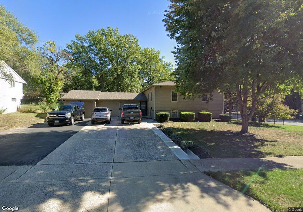
901 N Ute St Independence, MO 64056
Randall NeighborhoodEstimated Value: $189,000 - $207,234
3
Beds
2
Baths
1,147
Sq Ft
$174/Sq Ft
Est. Value
About This Home
This home is located at 901 N Ute St, Independence, MO 64056 and is currently estimated at $199,809, approximately $174 per square foot. 901 N Ute St is a home located in Jackson County with nearby schools including Fort Osage High School.
Ownership History
Date
Name
Owned For
Owner Type
Purchase Details
Closed on
Aug 3, 2005
Sold by
Donovan William Edward
Bought by
Wallander Ronnie and Wallander Rebecca A
Current Estimated Value
Home Financials for this Owner
Home Financials are based on the most recent Mortgage that was taken out on this home.
Original Mortgage
$64,000
Outstanding Balance
$33,382
Interest Rate
5.55%
Mortgage Type
Fannie Mae Freddie Mac
Estimated Equity
$166,427
Create a Home Valuation Report for This Property
The Home Valuation Report is an in-depth analysis detailing your home's value as well as a comparison with similar homes in the area
Home Values in the Area
Average Home Value in this Area
Purchase History
| Date | Buyer | Sale Price | Title Company |
|---|---|---|---|
| Wallander Ronnie | $80,000 | Commonwealth Title |
Source: Public Records
Mortgage History
| Date | Status | Borrower | Loan Amount |
|---|---|---|---|
| Open | Wallander Ronnie | $64,000 |
Source: Public Records
Tax History Compared to Growth
Tax History
| Year | Tax Paid | Tax Assessment Tax Assessment Total Assessment is a certain percentage of the fair market value that is determined by local assessors to be the total taxable value of land and additions on the property. | Land | Improvement |
|---|---|---|---|---|
| 2025 | $2,141 | $29,650 | $4,699 | $24,951 |
| 2024 | $2,131 | $26,959 | $4,530 | $22,429 |
| 2023 | $2,131 | $26,960 | $2,233 | $24,727 |
| 2022 | $1,865 | $22,420 | $4,712 | $17,708 |
| 2021 | $1,865 | $22,420 | $4,712 | $17,708 |
| 2020 | $1,771 | $21,012 | $4,712 | $16,300 |
| 2019 | $1,754 | $21,012 | $4,712 | $16,300 |
| 2018 | $1,536 | $18,287 | $4,101 | $14,186 |
| 2017 | $1,372 | $18,287 | $4,101 | $14,186 |
| 2016 | $1,372 | $17,829 | $2,936 | $14,893 |
| 2014 | $1,339 | $17,309 | $2,850 | $14,459 |
Source: Public Records
Map
Nearby Homes
- 802 N Ute St
- 18000 E Dakota Dr
- 17611 E Susquehanna Dr
- 18507 E Bundschu Place
- 1104 N Viking Dr
- 801 N Redwood Dr
- 915 N Cochise Ave
- 18100 E 11th Terrace Ct N
- 1124 N Ponca Dr
- 18001 E 12th St N
- 18400 E Arrowhead Ln
- 0 Bundschu Rd Unit HMS2577360
- 812 N Cheyenne Dr
- 818 N Wigwam Trail
- 813 N Pawnee Ave
- 1201 N Indian Ln
- 17501 E Cheyenne Dr
- 18602 E 6th St N
- 1120 Arrowhead Ridge
- 18607 E 6th St N