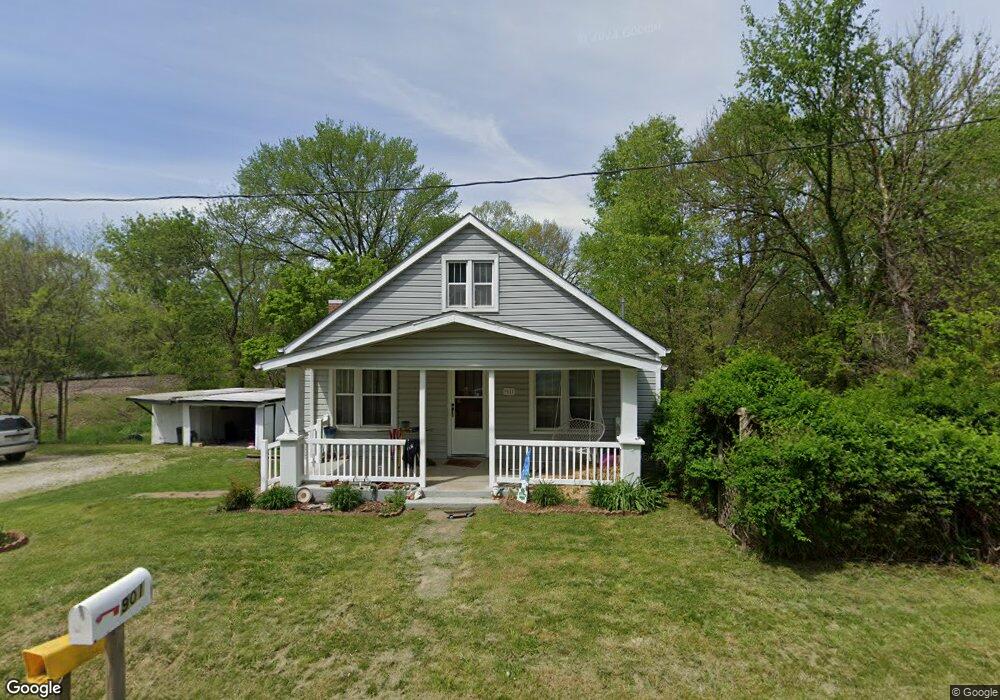
901 Route T Jefferson City, MO 65109
Estimated Value: $174,000 - $210,000
3
Beds
1
Bath
1,276
Sq Ft
$152/Sq Ft
Est. Value
About This Home
This home is located at 901 Route T, Jefferson City, MO 65109 and is currently estimated at $194,042, approximately $152 per square foot. 901 Route T is a home located in Cole County with nearby schools including Pioneer Trail Elementary School, Thomas Jefferson Middle School, and Capital City High School.
Ownership History
Date
Name
Owned For
Owner Type
Purchase Details
Closed on
May 17, 2022
Sold by
Roush Brenda K
Bought by
Buchmiller Ashley Anne
Current Estimated Value
Home Financials for this Owner
Home Financials are based on the most recent Mortgage that was taken out on this home.
Original Mortgage
$139,671
Outstanding Balance
$132,744
Interest Rate
5.3%
Mortgage Type
New Conventional
Estimated Equity
$61,298
Create a Home Valuation Report for This Property
The Home Valuation Report is an in-depth analysis detailing your home's value as well as a comparison with similar homes in the area
Home Values in the Area
Average Home Value in this Area
Purchase History
| Date | Buyer | Sale Price | Title Company |
|---|---|---|---|
| Buchmiller Ashley Anne | -- | None Listed On Document |
Source: Public Records
Mortgage History
| Date | Status | Borrower | Loan Amount |
|---|---|---|---|
| Open | Buchmiller Ashley Anne | $139,671 | |
| Closed | Buchmiller Ashley Anne | $139,671 |
Source: Public Records
Tax History Compared to Growth
Tax History
| Year | Tax Paid | Tax Assessment Tax Assessment Total Assessment is a certain percentage of the fair market value that is determined by local assessors to be the total taxable value of land and additions on the property. | Land | Improvement |
|---|---|---|---|---|
| 2025 | $625 | $10,950 | $860 | $10,090 |
| 2024 | $625 | $10,950 | $860 | $10,090 |
| 2023 | $625 | $10,950 | $860 | $10,090 |
| 2022 | $593 | $10,370 | $0 | $10,370 |
| 2021 | $597 | $10,370 | $0 | $10,370 |
| 2020 | $604 | $13,718 | $855 | $12,863 |
| 2019 | $587 | $13,889 | $855 | $13,034 |
| 2018 | $586 | $11,191 | $855 | $10,336 |
| 2017 | $571 | $10,374 | $855 | $9,519 |
| 2016 | $483 | $10,374 | $855 | $9,519 |
| 2015 | $532 | $0 | $0 | $0 |
| 2014 | $532 | $11,400 | $855 | $10,545 |
Source: Public Records
Map
Nearby Homes
- 731 Biltmore Dr
- 732 Biltmore Dr
- 728 Biltmore Dr
- 720 Biltmore Dr
- 313 Ridge Top Dr
- 301 Ridge Top Dr
- 0 Poelker Place Unit 10070469
- 0 Poelker Place Unit 10070470
- 105 Summerhill Dr
- 218 Pheasant Run Rd
- 215 Carel Rd
- 202 Carel Rd
- 5408 La Charette Dr
- 524 Natchez Trace Dr
- 726 Dickerson Creek Dr
- 730 Dickerson Creek Dr
- 802 Dickerson Creek Dr
- 814 Dickerson Creek Dr
- 815 Dickerson Creek Dr
- 807 Dickerson Creek Dr
- 902 Route T
- 904 Route T
- 907 Route T
- 6717 2nd St
- 901 Elston High St
- 905 Elston High St
- 909 Route T
- 912 Route T
- 826 Route T
- 913 Route T
- 906 Elston High St
- 912 Elston High St
- 923 Elston High St
- 919 Elston Walnut St
- 801 Route T
- 916 Elston High St
- 923 Route T
- 922 Route T
- 929 Elston High St
- 928 State Hwy T