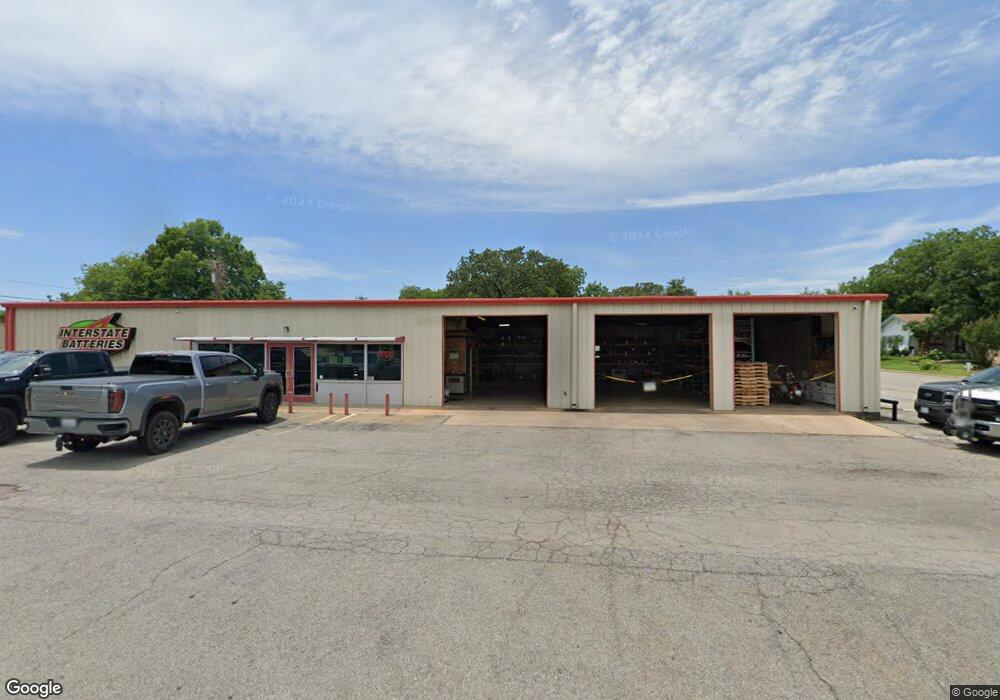
901 S Armstrong Ave Unit B Denison, TX 75020
Studio
--
Bath
5,000
Sq Ft
14,985
Sq Ft Lot
About This Home
This home is located at 901 S Armstrong Ave Unit B, Denison, TX 75020. 901 S Armstrong Ave Unit B is a home located in Grayson County with nearby schools including Houston Elementary School, Scott Middle School, and Denison High School.
Ownership History
Date
Name
Owned For
Owner Type
Purchase Details
Closed on
Oct 1, 2018
Sold by
Hulsey & Hulsey Llc
Bought by
Shubrook Mark
Home Financials for this Owner
Home Financials are based on the most recent Mortgage that was taken out on this home.
Original Mortgage
$144,000
Outstanding Balance
$125,577
Interest Rate
4.5%
Purchase Details
Closed on
Oct 20, 2008
Sold by
Jones Jimmie D and Jones Lynita F
Bought by
Hulsey & Hulsey Llc
Home Financials for this Owner
Home Financials are based on the most recent Mortgage that was taken out on this home.
Original Mortgage
$150,000
Interest Rate
6.35%
Mortgage Type
Commercial
Create a Home Valuation Report for This Property
The Home Valuation Report is an in-depth analysis detailing your home's value as well as a comparison with similar homes in the area
Home Values in the Area
Average Home Value in this Area
Purchase History
| Date | Buyer | Sale Price | Title Company |
|---|---|---|---|
| Shubrook Mark | -- | Red River Title Co | |
| Hulsey & Hulsey Llc | -- | Grayson County Title |
Source: Public Records
Mortgage History
| Date | Status | Borrower | Loan Amount |
|---|---|---|---|
| Open | Shubrook Mark | $144,000 | |
| Previous Owner | Hulsey & Hulsey Llc | $150,000 |
Source: Public Records
Tax History
| Year | Tax Paid | Tax Assessment Tax Assessment Total Assessment is a certain percentage of the fair market value that is determined by local assessors to be the total taxable value of land and additions on the property. | Land | Improvement |
|---|---|---|---|---|
| 2025 | $5,432 | $212,186 | $55,755 | $156,431 |
| 2024 | $5,432 | $233,788 | $49,875 | $183,913 |
| 2023 | $5,297 | $233,788 | $47,250 | $186,538 |
| 2022 | $4,777 | $201,048 | $47,250 | $153,798 |
| 2021 | $2,825 | $112,027 | $19,425 | $92,602 |
| 2020 | $2,955 | $112,027 | $19,425 | $92,602 |
| 2019 | $3,083 | $112,027 | $19,425 | $92,602 |
| 2018 | $3,108 | $112,027 | $14,700 | $97,327 |
| 2017 | $2,908 | $103,954 | $14,700 | $89,254 |
| 2016 | $2,553 | $91,268 | $14,700 | $76,568 |
| 2015 | $1,896 | $67,128 | $14,700 | $52,428 |
| 2014 | $1,947 | $68,922 | $14,700 | $54,222 |
Source: Public Records
Map
Nearby Homes
- 1011 S Armstrong Ave
- 1007 S Scullin Ave
- TBD W Texas St
- 1401 W Texas St
- 0000 W Texas St
- 704 W Hull St
- 701 W Hull St Unit 101-2
- 811 W Day St
- 708 W Day St
- 727 W Day St
- 919 W Day St
- 715 W Monterey St
- 820 W Shepherd St
- 826 W Shepherd St
- 621 W Munson St
- 904 W Shepherd St
- 1029 W Hull St
- 700 W Monterey St
- 513 W Texas St
- 511 W Munson St
- 901 S Armstrong Ave
- 816 W Munson St
- 917 S Armstrong Ave
- 0 W Munson Unit 13352613
- 805 W Munson St
- 831 S Armstrong Ave
- 912 S Armstrong Ave Unit Upstairs
- 912 S Armstrong Ave Unit 101
- 912 S Armstrong Ave
- 912 S Armstrong Ave Unit 2
- 912 S Armstrong Ave Unit 1
- 731 W Munson St
- 731 W Hull & 912 S Armstrong Ave Unit 201 & 101
- 820 W Munson St
- 809 W Munson St
- 819 W Hull St
- 815 W Munson St
- 727 W Hull St
- 731 W Hull St Unit 912 S Armstrong st.
- 731 W Hull St
Your Personal Tour Guide
Ask me questions while you tour the home.