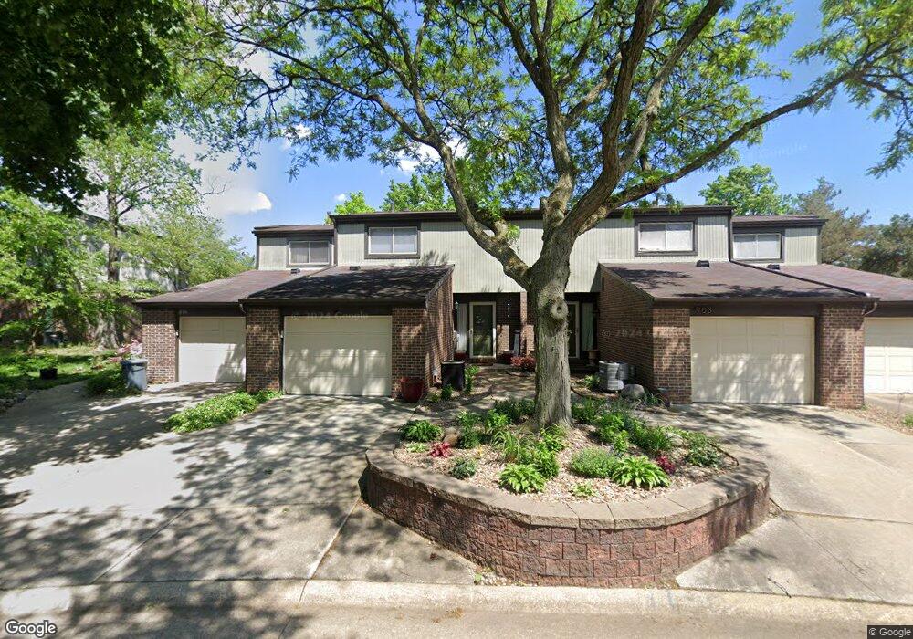
901 Saint Ambrose Dr Akron, OH 44307
Downtown Akron NeighborhoodEstimated Value: $140,000 - $179,000
3
Beds
2
Baths
1,424
Sq Ft
$108/Sq Ft
Est. Value
About This Home
This home is located at 901 Saint Ambrose Dr, Akron, OH 44307 and is currently estimated at $154,404, approximately $108 per square foot. 901 Saint Ambrose Dr is a home located in Summit County with nearby schools including St. Bernard-St. Mary Elementary School.
Ownership History
Date
Name
Owned For
Owner Type
Purchase Details
Closed on
Nov 16, 2000
Sold by
Federal National Mortgage Association
Bought by
Love Bernice
Current Estimated Value
Home Financials for this Owner
Home Financials are based on the most recent Mortgage that was taken out on this home.
Original Mortgage
$68,425
Outstanding Balance
$25,177
Interest Rate
7.86%
Mortgage Type
FHA
Estimated Equity
$129,227
Purchase Details
Closed on
Jun 9, 1999
Sold by
Henning Joseph R
Bought by
Federal National Mortgage Association
Purchase Details
Closed on
Sep 29, 1994
Sold by
Hunter Pearl
Bought by
Henning Joseph R
Home Financials for this Owner
Home Financials are based on the most recent Mortgage that was taken out on this home.
Original Mortgage
$62,745
Interest Rate
6%
Mortgage Type
New Conventional
Create a Home Valuation Report for This Property
The Home Valuation Report is an in-depth analysis detailing your home's value as well as a comparison with similar homes in the area
Home Values in the Area
Average Home Value in this Area
Purchase History
| Date | Buyer | Sale Price | Title Company |
|---|---|---|---|
| Love Bernice | $70,000 | -- | |
| Federal National Mortgage Association | $56,000 | -- | |
| Henning Joseph R | $69,717 | -- |
Source: Public Records
Mortgage History
| Date | Status | Borrower | Loan Amount |
|---|---|---|---|
| Open | Love Bernice | $68,425 | |
| Previous Owner | Henning Joseph R | $62,745 |
Source: Public Records
Tax History Compared to Growth
Tax History
| Year | Tax Paid | Tax Assessment Tax Assessment Total Assessment is a certain percentage of the fair market value that is determined by local assessors to be the total taxable value of land and additions on the property. | Land | Improvement |
|---|---|---|---|---|
| 2025 | $1,878 | $34,444 | $4,557 | $29,887 |
| 2024 | $1,878 | $34,444 | $4,557 | $29,887 |
| 2023 | $1,878 | $34,444 | $4,557 | $29,887 |
| 2022 | $2,024 | $29,337 | $3,864 | $25,473 |
| 2021 | $1,998 | $28,921 | $3,864 | $25,057 |
| 2020 | $1,969 | $28,920 | $3,860 | $25,060 |
| 2019 | $1,861 | $24,740 | $3,860 | $20,880 |
| 2018 | $1,835 | $24,750 | $3,820 | $20,930 |
| 2017 | $1,628 | $24,750 | $3,820 | $20,930 |
| 2016 | $1,629 | $21,420 | $3,820 | $17,600 |
| 2015 | $1,628 | $21,420 | $3,820 | $17,600 |
| 2014 | $1,615 | $21,420 | $3,820 | $17,600 |
| 2013 | $2,212 | $30,590 | $3,820 | $26,770 |
Source: Public Records
Map
Nearby Homes
- 263 Millcreek Dr Unit 263
- 108 Furnace Run Dr Unit 14108
- 783 Boulevard St
- 385 Campbell St
- 810 Amherst St
- 834 Kenyon St
- 949 Raymond St
- 832 Yale St
- 829 Yale St
- 817 Raymond St
- 849 Amherst St
- 837 Yale St
- 849 Yale St
- 151 Russell Ave
- 577 Rhodes Ave
- 483 Bishop St
- 677 Vernon Odom Blvd
- 639 Bellevue Ave
- 650 Easter Ave
- 670 Euclid Ave
- 899 Saint Ambrose Dr
- 903 Saint Ambrose Dr Unit 903
- 905 Saint Ambrose Dr
- 208 Saint Clair Dr
- 206 Saint Clair Dr
- 909 Saint Ambrose Dr
- 911 Saint Ambrose Dr
- 204 Saint Clair Dr Unit 204
- 202 Saint Clair Dr Unit 202
- 913 Saint Ambrose Dr
- 915 Saint Ambrose Dr
- 917 Saint Ambrose Dr
- 192 Saint Clair Dr
- 190 Saint Clair Dr
- 188 Saint Clair Dr
- 186 Saint Clair Dr
- 931 Trimble Dr Unit 931
- 184 Saint Clair Dr
- 937 Trimble Dr
- 935 Trimble Dr