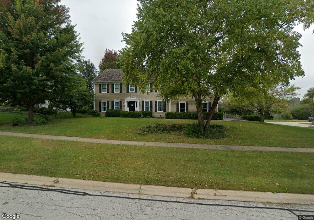
901 Stanton St Batavia, IL 60510
Southeast Batavia NeighborhoodEstimated Value: $529,774 - $617,000
4
Beds
--
Bath
2,926
Sq Ft
$198/Sq Ft
Est. Value
About This Home
This home is located at 901 Stanton St, Batavia, IL 60510 and is currently estimated at $579,694, approximately $198 per square foot. 901 Stanton St is a home located in Kane County with nearby schools including J B Nelson Elementary School, Sam Rotolo Middle School, and Batavia Sr High School.
Ownership History
Date
Name
Owned For
Owner Type
Purchase Details
Closed on
Jun 16, 1999
Sold by
Huston Richard L and Huston Pamela Jo
Bought by
Shaw Cornell G and Cook Shaw Tamara D
Current Estimated Value
Home Financials for this Owner
Home Financials are based on the most recent Mortgage that was taken out on this home.
Original Mortgage
$216,000
Outstanding Balance
$58,047
Interest Rate
7.28%
Estimated Equity
$521,647
Create a Home Valuation Report for This Property
The Home Valuation Report is an in-depth analysis detailing your home's value as well as a comparison with similar homes in the area
Home Values in the Area
Average Home Value in this Area
Purchase History
| Date | Buyer | Sale Price | Title Company |
|---|---|---|---|
| Shaw Cornell G | $270,000 | Chicago Title Insurance Co |
Source: Public Records
Mortgage History
| Date | Status | Borrower | Loan Amount |
|---|---|---|---|
| Open | Shaw Cornell G | $216,000 |
Source: Public Records
Tax History
| Year | Tax Paid | Tax Assessment Tax Assessment Total Assessment is a certain percentage of the fair market value that is determined by local assessors to be the total taxable value of land and additions on the property. | Land | Improvement |
|---|---|---|---|---|
| 2024 | $11,453 | $160,862 | $19,301 | $141,561 |
| 2023 | $11,842 | $146,000 | $17,518 | $128,482 |
| 2022 | $12,107 | $144,655 | $14,884 | $129,771 |
| 2021 | $11,630 | $137,192 | $14,116 | $123,076 |
| 2020 | $12,376 | $146,231 | $13,845 | $132,386 |
| 2019 | $12,180 | $141,054 | $13,355 | $127,699 |
| 2018 | $11,701 | $135,681 | $12,846 | $122,835 |
| 2017 | $11,423 | $131,206 | $12,422 | $118,784 |
| 2016 | $11,102 | $127,384 | $12,060 | $115,324 |
| 2015 | -- | $124,483 | $11,785 | $112,698 |
| 2014 | -- | $120,565 | $11,414 | $109,151 |
| 2013 | -- | $118,212 | $11,191 | $107,021 |
Source: Public Records
Map
Nearby Homes
- 694 Hart Rd
- Lot 4 Manchester Ave
- 860 S River St
- 304 S Prairie St
- 1136 Pine Ct
- 414 Cleveland Ave
- Lot 1 Center St
- 1206 Beckman Ln
- 637 E Wilson St
- 121 S Raddant Rd
- 570 Violet Ln
- 1025 E Wilson St
- 404 S Batavia Ave
- 527 Ridgelawn Trail
- 724 S Jefferson St
- 345 Main St
- 330 First St
- 1705 South Ct
- 417 N Van Buren St
- 1402 Cherry Dr
- 911 Stanton St Unit 2
- 558 Dahlstrom Ct
- 921 Stanton St
- 616 Young Ave
- 561 Young Ave
- 571 Young Ave
- 548 Dahlstrom Ct Unit II
- 551 Young Ave
- 601 Young Ave
- 912 Stanton St
- 931 Stanton St
- 626 Young Ave
- 611 Young Ave
- 922 Stanton St
- 541 Young Ave Unit 2
- 542 Dahlstrom Ct Unit 2
- 530 Young Ave Unit 2
- 932 Stanton St
- 626 Pine St
- 536 Dahlstrom Ct
Your Personal Tour Guide
Ask me questions while you tour the home.