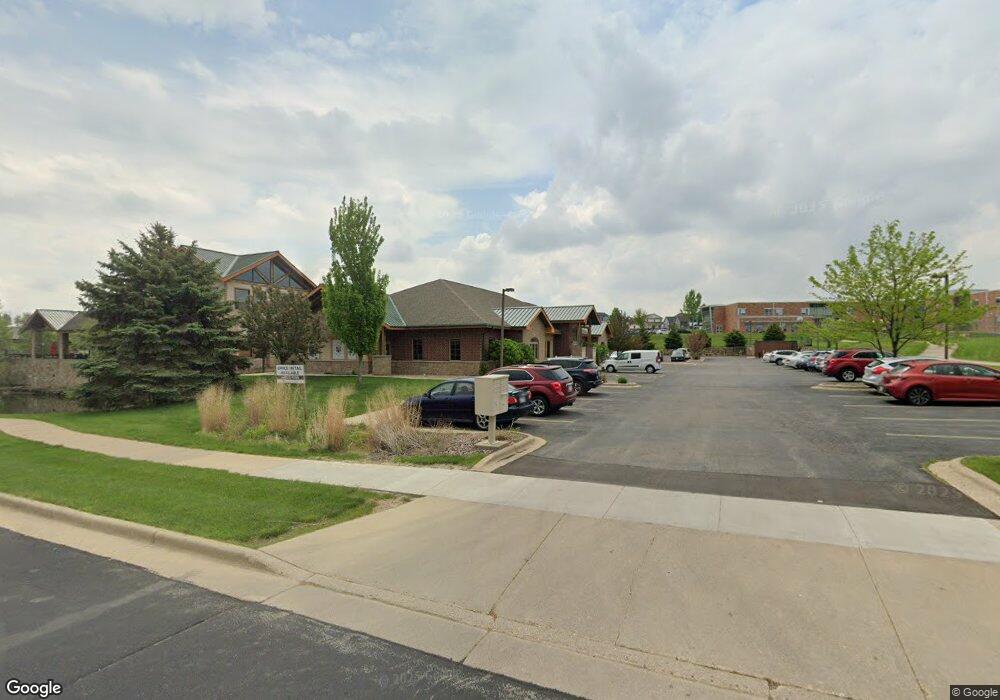
901 Whalen Rd Unit C Verona, WI 53593
Estimated Value: $9,676,311
--
Bed
--
Bath
508
Sq Ft
$19,048/Sq Ft
Est. Value
About This Home
This home is located at 901 Whalen Rd Unit C, Verona, WI 53593 and is currently estimated at $9,676,311, approximately $19,047 per square foot. 901 Whalen Rd Unit C is a home located in Dane County with nearby schools including Glacier Edge Elementary School, Savanna Oaks Middle School, and Verona Area High School.
Ownership History
Date
Name
Owned For
Owner Type
Purchase Details
Closed on
Dec 14, 2006
Sold by
Old Pb Developments Llc
Bought by
Midtown Holdings Llc
Current Estimated Value
Home Financials for this Owner
Home Financials are based on the most recent Mortgage that was taken out on this home.
Original Mortgage
$1,500,000
Outstanding Balance
$893,334
Interest Rate
6.24%
Mortgage Type
Commercial
Estimated Equity
$8,782,977
Create a Home Valuation Report for This Property
The Home Valuation Report is an in-depth analysis detailing your home's value as well as a comparison with similar homes in the area
Home Values in the Area
Average Home Value in this Area
Purchase History
| Date | Buyer | Sale Price | Title Company |
|---|---|---|---|
| Midtown Holdings Llc | $4,476,400 | None Available | |
| Maple Grove Holdings Llc | -- | None Available |
Source: Public Records
Mortgage History
| Date | Status | Borrower | Loan Amount |
|---|---|---|---|
| Open | Midtown Holdings Llc | $1,500,000 |
Source: Public Records
Tax History Compared to Growth
Tax History
| Year | Tax Paid | Tax Assessment Tax Assessment Total Assessment is a certain percentage of the fair market value that is determined by local assessors to be the total taxable value of land and additions on the property. | Land | Improvement |
|---|---|---|---|---|
| 2024 | $48,900 | $3,038,500 | $471,000 | $2,567,500 |
| 2023 | $52,854 | $2,900,400 | $455,400 | $2,445,000 |
| 2021 | $49,824 | $2,548,000 | $455,400 | $2,092,600 |
| 2020 | $52,347 | $2,548,000 | $455,400 | $2,092,600 |
| 2019 | $56,223 | $2,367,000 | $364,300 | $2,002,700 |
| 2018 | $61,458 | $2,367,000 | $364,300 | $2,002,700 |
| 2017 | $58,101 | $2,367,000 | $364,300 | $2,002,700 |
| 2016 | $53,471 | $2,367,000 | $364,300 | $2,002,700 |
| 2015 | $51,548 | $2,367,000 | $364,300 | $2,002,700 |
| 2014 | $51,550 | $2,367,000 | $364,300 | $2,002,700 |
| 2013 | $32,145 | $1,536,700 | $364,300 | $1,172,400 |
Source: Public Records
Map
Nearby Homes
- 859 Kimball Ln
- 657 Thornton Terrace
- 571 S Hillcrest Dr
- 6690 Grandview Rd
- 1045 Range Trail
- 955 Westminster Way
- 1208 Merry Blossom Ln
- 1245 Merry Blossom Ln
- 102 Prairie Heights Dr Unit 416
- 188 Depot Dr
- 143 Paoli St
- 6500 Shady Bend Rd
- 6435 County Road M
- 6435 County Highway M
- 554 Enterprise Dr
- 301 Barbara St
- 803 N Main St
- 3833 Drumlin Ln
- 875 N Edge Trail
- 527 Linden Ct
- 648 Military Ridge Dr Unit 16
- 646 Military Ridge Dr
- 646 Military Ridge Dr Unit 15
- 644 Military Ridge Dr
- 642 Military Ridge Dr Unit 13
- 642 Military Ridge Dr
- 951 Kimball Ln
- 901 Kimball Ln Unit 1200
- 618 Military Ridge Dr Unit 1
- 640 Military Ridge Dr
- 622 Military Ridge Dr
- 638 Military Ridge Dr Unit 11
- 620 Military Ridge Dr
- 636 Military Ridge Dr
- 624 Military Ridge Dr
- 634 Military Ridge Dr
- 611 Military Ridge Dr
- 626 Military Ridge Dr
- 628 Military Ridge Dr Unit 6
- 630 Military Ridge Dr