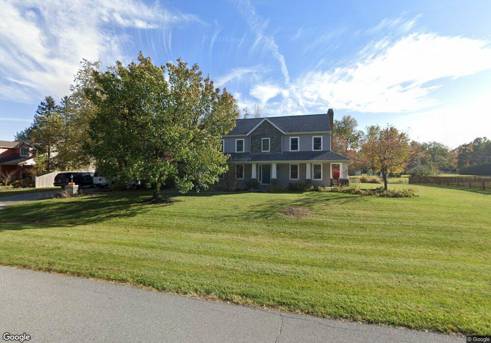
9010 Laurel Hurst Fort Wayne, IN 46835
Arlington Park NeighborhoodEstimated Value: $380,000 - $537,000
4
Beds
4
Baths
3,478
Sq Ft
$133/Sq Ft
Est. Value
About This Home
This home is located at 9010 Laurel Hurst, Fort Wayne, IN 46835 and is currently estimated at $463,015, approximately $133 per square foot. 9010 Laurel Hurst is a home located in Allen County with nearby schools including Arlington Elementary School, Jefferson Middle School, and Northrop High School.
Ownership History
Date
Name
Owned For
Owner Type
Purchase Details
Closed on
May 27, 2005
Sold by
Coil Michael D and Coil Linda D
Bought by
Morris Robert D
Current Estimated Value
Home Financials for this Owner
Home Financials are based on the most recent Mortgage that was taken out on this home.
Original Mortgage
$193,600
Interest Rate
5.91%
Mortgage Type
Fannie Mae Freddie Mac
Create a Home Valuation Report for This Property
The Home Valuation Report is an in-depth analysis detailing your home's value as well as a comparison with similar homes in the area
Home Values in the Area
Average Home Value in this Area
Purchase History
| Date | Buyer | Sale Price | Title Company |
|---|---|---|---|
| Morris Robert D | -- | Century Title Services |
Source: Public Records
Mortgage History
| Date | Status | Borrower | Loan Amount |
|---|---|---|---|
| Closed | Morris Robert D | $193,600 |
Source: Public Records
Tax History
| Year | Tax Paid | Tax Assessment Tax Assessment Total Assessment is a certain percentage of the fair market value that is determined by local assessors to be the total taxable value of land and additions on the property. | Land | Improvement |
|---|---|---|---|---|
| 2025 | $4,342 | $403,400 | $63,600 | $339,800 |
| 2024 | $4,396 | $375,600 | $63,600 | $312,000 |
| 2023 | $4,271 | $371,500 | $63,600 | $307,900 |
| 2022 | $3,781 | $332,600 | $63,600 | $269,000 |
| 2021 | $3,221 | $285,400 | $51,800 | $233,600 |
| 2020 | $3,086 | $277,700 | $51,800 | $225,900 |
| 2019 | $2,815 | $254,800 | $51,800 | $203,000 |
| 2018 | $2,895 | $260,200 | $51,800 | $208,400 |
| 2017 | $2,829 | $252,000 | $51,800 | $200,200 |
| 2016 | $2,694 | $246,000 | $51,800 | $194,200 |
| 2014 | $2,268 | $218,800 | $51,800 | $167,000 |
| 2013 | $2,221 | $214,600 | $51,800 | $162,800 |
Source: Public Records
Map
Nearby Homes
- 4544 E Shenandoah Cir
- 8301 Lamplighter Ct
- 4825 Wheatridge Rd
- 3914 Stanton Hall Pkwy
- 9434 Maysville Rd
- 9406 Mill Ridge Run
- 4803 Oak Creek Ct
- 10206 Maysville Rd
- 3634 Colorado Ct
- 4118 Stillwood Dr
- 7927 Willowwood Dr
- 3417 Montana Dr
- 8230 Oklahoma Trail
- 3310 Brantley Dr
- 3414 Country Park Ln
- 7728 Wishingwell Ct
- 7219 Putt Ln
- 7530 Glenoak Pkwy
- 5424 Thornbriar Ln
- 4615 Beechcrest Dr
- 9022 Laurel Hurst
- 8932 Laurel Hurst
- 9009 Laurel Hurst
- 9021 Laurel Hurst
- 8929 Laurel Hurst
- 9034 Laurel Hurst
- 8924 Laurel Hurst
- 8757 Stellhorn Rd
- 9033 Laurel Hurst
- 8815 Stellhorn Rd
- 8717 Stellhorn Rd
- 4610 Creek Ridge Place
- 4618 Creek Ridge Place
- 8839 Stellhorn Rd
- 4630 Creek Ridge Place
- 9106 Laurel Hurst
- 8707 Stellhorn Rd
- 8916 Laurel Hurst
- 8859 Stellhorn Rd
- 4712 Creek Ridge Place
Your Personal Tour Guide
Ask me questions while you tour the home.