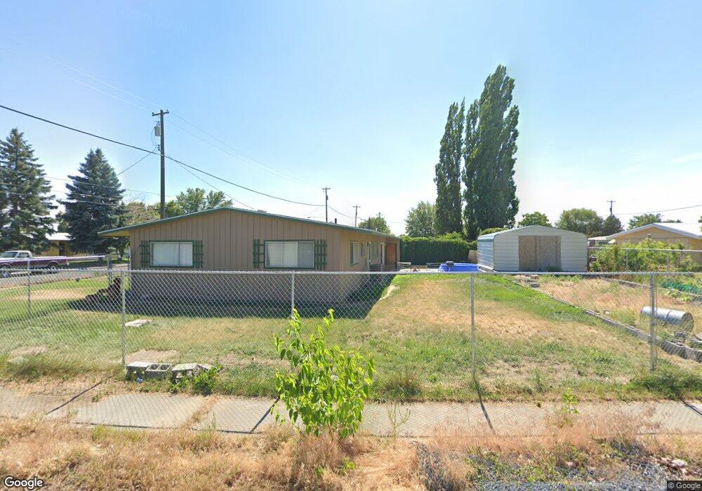
9011 Bong Loop Moses Lake, WA 98837
Estimated Value: $246,000 - $269,000
3
Beds
2
Baths
1,850
Sq Ft
$139/Sq Ft
Est. Value
About This Home
This home is located at 9011 Bong Loop, Moses Lake, WA 98837 and is currently estimated at $258,015, approximately $139 per square foot. 9011 Bong Loop is a home located in Grant County with nearby schools including Larson Heights Elementary School, Endeavor Middle School, and Moses Lake High School.
Ownership History
Date
Name
Owned For
Owner Type
Purchase Details
Closed on
Dec 17, 2014
Sold by
Fesler Steven A and Fesler Connie R
Bought by
Dickey Opal A
Current Estimated Value
Home Financials for this Owner
Home Financials are based on the most recent Mortgage that was taken out on this home.
Original Mortgage
$91,066
Outstanding Balance
$69,760
Interest Rate
4%
Mortgage Type
FHA
Estimated Equity
$188,255
Create a Home Valuation Report for This Property
The Home Valuation Report is an in-depth analysis detailing your home's value as well as a comparison with similar homes in the area
Home Values in the Area
Average Home Value in this Area
Purchase History
| Date | Buyer | Sale Price | Title Company |
|---|---|---|---|
| Dickey Opal A | $99,500 | Stewart Title |
Source: Public Records
Mortgage History
| Date | Status | Borrower | Loan Amount |
|---|---|---|---|
| Open | Dickey Opal A | $91,066 |
Source: Public Records
Tax History
| Year | Tax Paid | Tax Assessment Tax Assessment Total Assessment is a certain percentage of the fair market value that is determined by local assessors to be the total taxable value of land and additions on the property. | Land | Improvement |
|---|---|---|---|---|
| 2025 | $2,041 | $206,190 | -- | -- |
| 2024 | $1,761 | $150,209 | $22,500 | $127,709 |
| 2023 | $1,513 | $105,175 | $22,500 | $82,675 |
| 2022 | $1,338 | $105,175 | $22,500 | $82,675 |
| 2021 | $1,140 | $105,175 | $22,500 | $82,675 |
| 2020 | $1,383 | $85,670 | $22,500 | $63,170 |
| 2019 | $1,645 | $120,050 | $20,000 | $100,050 |
| 2018 | $1,852 | $115,730 | $20,000 | $95,730 |
| 2017 | $1,677 | $115,730 | $20,000 | $95,730 |
| 2016 | $1,528 | $103,180 | $20,000 | $83,180 |
| 2013 | -- | $95,620 | $20,000 | $75,620 |
Source: Public Records
Map
Nearby Homes
- 9008 Bong Loop Unit B
- 9016 Bong Loop Unit A
- 9016 Bong Loop Unit B
- 406 Biggs Dr NE
- 410 Biggs Dr NE
- 9021 Mcconnell Dr Unit A
- 9023 Mcconnell Dr Unit A
- 205 March Dr NE
- 430 Biggs Dr NE
- 9035 Forrestal Ln
- 1314 Pershing Rd
- 8521 Jean Rd NE
- 1316 Pershing Rd
- 4815 Airway Dr NE Unit 86
- 4815 Airway Dr NE Unit 72
- 4815 Airway Dr NE Unit 81
- 1215 Lowry St
- 8674 Vince Rd NE
- 0 Nna I Rd NE Unit NWM2484402
- 4898 Shorecrest Dr NE
- 9011 Bong Loop
- 9011 Bong Loop Unit A
- 9011B Bong Loop
- 9013 Bong Loop
- 9013 Bong Loop Unit A & B
- 9012 Bong Loop
- 9006 Bong Loop Unit A
- 9006 Bong Loop
- 9006 Bong Loop
- 9006 Bong Loop Unit B
- 9012B Bong Loop
- 9004 Bong Loop Unit B
- 9004 Bong Loop
- 9004 Bong Loop Unit A
- 9012A Bong Loop
- 9014 A & B Bong Lp
- 9004B Bong Loop
- 9008 Bong Loop
- 9008 Bong Loop
- 9009 Bong Loop
Your Personal Tour Guide
Ask me questions while you tour the home.