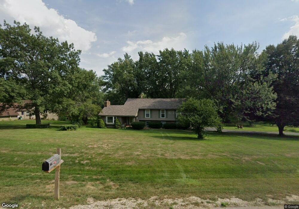
9011 Robin Hill Dr Woodstock, IL 60098
Estimated Value: $403,315 - $450,000
3
Beds
--
Bath
1,788
Sq Ft
$236/Sq Ft
Est. Value
About This Home
This home is located at 9011 Robin Hill Dr, Woodstock, IL 60098 and is currently estimated at $422,329, approximately $236 per square foot. 9011 Robin Hill Dr is a home located in McHenry County with nearby schools including West Elementary School, Richard F Bernotas Middle School, and Prairie Ridge High School.
Ownership History
Date
Name
Owned For
Owner Type
Purchase Details
Closed on
Jul 25, 2003
Sold by
Middendorf Kathryn E
Bought by
Gilmore Thomas E and Gilmore Lisa C
Current Estimated Value
Home Financials for this Owner
Home Financials are based on the most recent Mortgage that was taken out on this home.
Original Mortgage
$214,800
Outstanding Balance
$92,766
Interest Rate
5.47%
Mortgage Type
Unknown
Estimated Equity
$329,563
Purchase Details
Closed on
Jun 4, 1996
Sold by
Middendorf James F and Middendorf Kathryn E
Bought by
Middendorf Kathryn E and Kathryn E Middendorf Revocable Trust
Create a Home Valuation Report for This Property
The Home Valuation Report is an in-depth analysis detailing your home's value as well as a comparison with similar homes in the area
Home Values in the Area
Average Home Value in this Area
Purchase History
| Date | Buyer | Sale Price | Title Company |
|---|---|---|---|
| Gilmore Thomas E | $268,500 | Pntn | |
| Middendorf Kathryn E | -- | -- |
Source: Public Records
Mortgage History
| Date | Status | Borrower | Loan Amount |
|---|---|---|---|
| Open | Gilmore Thomas E | $214,800 |
Source: Public Records
Tax History Compared to Growth
Tax History
| Year | Tax Paid | Tax Assessment Tax Assessment Total Assessment is a certain percentage of the fair market value that is determined by local assessors to be the total taxable value of land and additions on the property. | Land | Improvement |
|---|---|---|---|---|
| 2024 | $8,593 | $117,798 | $18,998 | $98,800 |
| 2023 | $8,359 | $106,527 | $17,180 | $89,347 |
| 2022 | $8,075 | $98,749 | $15,247 | $83,502 |
| 2021 | $7,635 | $92,263 | $14,246 | $78,017 |
| 2020 | $7,379 | $87,669 | $13,537 | $74,132 |
| 2019 | $7,128 | $83,686 | $12,922 | $70,764 |
| 2018 | $6,575 | $77,117 | $14,741 | $62,376 |
| 2017 | $6,511 | $72,581 | $13,874 | $58,707 |
| 2016 | $6,289 | $67,204 | $12,846 | $54,358 |
| 2013 | -- | $63,695 | $15,019 | $48,676 |
Source: Public Records
Map
Nearby Homes
- 3317 S Country Club Rd
- 9221 Dirkshire Dr
- 8612 Crystal Springs Rd
- 8210 Austin Trail
- Lot 1 Crystal Springs Rd
- 8205 Austin Trail
- 8201 Austin Trail
- 2417 Fairview Cir
- 8106 Austin Trail
- 0 Mason Hill Rd
- 7615 Surini Ln
- Lot #78 E Longwood Dr
- Lot #60 E Longwood Dr
- Lot #51 E Longwood Dr
- Lot #50 E Longwood Dr
- Lot #49 E Longwood Dr
- Lot #47 E Longwood Dr
- Lot #46 E Longwood Dr
- Lot #45 E Longwood Dr
- Lot #42 E Longwood Dr
- 8923 Robin Hill Dr
- 9025 Robin Hill Dr
- 9012 Robin Hill Dr
- 8915 Robin Hill Dr
- 9008 Robin Hill Dr
- 9016 Robin Hill Dr
- 9004 Robin Hill Dr
- 8920 Robin Hill Dr
- 9033 Robin Hill Dr
- 8924 Robin Hill Dr
- 8909 Robin Hill Dr
- 8912 Robin Hill Dr
- 8916 Robin Hill Dr
- 9028 Robin Hill Dr
- 8908 Robin Hill Dr
- 3305 Cardinal Ln
- 8902 Robin Hill Dr
- 3017 S Country Club Rd
- 8929 Robin Hill Dr
- 3315 Cardinal Ln