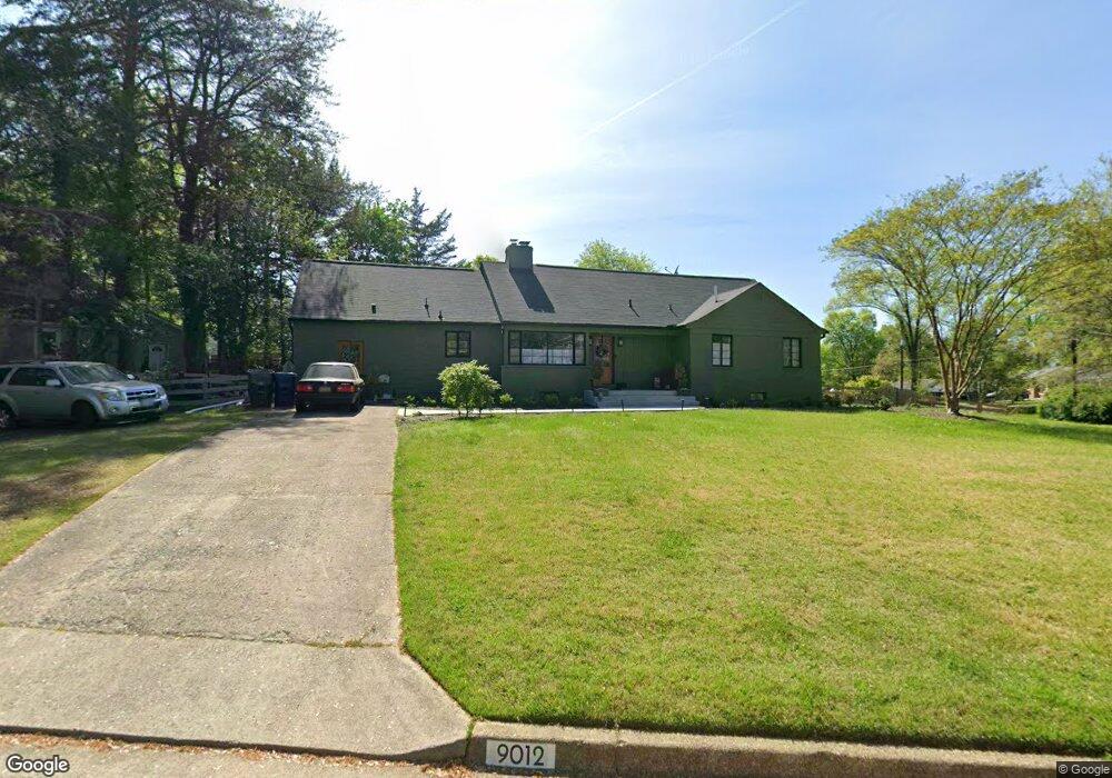
9012 Linton Ln Alexandria, VA 22308
Fort Hunt NeighborhoodEstimated Value: $854,000 - $1,012,000
4
Beds
4
Baths
2,436
Sq Ft
$378/Sq Ft
Est. Value
About This Home
This home is located at 9012 Linton Ln, Alexandria, VA 22308 and is currently estimated at $921,771, approximately $378 per square foot. 9012 Linton Ln is a home located in Fairfax County with nearby schools including Fort Hunt Elementary School, Sandburg Middle, and West Potomac High School.
Ownership History
Date
Name
Owned For
Owner Type
Purchase Details
Closed on
Aug 31, 2021
Sold by
Revere Robert B and Revere Virginia L
Bought by
Obrien Margaret Ann
Current Estimated Value
Home Financials for this Owner
Home Financials are based on the most recent Mortgage that was taken out on this home.
Original Mortgage
$548,250
Outstanding Balance
$498,122
Interest Rate
2.7%
Mortgage Type
New Conventional
Estimated Equity
$423,649
Purchase Details
Closed on
Aug 1, 2021
Sold by
Revere Robert B and Revere Virginia L
Bought by
Obrien Margaret Ann
Home Financials for this Owner
Home Financials are based on the most recent Mortgage that was taken out on this home.
Original Mortgage
$548,250
Outstanding Balance
$498,122
Interest Rate
2.7%
Mortgage Type
New Conventional
Estimated Equity
$423,649
Create a Home Valuation Report for This Property
The Home Valuation Report is an in-depth analysis detailing your home's value as well as a comparison with similar homes in the area
Home Values in the Area
Average Home Value in this Area
Purchase History
| Date | Buyer | Sale Price | Title Company |
|---|---|---|---|
| Obrien Margaret Ann | $618,000 | Monument Title Company | |
| Obrien Margaret Ann | $618,000 | Monument Title |
Source: Public Records
Mortgage History
| Date | Status | Borrower | Loan Amount |
|---|---|---|---|
| Open | Obrien Margaret Ann | $548,250 | |
| Closed | Obrien Margaret Ann | $548,250 |
Source: Public Records
Tax History Compared to Growth
Tax History
| Year | Tax Paid | Tax Assessment Tax Assessment Total Assessment is a certain percentage of the fair market value that is determined by local assessors to be the total taxable value of land and additions on the property. | Land | Improvement |
|---|---|---|---|---|
| 2025 | $9,725 | $830,110 | $348,000 | $482,110 |
| 2024 | $9,725 | $791,570 | $328,000 | $463,570 |
| 2023 | $9,585 | $805,910 | $328,000 | $477,910 |
| 2022 | $9,016 | $746,940 | $328,000 | $418,940 |
| 2021 | $8,667 | $704,450 | $296,000 | $408,450 |
| 2020 | $8,237 | $664,740 | $272,000 | $392,740 |
| 2019 | $8,111 | $652,850 | $264,000 | $388,850 |
| 2018 | $7,262 | $631,520 | $254,000 | $377,520 |
| 2017 | $7,677 | $631,520 | $254,000 | $377,520 |
| 2016 | $7,661 | $631,520 | $254,000 | $377,520 |
| 2015 | $7,277 | $621,140 | $254,000 | $367,140 |
| 2014 | $6,753 | $575,440 | $240,000 | $335,440 |
Source: Public Records
Map
Nearby Homes
- 8917 Linton Ln
- 2308 Creek Dr
- 8628 Plymouth Rd
- 8601 Buckboard Dr
- 2410 Ryegate Ln
- 8705 Stockton Pkwy
- 8518 Riverside Rd
- 8602 Cushman Place
- 2408 William And Mary Dr
- 3301 Battersea Ln
- 8305 Fort Hunt Rd
- Hampton II Plan at Collingwood Chase
- 8260 Colling Manor Ct
- 3108 Battersea Ln
- 8352 Orange Ct
- 8281 Colling Manor Ct
- 8280 Colling Manor Ct
- 8276 Colling Manor Ct
- 8264 Colling Manor Ct
- 1700 Collingwood Rd
- 2003 Westfield St
- 0 Westfield Unit 1005580498
- 0 Westfield Unit 1004878696
- 2000 Prices Ln
- 2002 Prices Ln
- 1917 Westfield St
- 2000 Westfield St
- 9013 Linton Ln
- 2005 Westfield St
- 2002 Westfield St
- 2004 Prices Ln
- 0 Prices Ln
- 9005 Linton Ln
- 1914 Prices Ln
- 9007 Linton Ln
- 2004 Westfield St
- 1915 Westfield St
- 2003 Prices Ln
- 9000 Linton Ln
- 2100 Prices Ln