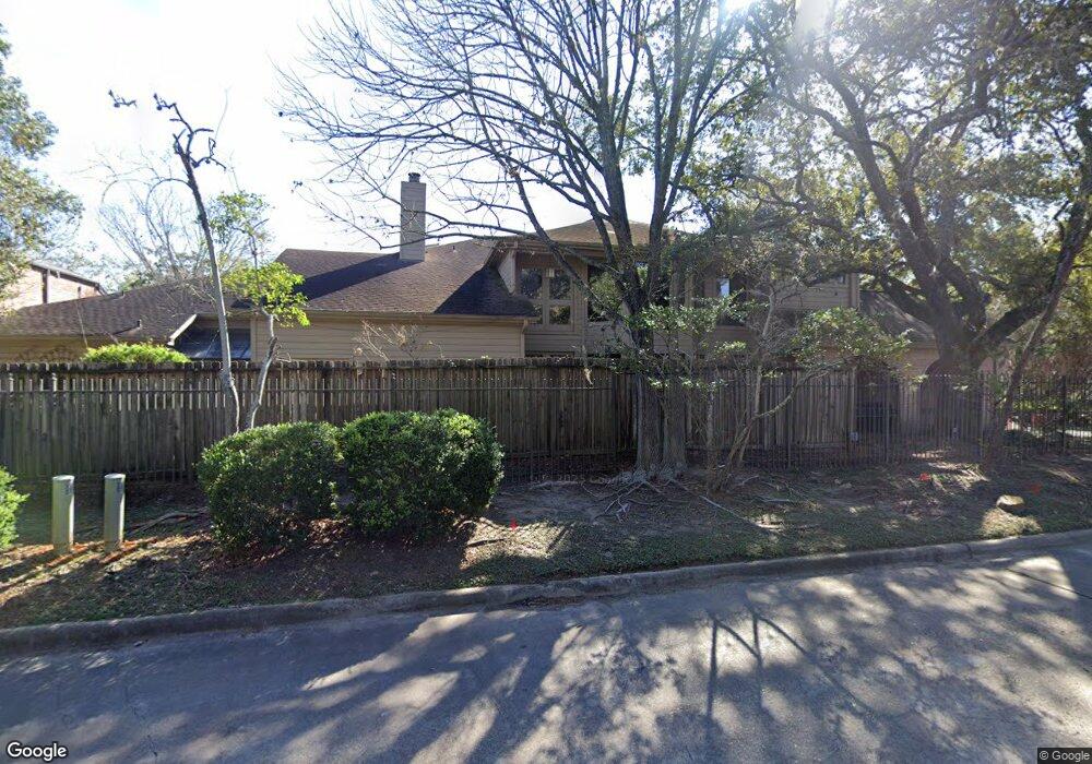
9013 Briar Forest Dr Houston, TX 77024
Memorial NeighborhoodEstimated Value: $507,000 - $671,000
2
Beds
3
Baths
2,621
Sq Ft
$224/Sq Ft
Est. Value
About This Home
This home is located at 9013 Briar Forest Dr, Houston, TX 77024 and is currently estimated at $586,164, approximately $223 per square foot. 9013 Briar Forest Dr is a home located in Harris County with nearby schools including Memorial Drive Elementary School, Spring Branch Middle School, and Memorial High School.
Ownership History
Date
Name
Owned For
Owner Type
Purchase Details
Closed on
Jun 27, 2013
Sold by
Care Bernard W and Care Lilian
Bought by
Herrin Mark and Herrin Paige E
Current Estimated Value
Home Financials for this Owner
Home Financials are based on the most recent Mortgage that was taken out on this home.
Original Mortgage
$288,000
Outstanding Balance
$206,014
Interest Rate
3.54%
Mortgage Type
New Conventional
Estimated Equity
$380,150
Purchase Details
Closed on
Dec 6, 2010
Sold by
King Norma and Adams Norma King
Bought by
Care Bernard W
Home Financials for this Owner
Home Financials are based on the most recent Mortgage that was taken out on this home.
Original Mortgage
$318,400
Interest Rate
4.23%
Mortgage Type
Purchase Money Mortgage
Purchase Details
Closed on
Sep 1, 2005
Sold by
Adams James Moomaw
Bought by
Adams Norma King
Home Financials for this Owner
Home Financials are based on the most recent Mortgage that was taken out on this home.
Original Mortgage
$210,000
Interest Rate
5.81%
Mortgage Type
Purchase Money Mortgage
Purchase Details
Closed on
Aug 22, 2005
Sold by
Cendant Mobility Financial Corp
Bought by
Adams James M and Adams Norma E King
Home Financials for this Owner
Home Financials are based on the most recent Mortgage that was taken out on this home.
Original Mortgage
$210,000
Interest Rate
5.81%
Mortgage Type
Purchase Money Mortgage
Purchase Details
Closed on
Aug 3, 2005
Sold by
Goff Stephen C and Goff Yvette M
Bought by
Cendant Mobility Financial Corp
Home Financials for this Owner
Home Financials are based on the most recent Mortgage that was taken out on this home.
Original Mortgage
$210,000
Interest Rate
5.81%
Mortgage Type
Purchase Money Mortgage
Purchase Details
Closed on
Aug 28, 2002
Sold by
Sayyah Jack and Sayyah Patricia Hall
Bought by
Goff Stephen C
Home Financials for this Owner
Home Financials are based on the most recent Mortgage that was taken out on this home.
Original Mortgage
$196,000
Interest Rate
6.47%
Create a Home Valuation Report for This Property
The Home Valuation Report is an in-depth analysis detailing your home's value as well as a comparison with similar homes in the area
Home Values in the Area
Average Home Value in this Area
Purchase History
| Date | Buyer | Sale Price | Title Company |
|---|---|---|---|
| Herrin Mark | -- | None Available | |
| Care Bernard W | -- | Stewart Title Houston Div | |
| Adams Norma King | -- | Stewart Title Houston Div | |
| Adams James M | -- | Texas American Title Company | |
| Cendant Mobility Financial Corp | -- | Texas American Title Company | |
| Goff Stephen C | -- | Houston Title Co |
Source: Public Records
Mortgage History
| Date | Status | Borrower | Loan Amount |
|---|---|---|---|
| Open | Herrin Mark | $288,000 | |
| Previous Owner | Care Bernard W | $318,400 | |
| Previous Owner | Adams James M | $210,000 | |
| Previous Owner | Cendant Mobility Financial Corp | $210,000 | |
| Previous Owner | Goff Stephen C | $196,000 | |
| Closed | Goff Stephen C | $24,500 | |
| Closed | Adams Norma King | $0 |
Source: Public Records
Tax History Compared to Growth
Tax History
| Year | Tax Paid | Tax Assessment Tax Assessment Total Assessment is a certain percentage of the fair market value that is determined by local assessors to be the total taxable value of land and additions on the property. | Land | Improvement |
|---|---|---|---|---|
| 2025 | $5,995 | $499,000 | $172,480 | $326,520 |
| 2024 | $5,995 | $401,011 | $172,480 | $228,531 |
| 2023 | $5,995 | $421,406 | $172,480 | $248,926 |
| 2022 | $9,576 | $409,594 | $172,480 | $237,114 |
| 2021 | $9,509 | $389,466 | $172,480 | $216,986 |
| 2020 | $9,758 | $389,466 | $172,480 | $216,986 |
| 2019 | $11,266 | $430,343 | $172,480 | $257,863 |
| 2018 | $3,920 | $400,500 | $172,480 | $228,020 |
| 2017 | $10,480 | $400,600 | $172,480 | $228,120 |
| 2016 | $10,791 | $412,500 | $172,480 | $240,020 |
| 2015 | $8,574 | $412,500 | $188,055 | $224,445 |
| 2014 | $8,574 | $412,500 | $188,055 | $224,445 |
Source: Public Records
Map
Nearby Homes
- 251 Sugarberry Cir
- 9171 Briar Forest Dr
- 9109 Briar Forest Dr
- 9400 Doliver Dr Unit 70
- 9400 Doliver Dr Unit 12
- 9400 Doliver Dr Unit 36
- 9400 Doliver Dr Unit 56
- 22 Sugarberry Cir
- 148 Sugarberry Cir
- 14 1/2 W Shady Ln
- 2003 Arrowwood Cir N
- 9518 Bayou Brook St
- 31 Knipp Rd
- 45 Patti Lynn Ln
- 11711 Memorial Dr Unit 570
- 11711 Memorial Dr Unit 55
- 11711 Memorial Dr Unit 21
- 11711 Memorial Dr Unit 565
- 11711 Memorial Dr Unit 695
- 11711 Memorial Dr Unit 644
- 9015 Briar Forest Dr
- 9017 Briar Forest Dr
- 9011 Briar Forest Dr
- 9019 Briar Forest Dr
- 9009 Briar Forest Dr
- 9021 Briar Forest Dr
- 9007 Briar Forest Dr
- 43 Hudson Cir
- 9023 Briar Forest Dr
- 9005 Briar Forest Dr
- 9107 Hudson Ct
- 8993 Briar Forest Dr
- 9103 Hudson Ct
- 9003 Briar Forest Dr
- 8991 Briar Forest Dr
- 39 Hudson Cir
- 9027 Briar Forest Dr
- 9203 Hudson Ct
- 9001 Briar Forest Dr
- 8989 Briar Forest Dr