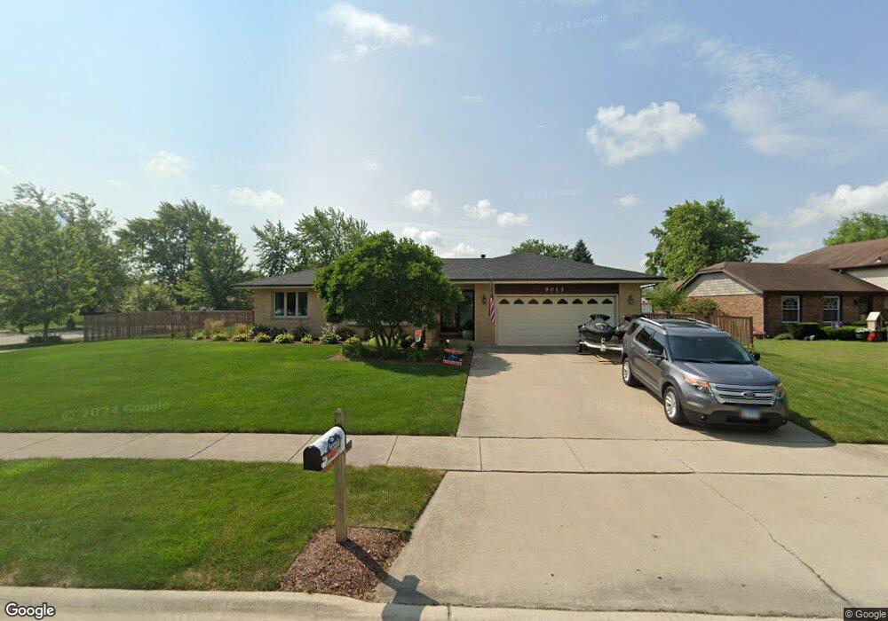
9013 Windsor Dr Unit 1 Orland Park, IL 60462
Silver Lake South NeighborhoodEstimated Value: $431,250 - $453,000
3
Beds
3
Baths
2,000
Sq Ft
$219/Sq Ft
Est. Value
About This Home
This home is located at 9013 Windsor Dr Unit 1, Orland Park, IL 60462 and is currently estimated at $438,313, approximately $219 per square foot. 9013 Windsor Dr Unit 1 is a home located in Cook County with nearby schools including Liberty Elementary School, Orland Center School, and Jerling Junior High School.
Ownership History
Date
Name
Owned For
Owner Type
Purchase Details
Closed on
Jul 22, 2011
Sold by
Marquette Bank
Bought by
Armstrong William C and Armstrong Michelle R
Current Estimated Value
Home Financials for this Owner
Home Financials are based on the most recent Mortgage that was taken out on this home.
Original Mortgage
$256,184
Interest Rate
4.32%
Mortgage Type
VA
Create a Home Valuation Report for This Property
The Home Valuation Report is an in-depth analysis detailing your home's value as well as a comparison with similar homes in the area
Home Values in the Area
Average Home Value in this Area
Purchase History
| Date | Buyer | Sale Price | Title Company |
|---|---|---|---|
| Armstrong William C | $248,000 | Millennium Title Group Ltd |
Source: Public Records
Mortgage History
| Date | Status | Borrower | Loan Amount |
|---|---|---|---|
| Previous Owner | Armstrong William C | $256,184 |
Source: Public Records
Tax History Compared to Growth
Tax History
| Year | Tax Paid | Tax Assessment Tax Assessment Total Assessment is a certain percentage of the fair market value that is determined by local assessors to be the total taxable value of land and additions on the property. | Land | Improvement |
|---|---|---|---|---|
| 2024 | -- | $38,001 | $7,833 | $30,168 |
| 2023 | -- | $38,001 | $7,833 | $30,168 |
| 2022 | $0 | $28,798 | $6,893 | $21,905 |
| 2021 | $7,155 | $28,796 | $6,892 | $21,904 |
| 2020 | $7,155 | $28,796 | $6,892 | $21,904 |
| 2019 | $6,615 | $27,529 | $6,266 | $21,263 |
| 2018 | $6,432 | $27,529 | $6,266 | $21,263 |
| 2017 | $6,302 | $27,529 | $6,266 | $21,263 |
| 2016 | $6,624 | $26,236 | $5,639 | $20,597 |
| 2015 | $6,525 | $26,236 | $5,639 | $20,597 |
| 2014 | $6,444 | $26,236 | $5,639 | $20,597 |
| 2013 | $5,682 | $24,800 | $5,639 | $19,161 |
Source: Public Records
Map
Nearby Homes
- 15324 Regent Dr
- 15336 Regent Dr
- 9203 Wheeler Dr
- 9180 136th St
- 9061 Somerset Ct Unit 16
- 9314 Wherry Ln Unit D
- 56 Orland Square Dr
- 9291 Erin Ln Unit D7
- 8944 Fernwood Ct
- 15137 Quail Hollow Dr Unit 203
- 9350 Waterford Ln Unit C16
- 15726 Orlan Brook Dr Unit 193
- 9337 Waterford Ln Unit D3
- 9148 Clairmont Ct Unit 120
- 15713 Orlan Brook Dr Unit 98
- 14739 Maple Ave
- 15826 Orlan Brook Dr Unit 3S
- 14759 Montgomery Dr
- 14746 Lakeview Dr
- 15817 Orlan Brook Dr Unit 35
- 15341 Sheffield Ln
- 15343 Sheffield Ln
- 9019 Windsor Dr
- 15336 Wexford Ln
- 15353 Sheffield Ln
- 15309 Sheffield Ln
- 15333 Wexford Ln
- 9016 Windsor Dr
- 15333 Sheffield Ln
- 15339 Wexford Ln
- 15339 Sheffield Ln
- 15342 Wexford Ln
- 15312 Windsor Dr
- 9022 Windsor Dr
- 15321 Windsor Dr
- 15306 Sheffield Ln
- 15345 Sheffield Ln
- 15304 Sheffield Ln
- 15373 Sheffield Ln
- 15355 Sheffield Ln