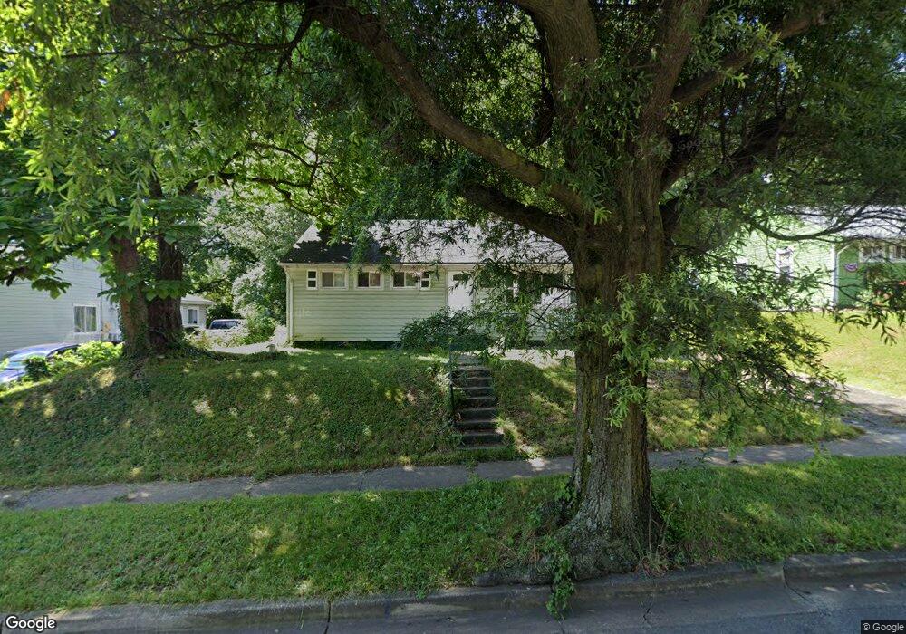
9017 Varnum St Lanham, MD 20706
Estimated Value: $311,000 - $347,752
Studio
1
Bath
936
Sq Ft
$349/Sq Ft
Est. Value
About This Home
This home is located at 9017 Varnum St, Lanham, MD 20706 and is currently estimated at $326,688, approximately $349 per square foot. 9017 Varnum St is a home located in Prince George's County with nearby schools including James Mchenry Elementary School, Thomas Johnson Middle School, and Duval High School.
Ownership History
Date
Name
Owned For
Owner Type
Purchase Details
Closed on
May 29, 2007
Sold by
Ligon Barbara M
Bought by
Hylton Clinton
Current Estimated Value
Home Financials for this Owner
Home Financials are based on the most recent Mortgage that was taken out on this home.
Original Mortgage
$242,000
Outstanding Balance
$147,763
Interest Rate
6.24%
Mortgage Type
Purchase Money Mortgage
Estimated Equity
$178,925
Purchase Details
Closed on
May 15, 2007
Sold by
Ligon Barbara M
Bought by
Hylton Clinton
Home Financials for this Owner
Home Financials are based on the most recent Mortgage that was taken out on this home.
Original Mortgage
$242,000
Outstanding Balance
$147,763
Interest Rate
6.24%
Mortgage Type
Purchase Money Mortgage
Estimated Equity
$178,925
Purchase Details
Closed on
Oct 15, 1979
Sold by
Canaday Rufus G
Bought by
Ligon Barbara M
Create a Home Valuation Report for This Property
The Home Valuation Report is an in-depth analysis detailing your home's value as well as a comparison with similar homes in the area
Home Values in the Area
Average Home Value in this Area
Purchase History
| Date | Buyer | Sale Price | Title Company |
|---|---|---|---|
| Hylton Clinton | $242,000 | -- | |
| Hylton Clinton | $242,000 | -- | |
| Ligon Barbara M | $45,000 | -- |
Source: Public Records
Mortgage History
| Date | Status | Borrower | Loan Amount |
|---|---|---|---|
| Open | Hylton Clinton | $242,000 | |
| Closed | Hylton Clinton | $242,000 |
Source: Public Records
Tax History
| Year | Tax Paid | Tax Assessment Tax Assessment Total Assessment is a certain percentage of the fair market value that is determined by local assessors to be the total taxable value of land and additions on the property. | Land | Improvement |
|---|---|---|---|---|
| 2025 | $3,838 | $258,533 | -- | -- |
| 2024 | $3,838 | $231,467 | -- | -- |
| 2023 | $3,435 | $204,400 | $71,200 | $133,200 |
| 2022 | $3,399 | $201,933 | $0 | $0 |
| 2021 | $3,362 | $199,467 | $0 | $0 |
| 2020 | $3,325 | $197,000 | $70,600 | $126,400 |
| 2019 | $3,121 | $183,233 | $0 | $0 |
| 2018 | $2,916 | $169,467 | $0 | $0 |
| 2017 | $2,712 | $155,700 | $0 | $0 |
| 2016 | -- | $154,000 | $0 | $0 |
| 2015 | $2,783 | $152,300 | $0 | $0 |
| 2014 | $2,783 | $150,600 | $0 | $0 |
Source: Public Records
Map
Nearby Homes
- 9013 Volta St
- 4818 Jefferson St
- 4224 Kinmount Rd
- 4217 Kinmount Rd
- 3708 Endicott Place
- 8909 Keewatin Rd
- 8912 Keewatin Rd
- 9311 Hobart St
- 9310 Biemans Terrace
- 4523 Kinmount Rd
- 4407 Jefferson St
- 9713 Weshire Dr
- 3610 Tyrol Dr
- 7934 Dellwood Ave
- 9207 Cooks Point Ct Unit 28 TO BE BUILT ELDER
- 4704 Cooks Point Ct Unit 5
- 9202 Cooks Point Ct Unit 15 MODEL HOME
- 4703 Cooks Hill Rd Unit 13
- 9217 Fowler Ln
- 4706 Cooks Hill Rd Unit 6 TO BE BUILT ELDER
Your Personal Tour Guide
Ask me questions while you tour the home.