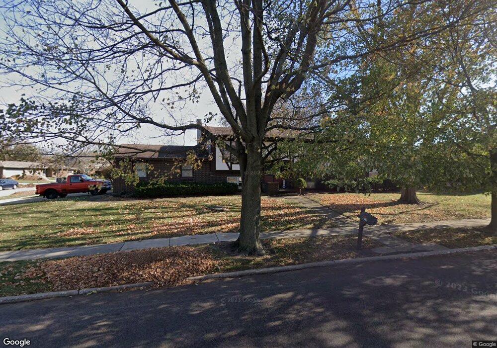
902 Broadmoor Dr Bloomington, IL 61704
Estimated Value: $250,000 - $271,000
3
Beds
2
Baths
1,255
Sq Ft
$207/Sq Ft
Est. Value
About This Home
This home is located at 902 Broadmoor Dr, Bloomington, IL 61704 and is currently estimated at $259,898, approximately $207 per square foot. 902 Broadmoor Dr is a home located in McLean County with nearby schools including Oakland Elementary School, Bloomington Junior High School, and Bloomington High School.
Ownership History
Date
Name
Owned For
Owner Type
Purchase Details
Closed on
Feb 5, 2008
Sold by
Landamerica Onestop Inc Trust
Bought by
Thomas Albert and Thomas Lisa
Current Estimated Value
Home Financials for this Owner
Home Financials are based on the most recent Mortgage that was taken out on this home.
Original Mortgage
$124,000
Outstanding Balance
$76,938
Interest Rate
5.75%
Estimated Equity
$182,960
Purchase Details
Closed on
Dec 2, 2007
Sold by
Strobel Paul and Strobel Tamara
Bought by
Landamerica Onestop Inc Trust
Create a Home Valuation Report for This Property
The Home Valuation Report is an in-depth analysis detailing your home's value as well as a comparison with similar homes in the area
Purchase History
| Date | Buyer | Sale Price | Title Company |
|---|---|---|---|
| Thomas Albert | $155,000 | First Community Title | |
| Landamerica Onestop Inc Trust | $155,500 | First Community Title |
Source: Public Records
Mortgage History
| Date | Status | Borrower | Loan Amount |
|---|---|---|---|
| Open | Thomas Albert | $124,000 |
Source: Public Records
Tax History
| Year | Tax Paid | Tax Assessment Tax Assessment Total Assessment is a certain percentage of the fair market value that is determined by local assessors to be the total taxable value of land and additions on the property. | Land | Improvement |
|---|---|---|---|---|
| 2024 | $4,816 | $76,163 | $13,178 | $62,985 |
| 2022 | $4,816 | $62,672 | $10,844 | $51,828 |
| 2021 | $4,459 | $58,470 | $10,117 | $48,353 |
| 2020 | $4,355 | $57,379 | $9,928 | $47,451 |
| 2019 | $4,342 | $57,379 | $9,928 | $47,451 |
| 2018 | $4,253 | $56,531 | $9,781 | $46,750 |
| 2017 | $4,254 | $56,531 | $9,781 | $46,750 |
| 2016 | $4,339 | $57,625 | $9,970 | $47,655 |
| 2015 | $4,263 | $56,863 | $9,838 | $47,025 |
| 2014 | $4,085 | $56,342 | $9,838 | $46,504 |
| 2013 | -- | $56,342 | $9,838 | $46,504 |
Source: Public Records
Map
Nearby Homes
- 2805 Coventry Ct
- 1114 Andover St
- 207 Hampton Dr
- 5 Devon Rd
- 2306 Maysel St
- 1304 S Hershey Rd
- 807 Verkler Ct
- 2211 Benjamin Ln Unit 1
- 2204 E Lincoln St Unit 13
- 308 Granada Rd
- 1509 Beckenham Dr
- 2419 Maloney Dr
- 2110 E Oakland Ave
- 317 Waterford Estates Dr
- 3 Harvest Ct
- 20 Crystal Ct
- 610 Old Farm Rd
- 47 Stonebrook Ct
- 1926 E Oakland Ave
- 101 N Bellemont Rd
- 2803 Morningside Dr
- 2804 Capen Dr
- 901 Broadmoor Dr
- 806 Broadmoor Dr
- 2805 Morningside Dr
- 903 Broadmoor Dr
- 807 Broadmoor Dr
- 2804 Morningside Dr
- 2806 Capen Dr
- 905 Broadmoor Dr
- 2807 Morningside Dr
- 805 Broadmoor Dr
- 2806 Morningside Dr
- 804 Broadmoor Dr
- 1002 Broadmoor Dr
- 1001 Broadmoor Dr
- 2808 Morningside Dr
- 2810 Capen Dr
- 2803 Capen Dr
- 803 Broadmoor Dr
Your Personal Tour Guide
Ask me questions while you tour the home.