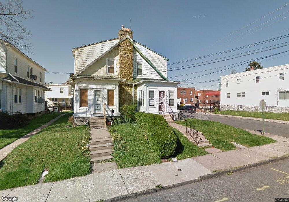
902 Bullock Ave Lansdowne, PA 19050
Estimated Value: $169,000 - $232,000
3
Beds
1
Bath
1,210
Sq Ft
$170/Sq Ft
Est. Value
About This Home
This home is located at 902 Bullock Ave, Lansdowne, PA 19050 and is currently estimated at $205,439, approximately $169 per square foot. 902 Bullock Ave is a home located in Delaware County with nearby schools including Evans Elementary School, Penn Wood Middle School, and Penn Wood High School - Cypress Street Campus.
Ownership History
Date
Name
Owned For
Owner Type
Purchase Details
Closed on
Mar 30, 2004
Sold by
Ward Joseph A and Ward Mary T
Bought by
Outen Thelema
Current Estimated Value
Home Financials for this Owner
Home Financials are based on the most recent Mortgage that was taken out on this home.
Original Mortgage
$69,000
Outstanding Balance
$42,244
Interest Rate
10.25%
Mortgage Type
Fannie Mae Freddie Mac
Estimated Equity
$163,195
Purchase Details
Closed on
Jul 23, 1997
Sold by
Ward Mary
Bought by
Ward Mary T and Ward Joseph A
Create a Home Valuation Report for This Property
The Home Valuation Report is an in-depth analysis detailing your home's value as well as a comparison with similar homes in the area
Home Values in the Area
Average Home Value in this Area
Purchase History
| Date | Buyer | Sale Price | Title Company |
|---|---|---|---|
| Outen Thelema | $69,000 | -- | |
| Ward Mary T | -- | Commonwealth Land Title Ins |
Source: Public Records
Mortgage History
| Date | Status | Borrower | Loan Amount |
|---|---|---|---|
| Open | Outen Thelema | $69,000 |
Source: Public Records
Tax History Compared to Growth
Tax History
| Year | Tax Paid | Tax Assessment Tax Assessment Total Assessment is a certain percentage of the fair market value that is determined by local assessors to be the total taxable value of land and additions on the property. | Land | Improvement |
|---|---|---|---|---|
| 2025 | $4,402 | $103,080 | $32,830 | $70,250 |
| 2024 | $4,402 | $103,080 | $32,830 | $70,250 |
| 2023 | $3,998 | $103,080 | $32,830 | $70,250 |
| 2022 | $3,812 | $103,080 | $32,830 | $70,250 |
| 2021 | $5,764 | $103,080 | $32,830 | $70,250 |
| 2020 | $3,831 | $61,340 | $18,940 | $42,400 |
| 2019 | $3,763 | $61,340 | $18,940 | $42,400 |
| 2018 | $3,711 | $61,340 | $0 | $0 |
| 2017 | $3,633 | $61,340 | $0 | $0 |
| 2016 | $337 | $61,340 | $0 | $0 |
| 2015 | $337 | $61,340 | $0 | $0 |
| 2014 | $337 | $61,340 | $0 | $0 |
Source: Public Records
Map
Nearby Homes
- 908 Yeadon Ave
- 921 Serrill Ave
- 939 Serrill Ave
- 808 Serrill Ave
- 825 Laurel Rd
- 800 Bullock Ave
- 923 Bell Ave
- 813 Arbor Rd
- 740 Church Ln
- 722 Yeadon Ave
- 711 Yeadon Ave Unit 1
- 1049 Yeadon Ave
- 702 Cedar Ave
- 6718 Cobbs Creek Pkwy
- 6535 Windsor St
- 1016 Whitby Ave
- 1781 S 65th St
- 6835 Chester Ave
- 6951 Chester Ave
- 6564 Belmar St
- 904 Bullock Ave
- 900 Bullock Ave
- 906 Bullock Ave
- 908 Bullock Ave
- 846 Bullock Ave
- 901 Yeadon Ave
- 905 Yeadon Ave
- 844 Bullock Ave
- 912 Bullock Ave
- 909 Yeadon Ave
- 847 Yeadon Ave
- 842 Bullock Ave
- 914 Bullock Ave
- 903 Bullock Ave
- 905 Bullock Ave
- 845 Yeadon Ave
- 901 Bullock Ave
- 907 Bullock Ave
- 913 Yeadon Ave
- 909 Bullock Ave