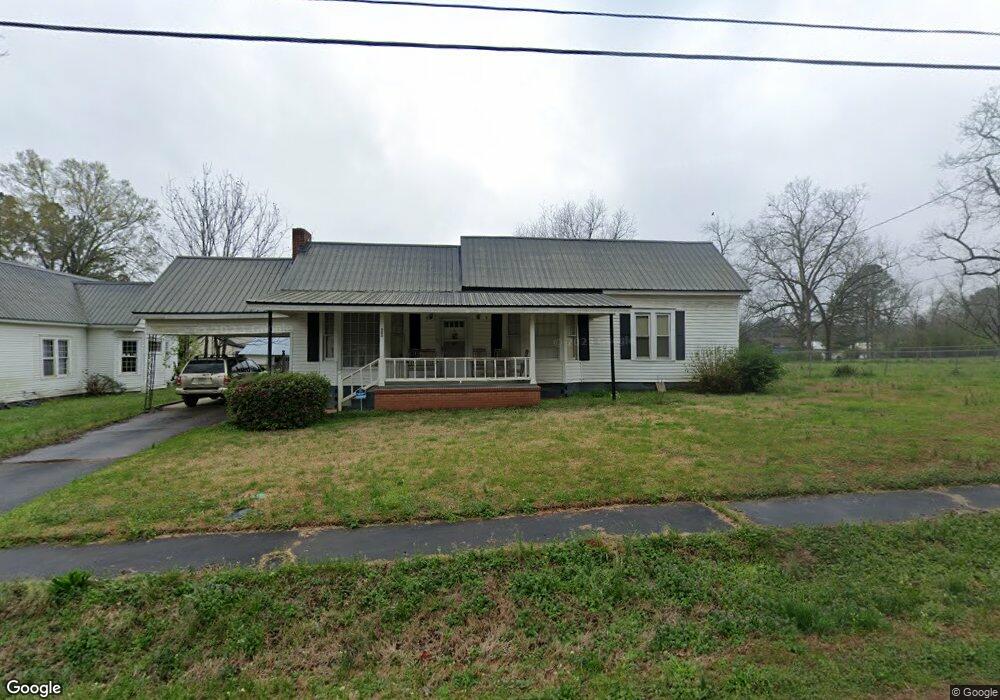
902 Dolvin Ave Union Point, GA 30669
Estimated Value: $198,269 - $250,000
3
Beds
2
Baths
1,854
Sq Ft
$123/Sq Ft
Est. Value
About This Home
This home is located at 902 Dolvin Ave, Union Point, GA 30669 and is currently estimated at $227,317, approximately $122 per square foot. 902 Dolvin Ave is a home located in Greene County with nearby schools including Greene County High School.
Ownership History
Date
Name
Owned For
Owner Type
Purchase Details
Closed on
Aug 25, 1995
Sold by
Burnsed David W
Bought by
Chester Millard and Chester Jacqueline
Current Estimated Value
Purchase Details
Closed on
Jul 28, 1993
Sold by
Carson James C
Bought by
Burnsed David W
Purchase Details
Closed on
Jan 1, 1983
Sold by
Carson Mary M
Bought by
Carson James C
Purchase Details
Closed on
Jan 1, 1955
Sold by
English S H Mrs
Bought by
Carson Mary M
Purchase Details
Closed on
Jan 1, 1946
Bought by
English S H Mrs
Create a Home Valuation Report for This Property
The Home Valuation Report is an in-depth analysis detailing your home's value as well as a comparison with similar homes in the area
Purchase History
| Date | Buyer | Sale Price | Title Company |
|---|---|---|---|
| Chester Millard | $45,000 | -- | |
| Burnsed David W | $20,000 | -- | |
| Carson James C | -- | -- | |
| Carson Mary M | -- | -- | |
| English S H Mrs | -- | -- |
Source: Public Records
Tax History
| Year | Tax Paid | Tax Assessment Tax Assessment Total Assessment is a certain percentage of the fair market value that is determined by local assessors to be the total taxable value of land and additions on the property. | Land | Improvement |
|---|---|---|---|---|
| 2025 | $1,028 | $86,400 | $5,880 | $80,520 |
| 2024 | $957 | $80,240 | $5,880 | $74,360 |
| 2023 | $247 | $77,240 | $5,880 | $71,360 |
| 2022 | $365 | $69,640 | $5,880 | $63,760 |
| 2021 | $366 | $62,560 | $5,880 | $56,680 |
| 2020 | $301 | $22,960 | $4,040 | $18,920 |
| 2019 | $307 | $22,960 | $4,040 | $18,920 |
| 2018 | $168 | $22,960 | $4,040 | $18,920 |
| 2017 | $274 | $23,000 | $4,050 | $18,950 |
| 2016 | $299 | $24,034 | $4,050 | $19,984 |
| 2015 | $268 | $24,034 | $4,050 | $19,984 |
| 2014 | $236 | $22,233 | $4,050 | $18,183 |
Source: Public Records
Map
Nearby Homes
- 215 Hunter St
- 0 S Rhodes St Unit 10618488
- 000 Washington Hwy
- 324 N Rhodes St
- 607 Bryan Ave
- 202 Veazey St
- 0 Woodland Ct Unit 10543600
- 405 Crawfordville Rd
- 1160 Moody St
- 1241 Old Siloam Rd
- 1041 Hillcrest Dr
- 1581 Highway 77 S Hwy
- 1581 Highway 77 S
- 1251 Adams Rd
- 5401 Union Point Hwy
- 1201 Buffalo Lick Rd
- 0 Buffalo Lick Rd Unit 10551234
- 0 Buffalo Lick Rd Unit 10551325
- 0 Old Union Point Rd Unit 1 10557753
- 1251 Brick House Rd
- 900 Dolvin Ave
- 908 Dolvin Ave
- 110 Barnes St
- 810 Dolvin Ave
- 901 Dolvin Ave
- 111 Hunter St
- 903 Carlton Ave
- 806 Dolvin Ave
- 905 Carlton Ave
- 901 Carlton Ave
- 909 Dolvin Ave
- 809 Dolvin Ave
- 807 Carlton Ave
- 108 Hunter St
- 204 Barnes St
- 907 Carlton Ave
- 805 Dolvin Ave
- 804 Dolvin Ave
- 805 Carlton Ave
- 102 Hunter St
Your Personal Tour Guide
Ask me questions while you tour the home.