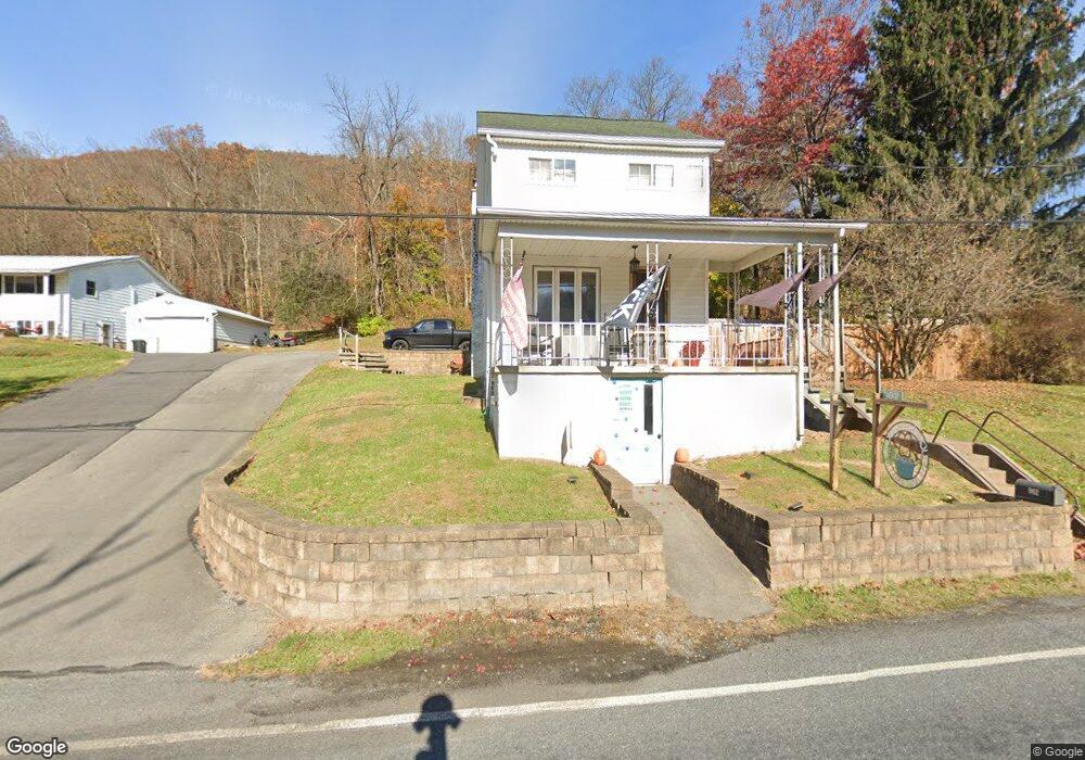
902 High Rd Ashland, PA 17921
Estimated Value: $123,209 - $198,000
3
Beds
1
Bath
1,377
Sq Ft
$107/Sq Ft
Est. Value
About This Home
This home is located at 902 High Rd, Ashland, PA 17921 and is currently estimated at $146,802, approximately $106 per square foot. 902 High Rd is a home located in Schuylkill County with nearby schools including North Schuylkill Elementary School and North Schuylkill Junior/Senior High School.
Ownership History
Date
Name
Owned For
Owner Type
Purchase Details
Closed on
Oct 29, 2021
Sold by
Spalti Terry M and Spalti Elisa S
Bought by
Bucher Chelsi Lynn and Bucher Elisa Michael
Current Estimated Value
Home Financials for this Owner
Home Financials are based on the most recent Mortgage that was taken out on this home.
Original Mortgage
$142,864
Outstanding Balance
$131,181
Interest Rate
3.14%
Estimated Equity
$15,621
Create a Home Valuation Report for This Property
The Home Valuation Report is an in-depth analysis detailing your home's value as well as a comparison with similar homes in the area
Home Values in the Area
Average Home Value in this Area
Purchase History
| Date | Buyer | Sale Price | Title Company |
|---|---|---|---|
| Bucher Chelsi Lynn | $145,500 | None Available | |
| Bucher Chelsi Lynn | $145,500 | None Listed On Document |
Source: Public Records
Mortgage History
| Date | Status | Borrower | Loan Amount |
|---|---|---|---|
| Open | Bucher Chelsi Lynn | $142,864 | |
| Closed | Bucher Chelsi Lynn | $142,864 |
Source: Public Records
Tax History Compared to Growth
Tax History
| Year | Tax Paid | Tax Assessment Tax Assessment Total Assessment is a certain percentage of the fair market value that is determined by local assessors to be the total taxable value of land and additions on the property. | Land | Improvement |
|---|---|---|---|---|
| 2025 | $1,276 | $16,430 | $4,050 | $12,380 |
| 2024 | $1,196 | $16,430 | $4,050 | $12,380 |
| 2023 | $1,196 | $16,430 | $4,050 | $12,380 |
| 2022 | $1,169 | $16,430 | $4,050 | $12,380 |
| 2021 | $1,155 | $16,430 | $4,050 | $12,380 |
| 2020 | $1,133 | $16,430 | $4,050 | $12,380 |
| 2018 | $1,094 | $16,430 | $4,050 | $12,380 |
| 2017 | $1,066 | $16,430 | $4,050 | $12,380 |
| 2015 | -- | $16,430 | $4,050 | $12,380 |
| 2011 | -- | $16,430 | $0 | $0 |
Source: Public Records
Map
Nearby Homes