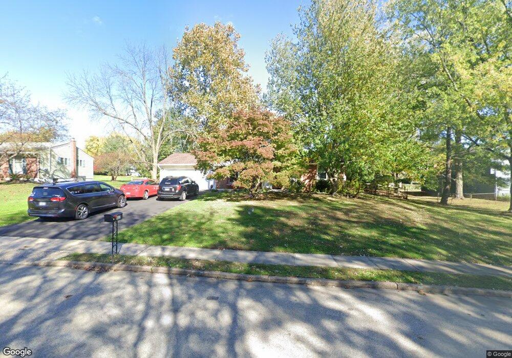
902 Independence Rd Norristown, PA 19403
Estimated Value: $401,000 - $416,913
3
Beds
2
Baths
1,120
Sq Ft
$366/Sq Ft
Est. Value
About This Home
This home is located at 902 Independence Rd, Norristown, PA 19403 and is currently estimated at $409,728, approximately $365 per square foot. 902 Independence Rd is a home located in Montgomery County with nearby schools including Paul V Fly Elementary School, East Norriton Middle School, and Charles Blockson Middle School.
Ownership History
Date
Name
Owned For
Owner Type
Purchase Details
Closed on
May 25, 2023
Sold by
Fox Kevin Walton and Fox Leilani Tesoro
Bought by
Daquilante Enrico and Daquilante Tara
Current Estimated Value
Purchase Details
Closed on
Mar 7, 2012
Sold by
Szymanski Stephen and Szymanski Walter
Bought by
Fox Kevin Walton and Fox Leilani Tesoro
Home Financials for this Owner
Home Financials are based on the most recent Mortgage that was taken out on this home.
Original Mortgage
$165,690
Interest Rate
3.75%
Mortgage Type
FHA
Create a Home Valuation Report for This Property
The Home Valuation Report is an in-depth analysis detailing your home's value as well as a comparison with similar homes in the area
Home Values in the Area
Average Home Value in this Area
Purchase History
| Date | Buyer | Sale Price | Title Company |
|---|---|---|---|
| Daquilante Enrico | $365,000 | None Listed On Document | |
| Fox Kevin Walton | $170,000 | None Available |
Source: Public Records
Mortgage History
| Date | Status | Borrower | Loan Amount |
|---|---|---|---|
| Previous Owner | Fox Kevin Walton | $165,690 |
Source: Public Records
Tax History Compared to Growth
Tax History
| Year | Tax Paid | Tax Assessment Tax Assessment Total Assessment is a certain percentage of the fair market value that is determined by local assessors to be the total taxable value of land and additions on the property. | Land | Improvement |
|---|---|---|---|---|
| 2025 | $6,184 | $131,270 | $48,210 | $83,060 |
| 2024 | $6,184 | $131,270 | $48,210 | $83,060 |
| 2023 | $6,111 | $131,270 | $48,210 | $83,060 |
| 2022 | $6,070 | $131,270 | $48,210 | $83,060 |
| 2021 | $6,032 | $131,270 | $48,210 | $83,060 |
| 2020 | $5,845 | $131,270 | $48,210 | $83,060 |
| 2019 | $5,710 | $131,270 | $48,210 | $83,060 |
| 2018 | $5,709 | $131,270 | $48,210 | $83,060 |
| 2017 | $5,377 | $131,270 | $48,210 | $83,060 |
| 2016 | $5,326 | $131,270 | $48,210 | $83,060 |
| 2015 | $5,048 | $131,270 | $48,210 | $83,060 |
| 2014 | $5,048 | $131,270 | $48,210 | $83,060 |
Source: Public Records
Map
Nearby Homes
- 3122 Taft Rd
- 3006 Potshop Rd
- 911 Caralea Dr
- 515 Faith Dr
- 805 Sandra Ln
- 3218 Nottingham Rd
- 1507 Potshop Rd
- 805 Stonybrook Dr
- 1105 Stonybrook Dr
- 1110 Stonybrook Dr
- 519 W Germantown Pike
- 425 Cherry Blossom Ln
- 1803 Sweet Gum Dr
- 2937 Keenwood Rd
- 1403 Reiner Rd
- 123 Barley Sheaf Dr Unit 23
- 1534 N Trooper Rd
- 0 Windy Hill Rd Unit METHACTON SD
- 210 Stony Way
- 000 Arden Dr Unit METHACTON SD
- 902 Independence
- 904 Independence Rd
- 3047 Taft Rd
- 906 Independence Rd
- 3043 Taft Rd
- 903 Woodland Ave
- 905 Woodland Ave
- 907 Woodland Ave
- 901 Woodland Ave
- 903 Independence Rd
- 3048 Taft Rd
- 908 Independence Rd
- 3050 Taft Rd
- 3046 Taft Rd
- 909 Woodland Ave
- 905 Independence Rd
- 3039 Taft Rd
- 3044 Taft Rd
- 3052 Taft Rd
- 910 Independence Rd