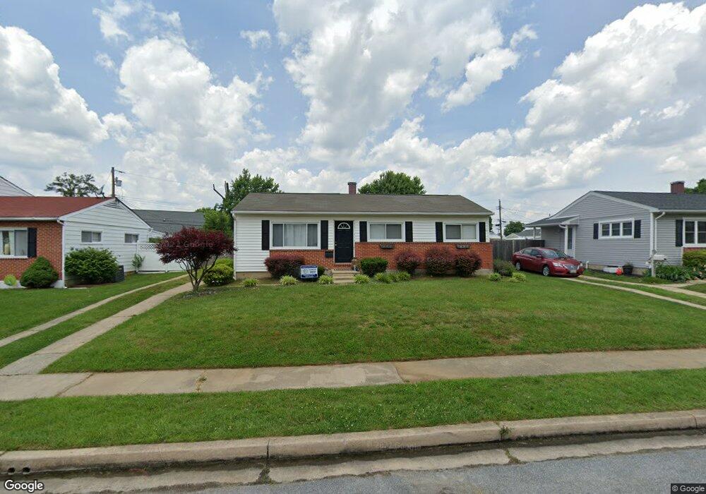
902 Marksworth Rd Catonsville, MD 21228
Estimated Value: $204,000 - $337,000
Studio
2
Baths
1,033
Sq Ft
$278/Sq Ft
Est. Value
About This Home
This home is located at 902 Marksworth Rd, Catonsville, MD 21228 and is currently estimated at $287,145, approximately $277 per square foot. 902 Marksworth Rd is a home located in Baltimore County with nearby schools including Johnnycake Elementary School, Southwest Academy, and Woodlawn High School.
Ownership History
Date
Name
Owned For
Owner Type
Purchase Details
Closed on
Feb 26, 2003
Sold by
Kratz Alan R
Bought by
Shifflett Kimberly and Pfeiffer Ryan A
Current Estimated Value
Purchase Details
Closed on
Mar 20, 2001
Sold by
Kratz Alan R
Bought by
Kratz Alan R and Kratz Sandra L G
Purchase Details
Closed on
May 2, 2000
Sold by
Laplanche Zella M
Bought by
Kratz Alan R and Watson Charles R
Purchase Details
Closed on
Nov 30, 1998
Sold by
Laplanche Zella M
Bought by
Laplanche Zella M
Purchase Details
Closed on
Nov 20, 1998
Sold by
Laplanche Zella M
Bought by
Laplanche Zella M
Create a Home Valuation Report for This Property
The Home Valuation Report is an in-depth analysis detailing your home's value as well as a comparison with similar homes in the area
Home Values in the Area
Average Home Value in this Area
Purchase History
| Date | Buyer | Sale Price | Title Company |
|---|---|---|---|
| Shifflett Kimberly | $95,200 | -- | |
| Kratz Alan R | -- | -- | |
| Kratz Alan R | -- | -- | |
| Laplanche Zella M | -- | -- | |
| Laplanche Zella M | -- | -- |
Source: Public Records
Tax History
| Year | Tax Paid | Tax Assessment Tax Assessment Total Assessment is a certain percentage of the fair market value that is determined by local assessors to be the total taxable value of land and additions on the property. | Land | Improvement |
|---|---|---|---|---|
| 2025 | $4,498 | $234,867 | -- | -- |
| 2024 | $4,498 | $218,200 | $77,900 | $140,300 |
| 2023 | $2,159 | $210,600 | $0 | $0 |
| 2022 | $3,847 | $203,000 | $0 | $0 |
| 2021 | $3,308 | $195,400 | $77,900 | $117,500 |
| 2020 | $3,308 | $188,533 | $0 | $0 |
| 2019 | $3,334 | $181,667 | $0 | $0 |
| 2018 | $3,274 | $174,800 | $64,400 | $110,400 |
| 2017 | $3,074 | $168,133 | $0 | $0 |
| 2016 | $2,280 | $161,467 | $0 | $0 |
| 2015 | $2,280 | $154,800 | $0 | $0 |
| 2014 | $2,280 | $154,800 | $0 | $0 |
Source: Public Records
Map
Nearby Homes
- 6035 Moorehead Rd
- 912 Marksworth Rd
- 910 Prestwood Rd
- 1008 Collwood Rd
- 914 Vanderwood Rd
- 1019 Crosby Rd
- 1000 Southridge Rd
- 6003 Johnnycake Rd
- 1338 Middleford Rd
- 6104 Chanceford Rd
- 6112 Chesworth Rd
- 1113 Kent Ave
- 1204 Canberwell Rd
- 1111 Mirga Cir
- 517 Winters Ln
- 1407 Adamsview Rd
- 1120 Ingleside Ave
- 1111 Cummings Ave
- 1215 Kent Ave
- 1215 Dorchester Ave
- 904 Marksworth Rd
- 900 Marksworth Rd
- 6039 Moorehead Rd
- 6037 Moorehead Rd
- 6041 Moorehead Rd
- 6002 Sherrill Rd
- 907 Marksworth Rd
- 909 Marksworth Rd
- 6033 Moorehead Rd
- 905 Marksworth Rd
- 6004 Sherrill Rd
- 911 Marksworth Rd
- 6000 Sherrill Rd
- 903 Marksworth Rd
- 6006 Sherrill Rd
- 908 Kent Ave
- 906 Kent Ave
- 901 Marksworth Rd
- 6040 Moorehead Rd
- 910 Kent Ave
Your Personal Tour Guide
Ask me questions while you tour the home.