Estimated Value: $340,165 - $384,000
3
Beds
2
Baths
1,704
Sq Ft
$213/Sq Ft
Est. Value
About This Home
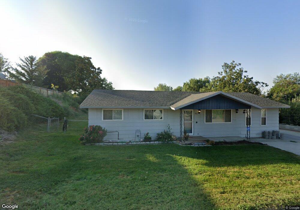
This home is located at 902 N 9th St, Parma, ID 83660 and is currently estimated at $363,541, approximately $213 per square foot. 902 N 9th St is a home located in Canyon County with nearby schools including Maxine Johnson Elementary School, Parma Middle School, and Parma High School.
Ownership History
Date
Name
Owned For
Owner Type
Purchase Details
Closed on
Sep 25, 2008
Sold by
Duering Kim D and Wensman Connie
Bought by
Hopwood Jody G and Hopwood Teena Kay
Current Estimated Value
Home Financials for this Owner
Home Financials are based on the most recent Mortgage that was taken out on this home.
Original Mortgage
$122,384
Outstanding Balance
$81,383
Interest Rate
6.43%
Mortgage Type
FHA
Estimated Equity
$282,158
Create a Home Valuation Report for This Property
The Home Valuation Report is an in-depth analysis detailing your home's value as well as a comparison with similar homes in the area
Home Values in the Area
Average Home Value in this Area
Purchase History
| Date | Buyer | Sale Price | Title Company |
|---|---|---|---|
| Hopwood Jody G | -- | Title One |
Source: Public Records
Mortgage History
| Date | Status | Borrower | Loan Amount |
|---|---|---|---|
| Open | Hopwood Jody G | $122,384 |
Source: Public Records
Tax History
| Year | Tax Paid | Tax Assessment Tax Assessment Total Assessment is a certain percentage of the fair market value that is determined by local assessors to be the total taxable value of land and additions on the property. | Land | Improvement |
|---|---|---|---|---|
| 2025 | $1,857 | $345,200 | $91,000 | $254,200 |
| 2024 | $1,857 | $342,300 | $91,000 | $251,300 |
| 2023 | $1,617 | $324,800 | $91,000 | $233,800 |
| 2022 | $2,284 | $342,000 | $97,500 | $244,500 |
| 2021 | $1,869 | $250,100 | $48,800 | $201,300 |
| 2020 | $1,677 | $203,500 | $32,500 | $171,000 |
| 2019 | $1,645 | $171,300 | $30,000 | $141,300 |
| 2018 | $1,586 | $0 | $0 | $0 |
| 2017 | $1,480 | $0 | $0 | $0 |
| 2016 | $1,439 | $0 | $0 | $0 |
| 2015 | $1,209 | $0 | $0 | $0 |
| 2014 | $1,147 | $92,500 | $15,500 | $77,000 |
Source: Public Records
Map
Nearby Homes
- 905 & 908 E Verina Cir
- 1011 E Fisk Ave
- 1001 E Fisk Ave
- 320 N 11th St
- 325 N 12th St
- 106 N 5th St
- 907 E Curtis Ave
- 26263 U S Route 95
- 1211 Mahogany St
- 2 E Bates Ave
- 25773 Clydesdale Ln
- 25701 Clydesdale Ln
- TBD Hwy 18
- 1220 N 4th St
- 1000 N Rodeo St
- 28403 Wamstad Rd
- 1010 N Rodeo St
- 1101 N Pioneer Way
- 1305 Birch St
- 1300 Birch St
Your Personal Tour Guide
Ask me questions while you tour the home.