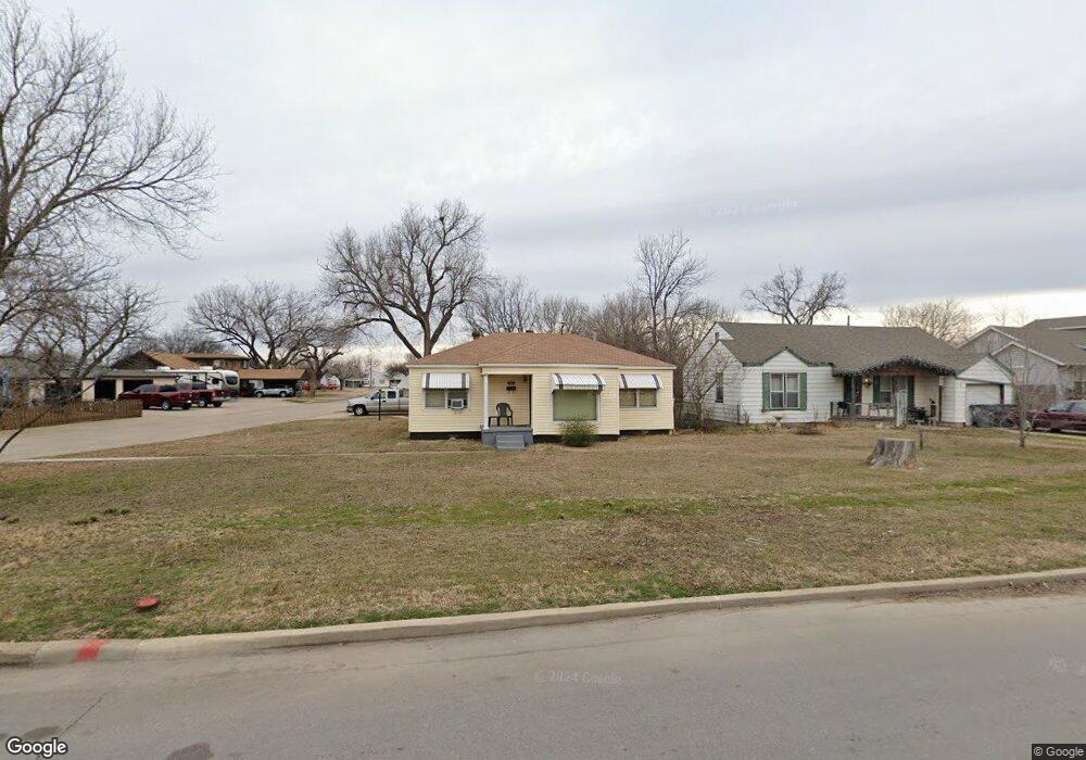
902 NW Pershing Dr Lawton, OK 73507
Liberty Heights NeighborhoodEstimated Value: $32,000 - $117,000
3
Beds
1
Bath
1,061
Sq Ft
$66/Sq Ft
Est. Value
About This Home
This home is located at 902 NW Pershing Dr, Lawton, OK 73507 and is currently estimated at $69,762, approximately $65 per square foot. 902 NW Pershing Dr is a home located in Comanche County with nearby schools including Whittier Elementary School, Tomlinson Middle School, and Lawton High School.
Ownership History
Date
Name
Owned For
Owner Type
Purchase Details
Closed on
May 21, 2025
Sold by
Mckesson Edward L
Bought by
Johnny Owens Properties Llc
Current Estimated Value
Home Financials for this Owner
Home Financials are based on the most recent Mortgage that was taken out on this home.
Original Mortgage
$30,861
Outstanding Balance
$26,931
Interest Rate
6.62%
Mortgage Type
New Conventional
Estimated Equity
$42,831
Create a Home Valuation Report for This Property
The Home Valuation Report is an in-depth analysis detailing your home's value as well as a comparison with similar homes in the area
Home Values in the Area
Average Home Value in this Area
Purchase History
| Date | Buyer | Sale Price | Title Company |
|---|---|---|---|
| Johnny Owens Properties Llc | $30,000 | None Listed On Document | |
| Johnny Owens Properties Llc | $30,000 | None Listed On Document |
Source: Public Records
Mortgage History
| Date | Status | Borrower | Loan Amount |
|---|---|---|---|
| Open | Johnny Owens Properties Llc | $30,861 | |
| Closed | Johnny Owens Properties Llc | $30,861 |
Source: Public Records
Tax History Compared to Growth
Tax History
| Year | Tax Paid | Tax Assessment Tax Assessment Total Assessment is a certain percentage of the fair market value that is determined by local assessors to be the total taxable value of land and additions on the property. | Land | Improvement |
|---|---|---|---|---|
| 2025 | $847 | $8,219 | $2,250 | $5,969 |
| 2024 | $847 | $7,827 | $2,250 | $5,577 |
| 2023 | $847 | $7,582 | $1,688 | $5,894 |
| 2022 | $807 | $7,568 | $1,688 | $5,880 |
| 2021 | $737 | $7,207 | $1,688 | $5,519 |
| 2020 | $698 | $6,864 | $1,688 | $5,176 |
| 2019 | $693 | $6,864 | $1,688 | $5,176 |
| 2018 | $702 | $7,052 | $1,688 | $5,364 |
| 2017 | $604 | $7,052 | $1,688 | $5,364 |
| 2016 | $653 | $7,424 | $1,688 | $5,736 |
| 2015 | $790 | $8,254 | $934 | $7,320 |
| 2014 | $748 | $7,862 | $934 | $6,928 |
Source: Public Records
Map
Nearby Homes
- 1742 NW Ash Ave
- 1713 NW Ferris Ave
- 2205 NW Crosby Ave
- 721 NW 17th St
- 1710 NW Kinyon Ave
- 1921 NW Oak Ave
- 4102 NE Mossy Oak Dr
- 1714 NW Oak Ave
- 1703 NW Euclid Ave
- 1712 NW Euclid Ave
- 1006 NW 15th St
- 1702 NW Euclid Ave
- 1335 NW Ash Ave
- 1339 NW Ferris Ave
- 768 NW 16th St
- 1908 NW Columbia Ave
- 1804 NW Columbia Ave
- 1303 NW Laird Ave
- 1712 NW Columbia Ave
- 1707 NW Lawton Ave
- 1917 NW Glenn Ave
- 904 NW Pershing Dr
- 1914 NW Glenn Ave
- 806 NW Pershing Dr
- 906 NW Pershing Dr
- 1905 NW Glenn Ave
- 804 NW Pershing Dr
- 1907 NW Glenn Ave
- 1737 NW Ash Ave
- 908 NW Pershing Dr
- 1906 NW Glenn Ave
- 801 NW Pershing Dr
- 802 NW Pershing Dr
- 1909 NW Glenn Ave
- 1735 NW Ash Ave
- 1908 NW Glenn Ave
- 1736 NW Cherry Ave
- 1901 NW Ash Ave
- 1906 NW Cherry Ave
- 1734 NW Cherry Ave