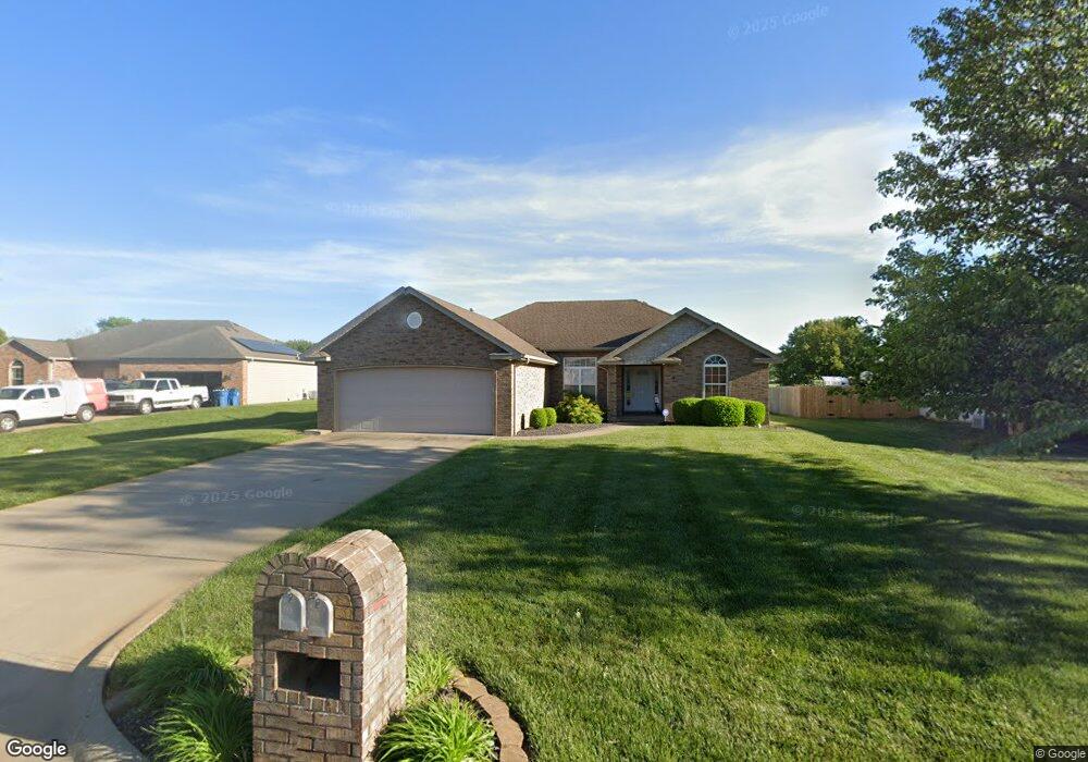
902 W Ashton Ave Strafford, MO 65757
Estimated Value: $271,246 - $301,000
3
Beds
2
Baths
1,623
Sq Ft
$176/Sq Ft
Est. Value
About This Home
This home is located at 902 W Ashton Ave, Strafford, MO 65757 and is currently estimated at $285,062, approximately $175 per square foot. 902 W Ashton Ave is a home located in Greene County with nearby schools including Strafford Elementary School, Strafford Middle School, and Strafford High School.
Ownership History
Date
Name
Owned For
Owner Type
Purchase Details
Closed on
Feb 15, 2006
Sold by
Fries Eric
Bought by
Mcswain William and Mcswain Christina
Current Estimated Value
Home Financials for this Owner
Home Financials are based on the most recent Mortgage that was taken out on this home.
Original Mortgage
$114,320
Outstanding Balance
$64,167
Interest Rate
6.15%
Mortgage Type
New Conventional
Estimated Equity
$220,895
Purchase Details
Closed on
Mar 8, 2005
Sold by
Hopper Phillips Development Inc
Bought by
Fries Eric
Home Financials for this Owner
Home Financials are based on the most recent Mortgage that was taken out on this home.
Original Mortgage
$120,000
Interest Rate
5.67%
Mortgage Type
Construction
Create a Home Valuation Report for This Property
The Home Valuation Report is an in-depth analysis detailing your home's value as well as a comparison with similar homes in the area
Purchase History
| Date | Buyer | Sale Price | Title Company |
|---|---|---|---|
| Mcswain William | -- | None Available | |
| Fries Eric | -- | None Available |
Source: Public Records
Mortgage History
| Date | Status | Borrower | Loan Amount |
|---|---|---|---|
| Open | Mcswain William | $114,320 | |
| Previous Owner | Fries Eric | $120,000 |
Source: Public Records
Tax History
| Year | Tax Paid | Tax Assessment Tax Assessment Total Assessment is a certain percentage of the fair market value that is determined by local assessors to be the total taxable value of land and additions on the property. | Land | Improvement |
|---|---|---|---|---|
| 2025 | $1,807 | $31,880 | $6,840 | $25,040 |
| 2024 | $1,753 | $30,250 | $4,560 | $25,690 |
| 2023 | $1,755 | $30,250 | $4,560 | $25,690 |
| 2022 | $1,478 | $26,490 | $4,560 | $21,930 |
| 2021 | $1,388 | $26,490 | $4,560 | $21,930 |
| 2020 | $1,410 | $26,490 | $4,560 | $21,930 |
| 2019 | $1,405 | $26,490 | $4,560 | $21,930 |
| 2018 | $1,414 | $26,410 | $4,560 | $21,850 |
| 2017 | $1,403 | $26,410 | $4,560 | $21,850 |
| 2016 | $1,396 | $26,410 | $4,560 | $21,850 |
| 2015 | $1,394 | $26,410 | $4,560 | $21,850 |
| 2014 | $1,408 | $26,410 | $4,560 | $21,850 |
Source: Public Records
Map
Nearby Homes
- Tbd E Farm Road 104
- 3246 Missouri 125
- 4070 N Castle Oaks Blvd
- 101 E Osage St
- 113 E Comanche Ct
- 805 N Dogwood St
- 7157 E Farm Road 84
- 809 N Washington St
- 605 S Birchwood St
- 211 E Seminole St
- 000 E Highway Oo
- 000 N Farm Road 215 Unit Parcel 1
- 000 N Farm Road 215 Unit Parcel 2
- 2991 N State Highway 125
- 704 N Ivy Ln
- 802 S Sunmeadow Dr
- 6118 E Farm Road 84
- Tract 2 N State Highway 215
- 4885 N Crows Nest Ln
- 000 E State Highway C
- 904 W Ashton Ave
- 900 W Ashton Ave
- 906 W Ashton Ave
- 108 N Austin Place
- 105 N Austin Place
- 106 N Austin Place
- 903 W Ashton Ave
- 908 W Ashton Ave
- 905 W Ashton Ave
- 104 N Austin Place
- 907 W Ashton Ave
- 101 N Austin Place
- 904 W Bluegrass Rd
- 102 N Austin Place
- 909 W Ashton Ave
- 906 W Bluegrass Rd
- 908 W Bluegrass Rd
- 802 W Bluegrass Rd
- 106 N Krystal Ln
- 910 W Bluegrass Rd
Your Personal Tour Guide
Ask me questions while you tour the home.